
1953 Map of Ritzville
USGS Topo · Published 1966About this map
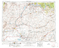
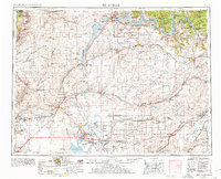
The Grand Coulee Dam anchors the northern reaches of this mid-century landscape, a massive engineering feat that transformed the Columbia Basin through the creation of Franklin D Roosevelt Lake. To the south, the Columbia Basin Project is evident in the intricate network of the West Canal and East Low Canal, which feed the Potholes Reservoir and Banks Lake. This irrigation infrastructure fundamentally altered the high desert, supporting new agricultural settlements alongside older rail hubs like Ritzville, Odessa, and Davenport.
Find a feature on this map
165 named features on this map. Tap any name to fly to it.
Don’t see what you’re looking for? This feature index may not catch every label — zoom into the map to look around manually.
Map Details
Editions of this 1953 Ritzville Map
3 editions found
Other maps of this area

1899 · Methow
USGS Topo · 1:125,000

1901 · Chelan
USGS Topo · 1:125,000

1901 · Methow
USGS Topo · 1:125,000

1905 · Okanogan
USGS Topo · 1:125,000

1909 · Quincy
USGS Topo · 1:62,500

1910 · Quincy
USGS Topo · 1:62,500

1910 · Winchester
USGS Topo · 1:62,500

1911 · Red Rock
USGS Topo · 1:62,500

1912 · Moses Lake
USGS Topo · 1:62,500

1912 · Beverly
USGS Topo · 1:62,500