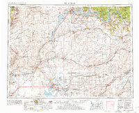
1953 Map of Ritzville
USGS Topo · Published 1978About this map
Grand Coulee Dam anchors the northern reaches of this landscape, where the Columbia River feeds into the expansive Franklin D Roosevelt Lake. The mid-century era is defined here by massive infrastructure projects, including the complex irrigation network of the West Canal and East Low Canal, which transformed the arid Sagebrush Flat and Bachelor Prairie. Military and industrial presence is prominent with the Ephrata Air Base and Larson Air Force Base situated near the growing hub of Ephrata.
Find a feature on this map
193 named features on this map. Tap any name to fly to it.
Don’t see what you’re looking for? This feature index may not catch every label — zoom into the map to look around manually.
Map Details
Editions of this 1953 Ritzville Map
3 editions found

Other maps of this area

1899 · Methow
USGS Topo · 1:125,000

1901 · Chelan
USGS Topo · 1:125,000

1901 · Methow
USGS Topo · 1:125,000

1905 · Okanogan
USGS Topo · 1:125,000

1909 · Quincy
USGS Topo · 1:62,500

1910 · Quincy
USGS Topo · 1:62,500

1910 · Winchester
USGS Topo · 1:62,500

1911 · Red Rock
USGS Topo · 1:62,500

1912 · Moses Lake
USGS Topo · 1:62,500

1912 · Beverly
USGS Topo · 1:62,500