Old Maps of Sunset Beach, Washington for Metal Detecting
Plan your next treasure hunt with 12 historic maps of Sunset Beach. Find old homesites, ghost towns, trails, and gathering spots that may be lost to time — perfect for identifying promising metal detecting locations.
- Locate forgotten sites: Uncover places like long-lost settlements, abandoned rail lines, or gathering spots.
- Plan better hunts: Use map overlays combined with LiDAR or satellite views to narrow in on historically rich areas.
- Made for detectorists: Thousands of hobbyists use these maps to discover relics, coins, and hidden history.
Use these historic maps to boost your research and find new opportunities beneath the surface of Sunset Beach.
Sunset Beach, WA maps
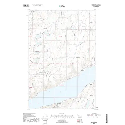
(12)- 1938 Map of Allyn, 1962 Print
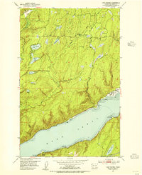
 1938 Allyn1962 Print · USGSCoastal life in the South Sound is captured in the late 1930s, documenting the shoreline of the Kitsap Peninsula and the surrounding inlets. Genealogists and local historians can trace small communities like Allyn, Grapeview, and Vaughn, or locate landmarks such as Grant Sch and Twanoh State Park.2 unique versions available
 - 1953 Map of Lake Wooten, 1955 Print
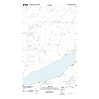
 1953 Lake Wooten1955 Print · USGSThe Kitsap Peninsula shoreline meets the deep waters of Hood Canal in the mid-1950s, a period of growing recreation and forestry. Trace the early development of Belfair State Park and coastal settlements like Sunbeach and Shady Beach.5 unique versions available
 - 1958 Map of Seattle, 1966 Print
 1958 Seattle1966 Print · USGSThe Puget Sound region in the mid-fifties showcases a balance of urban growth and Olympic wilderness. Trace the industrial waterfronts of Tacoma, old naval facilities like Keyport Naval Res, and mountain peaks like Mount Constance.3 unique versions available
 - 1962 Map of Seattle
 1962 Seattle1962 Print · USGSThe Puget Sound region and Olympic Peninsula are shown at a peak of mid-century growth. Genealogists and historians can trace rail lines like the Pacific Coast RR or locate landmarks such as Fort Lawton and the Bothell Power Station.
 - 1975 Map of Tacoma, 1977 Print
 1975 Tacoma1977 Print · USGSThe Puget Sound region in the mid-seventies reveals a landscape of growing urban centers and massive federal installations. Genealogists and historians can trace the development of Tacoma and Olympia, or locate landmarks like the McNeil Island Penitentiary and Fort Lewis Military Reservation.
 - 1991 Map of Tacoma
 1991 Tacoma1991 Print · USGSThe South Sound and Tacoma waterfront appear here in the early nineties, showing a landscape defined by deep-water inlets and massive federal installations. Researchers can trace the development of Lakewood Center or locate the historic rail lines of the Burlington Northern Railroad and Union Pacific Railroad.
 - 1999 Map of Lake Wooten, 2003 Print
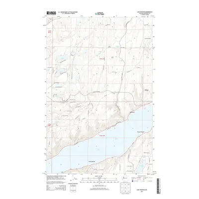
 1999 Lake Wooten2003 Print · USGSThe Kitsap Peninsula shoreline and its inland lake country are captured here at the close of the twentieth century. Genealogists and local historians can locate Dewatto Cem, the Tahuya Lookout, and waterfront communities like Sunbeach and Forest Beach.
 - 2011 Map of Lake Wooten, 2011 Print
 2011 Lake Wooten2011 Print · USGSCovers Sunset Beach, including Sunbeach, Forest Beach, and other nearby areas
 - 2014 Map of Lake Wooten, 2014 Print
 2014 Lake Wooten2014 Print · USGSCovers Sunset Beach, including Sunbeach, Forest Beach, and other nearby areas
 - 2017 Map of Lake Wooten, 2017 Print
 2017 Lake Wooten2017 Print · USGSCovers Sunset Beach, including Sunbeach, Forest Beach, and other nearby areas
 - 2020 Map of Lake Wooten, 2020 Print
 2020 Lake Wooten2020 Print · USGSCovers Sunset Beach, including Sunbeach, Forest Beach, and other nearby areas
 - 2023 Map of Lake Wooten, 2023 Print
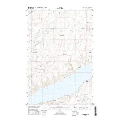
 2023 Lake Wooten2023 Print · USGSThe Mason County waterfront and interior lake country are shown in detail as they appeared in recent years. Researchers can trace established settlements like Belfair and Sunbeach or locate local landmarks such as the Dewatto Cem and Lake Wooten.
End of results
Showing maps 1-12 of 12
Top cities near Sunset Beach
- Bremerton historical maps
- Port Orchard historical maps
- Artondale historical maps
- Shelton historical maps
- Fox Island historical maps
- Erlands Point-Kitsap Lake historical maps
See more
Frequently asked questions
- What are the different types of historical maps available for Sunset Beach?
- What is the oldest map of Sunset Beach?
- Where can I purchase historical maps of Sunset Beach for my home or office?
- Where can I download high-res historical maps of Sunset Beach?
- Are there historical topographic maps available for Sunset Beach?
- Is there historical aerial imagery available for Sunset Beach?
- Where are historical maps of Sunset Beach sourced from?