2020s Maps of Pacific, Washington
Explore 4 historic maps of Pacific from the 2020s. These maps offer a rare glimpse into what life looked like during the 2020s — showing old roads, neighborhoods, homes, and landmarks that have changed or disappeared over time.
Whether you're researching your family's past, planning a metal detecting trip, or studying how Pacific's landscape evolved across the 2020s, these high-resolution maps are a powerful tool for exploring the history of this region.
- Focus on a specific era: All maps on this page are from the 2020s, giving you a focused view of this time period.
- See what’s changed: Compare century-old streets, trails, and buildings to today's modern landscape using overlays and satellite layers.
- Research with precision: Use these maps for genealogy, historical research, land use analysis, or educational projects.
- View, download, or print: Maps are fully viewable online in high resolution, and can be downloaded or printed for your own records.
Start exploring Pacific's history through authentic maps from the 2020s. This is your window into the past.
Pacific, WA maps
(4)- 2023 Map of Puyallup, 2023 Print
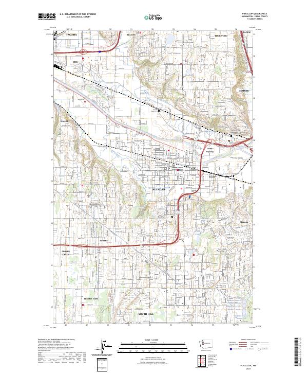 2023 Puyallup2023 Print · USGSThe Puyallup Valley and its surrounding bluffs are shown in high detail during this contemporary period of Pacific Northwest growth. Genealogists and historians can trace significant sites from the Indian Cem and Woodbine Cem to the early rail-stop area of Meeker.
 - 2023 Map of Auburn, 2023 Print
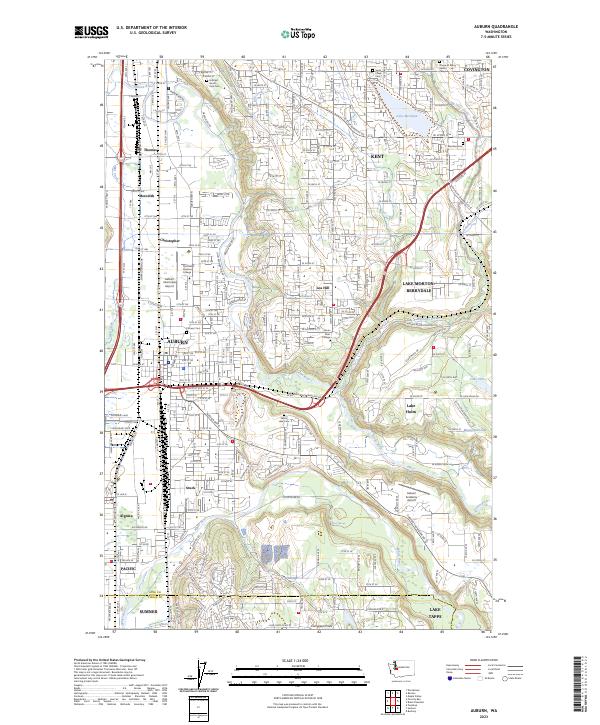 2023 Auburn2023 Print · USGSAuburn and the Green River valley are shown in the 2020s as a thriving hub of aviation, education, and suburban growth. Researchers can locate several burial grounds including Pioneer Cem and Hillcrest Burial Park Cem, or trace the rail lines of the BNSF Railway.
 - 2023 Map of Sumner, 2023 Print
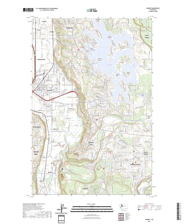 2023 Sumner2023 Print · USGSThe confluence of the White and Puyallup Rivers takes center stage in this contemporary look at the Puyallup Valley and the intricate shores of Lake Tapps. Genealogists and local historians can trace the evolution of old settlements like Dieringer and McMillin alongside landmarks like Victor Falls.
 - 2023 Map of Poverty Bay, 2023 Print
 2023 Poverty Bay2023 Print · USGSThe Puget Sound shoreline and the burgeoning plateau between Seattle and Tacoma are captured here during a period of intense suburban and industrial growth. Researchers can trace family history through Gethsemane Cem and Mountain View Cem or locate old neighborhood boundaries in Woodmont Beach and Lakota.
End of results
Showing maps 1-4 of 4
Top cities near Pacific
- Seattle historical maps
- Tacoma historical maps
- Kent historical maps
- Renton historical maps
- Federal Way historical maps
- Auburn historical maps
See more
Frequently asked questions
- What are the different types of historical maps available for Pacific?
- What is the oldest map of Pacific?
- Where can I purchase historical maps of Pacific for my home or office?
- Where can I download high-res historical maps of Pacific?
- Are there historical topographic maps available for Pacific?
- Is there historical aerial imagery available for Pacific?
- Where are historical maps of Pacific sourced from?