1970s Maps of Paradise, Washington
Explore 2 historic maps of Paradise from the 1970s. These maps offer a rare glimpse into what life looked like during the 1970s — showing old roads, neighborhoods, homes, and landmarks that have changed or disappeared over time.
Whether you're researching your family's past, planning a metal detecting trip, or studying how Paradise's landscape evolved across the 1970s, these high-resolution maps are a powerful tool for exploring the history of this region.
- Focus on a specific era: All maps on this page are from the 1970s, giving you a focused view of this time period.
- See what’s changed: Compare century-old streets, trails, and buildings to today's modern landscape using overlays and satellite layers.
- Research with precision: Use these maps for genealogy, historical research, land use analysis, or educational projects.
- View, download, or print: Maps are fully viewable online in high resolution, and can be downloaded or printed for your own records.
Start exploring Paradise's history through authentic maps from the 1970s. This is your window into the past.
Paradise, WA maps
(2)- 1971 Map of Mt Rainier East, 1974 Print
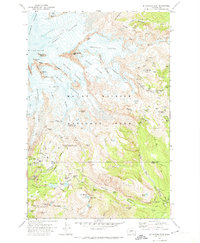 1971 Mt Rainier East1974 Print · USGSThe eastern slopes of the mountain in the early 1970s reveal a landscape of massive ice flows and established alpine trails. Trace the routes of climbers and hikers through Camp Muir, the Paradise Glacier Caves, and Reflection Lakes.2 unique versions available
 - 1978 Map of Mount Rainier
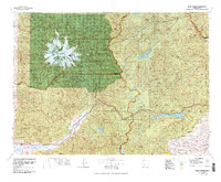 1978 Mount Rainier1978 Print · USGSThe high Cascades and the Yakima backcountry are shown in detail during the late seventies, centered on the glacial peaks and river valleys. Researchers can trace the development of Packwood and Goose Prairie or locate landmarks like the Packwood Landing Strip and Rimrock Lake.2 unique versions available
End of results
Showing maps 1-2 of 2
Top cities near Paradise
Frequently asked questions
- What are the different types of historical maps available for Paradise?
- What is the oldest map of Paradise?
- Where can I purchase historical maps of Paradise for my home or office?
- Where can I download high-res historical maps of Paradise?
- Are there historical topographic maps available for Paradise?
- Is there historical aerial imagery available for Paradise?
- Where are historical maps of Paradise sourced from?