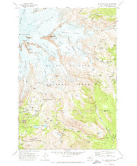
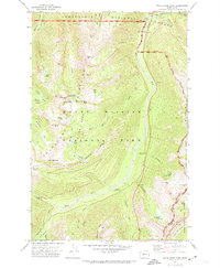
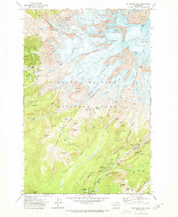
1971 Map of Mt Rainier East
USGS Topo · Published 1974About this map
Mount Rainier National Park is defined here by its massive glaciers and high-altitude alpine terrain as it was recorded in the early 1970s. The eastern face of the mountain features the expansive Emmons Glacier and Winthrop Glacier, punctuated by climber landmarks like Camp Muir and Camp Schurman. The survey documents the intricate trail networks of the era, including the Wonderland Trail and Skyline Trail, which connect high-country camps to the developed area at Paradise.
Find a feature on this map
84 named features on this map. Tap any name to fly to it.
Don’t see what you’re looking for? This feature index may not catch every label — zoom into the map to look around manually.
Map Details
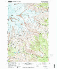
Editions of this 1971 Mt Rainier East Map
2 editions found
Other maps of this area

1924 · Mt Rainier
USGS Topo · 1:96,000

1928 · Mt Rainier
USGS Topo · 1:125,000

1950 · Yakima
USGS Topo · 1:250,000

1958 · Yakima
USGS Topo · 1:250,000

1961 · Yakima
USGS Topo · 1:250,000
1962 · Randle
USGS Topo · 1:62,500
1962 · Packwood
USGS Topo · 1:62,500

1971 · Sunrise
USGS Topo · 1:24,000
1971 · White River Park
USGS Topo · 1:24,000
1971 · Mt Rainier West
USGS Topo · 1:24,000