Old Maps of College Camp, San Juan County
Explore 9 old maps of College Camp, spanning from 1954 to today. These high-resolution historic maps reveal how streets, neighborhoods, landmarks, and natural features evolved over time — perfect for genealogy, metal detecting, research, and local history exploration.
What you can do with these maps:
- See how College Camp changed over time: Compare historical maps to modern-day views to trace roads, homesites, rail lines & more.
- View detailed metadata: Each map includes creators, publishers, year, scale, and archive source.
- Overlay maps with satellite & LiDAR: Visualize the past alongside modern tools to explore terrain & human change.
- Trusted historical sources: Maps sourced from the USGS, Library of Congress, and other archives.
- Access maps your way: View online, download high-res files, or order prints for personal or research use.
Start exploring old maps of College Camp to uncover forgotten places, hidden landmarks, and the deep history beneath your feet.
College Camp, San Juan County maps
(9)- 1954 Map of Waldron Island, 1957 Print
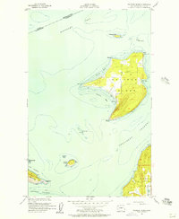 1954 Waldron Island1957 Print · USGSThe San Juan Islands remained a quiet maritime frontier in the mid-fifties, dominated by rocky shorelines and international waters. Trace the layout of the Waldron settlement, locate the island Cemetery, or find the Abandoned Quarry on the nearby cliffs of Orcas Island.4 unique versions available
 - 1957 Map of Victoria, 1960 Print
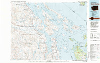
 1957 Victoria1960 Print · USGSThe San Juan Islands and the North Cascades coastline are shown in detail during the late fifties, a period of significant military and industrial presence. Researchers can trace historic rail lines like the Great Northern or locate sites such as the Whidbey Island Naval Air Sta and Friday Harbor.4 unique versions available
 - 1981 Map of Roche Harbor
 1981 Roche Harbor1981 Print · USGSThe maritime boundary between the Gulf Islands and San Juans was well-established by the early eighties. Researchers can trace transportation routes like the Canadian Pacific Railway and find coastal settlements from Sidney to Ganges.2 unique versions available
 - 1997 Map of Waldron Island, 2003 Print
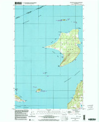 1997 Waldron Island2003 Print · USGSWaldron Island remains an isolated community in the late nineties, anchored by its small post office and local boat docks. Researchers can trace land use through features like Sawmill Corner, the local Cem, and the Landing Strip.
 - 2011 Map of Waldron Island, 2011 Print
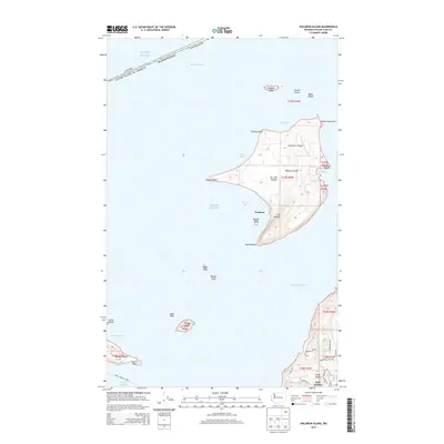
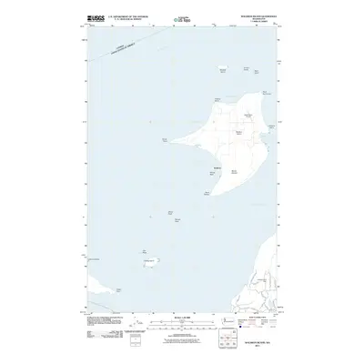 2011 Waldron Island2011 Print · USGSCovers College Camp, including Waldron, Southern Gulf Islands Electoral Area, and other nearby areas
 - 2014 Map of Waldron Island, 2014 Print
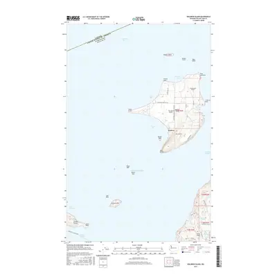
 2014 Waldron Island2014 Print · USGSCovers College Camp, including Waldron, Southern Gulf Islands Electoral Area, and other nearby areas
 - 2017 Map of Waldron Island, 2017 Print
 2017 Waldron Island2017 Print · USGSCovers College Camp, including Waldron, Southern Gulf Islands Electoral Area, and other nearby areas
 - 2020 Map of Waldron Island, 2020 Print
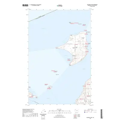 2020 Waldron Island2020 Print · USGSCovers College Camp, including Waldron, Southern Gulf Islands Electoral Area, and other nearby areas
 - 2023 Map of Waldron Island, 2023 Print
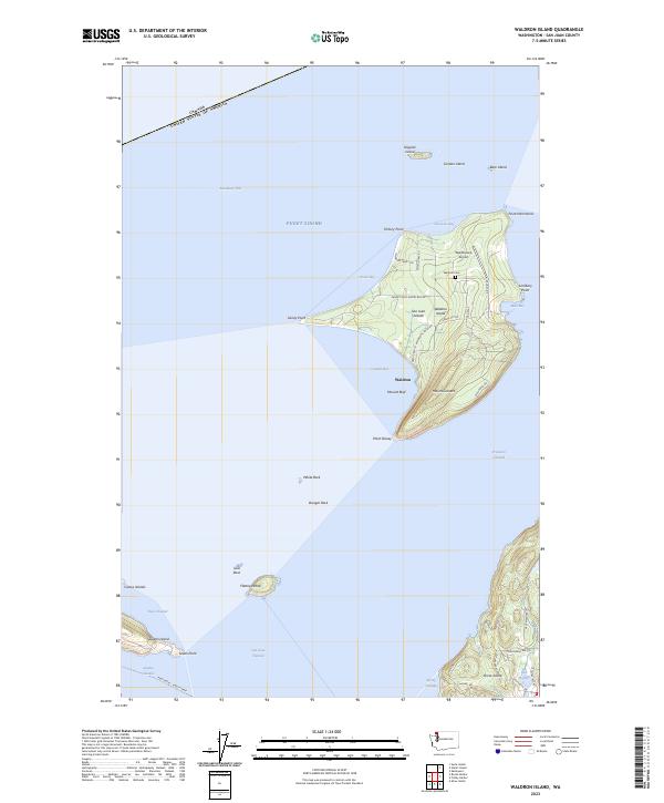 2023 Waldron Island2023 Print · USGSWaldron Island and its surrounding archipelago appear here in high detail during the early twenty-first century. Researchers can trace the local landscape from the Waldron Cem to the Waldronaire Airport, or locate small landmarks like Mount Cement and Mouatt Reef.
End of results
Showing maps 1-9 of 9
Frequently asked questions
- What are the different types of historical maps available for College Camp?
- What is the oldest map of College Camp?
- Where can I purchase historical maps of College Camp for my home or office?
- Where can I download high-res historical maps of College Camp?
- Are there historical topographic maps available for College Camp?
- Is there historical aerial imagery available for College Camp?
- Where are historical maps of College Camp sourced from?