Old Maps of Darlington, Everett for Metal Detecting
Plan your next treasure hunt with 14 historic maps of Darlington. Find old homesites, ghost towns, trails, and gathering spots that may be lost to time — perfect for identifying promising metal detecting locations.
- Locate forgotten sites: Uncover places like long-lost settlements, abandoned rail lines, or gathering spots.
- Plan better hunts: Use map overlays combined with LiDAR or satellite views to narrow in on historically rich areas.
- Made for detectorists: Thousands of hobbyists use these maps to discover relics, coins, and hidden history.
Use these historic maps to boost your research and find new opportunities beneath the surface of Darlington.
Darlington, Everett maps
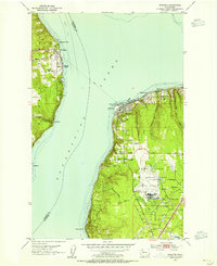
(14)- 1895 Map of Snohomish, 1954 Print
 1895 Snohomish1954 Print · USGSThe Puget Sound region in the late nineteenth century is documented here as Seattle and Everett rapidly expand via a growing rail network. Genealogists and historians can trace early waterfront settlements and inland junctions such as Mukilteo, Woodinville, and the grounds of Ft. Lawton.
 - 1897 Map of Seattle
 1897 Seattle1897 Print · USGSThe Puget Sound region is seen here in the late nineteenth century as the rail-and-water economy flourished. Genealogists and historians can trace early landings and rail stops like Curtis Landing, Moorland, and Kirkland Junction.10 unique versions available
 - 1942 Map of Edmonds, 1944 Print
 1942 Edmonds1944 Print · USGSCoastal Snohomish County and Whidbey Island are captured in the early 1940s during a period of maritime and rail expansion. Researchers can trace historic ferry lines, the Great Northern railroad, and local landmarks like Alderwood Manor and Firlands Sanitarium.
 - 1953 Map of Mukilteo, 1955 Print
 1953 Mukilteo1955 Print · USGSThe Mukilteo coastline and Whidbey Island are captured here in the early fifties, just as the local aviation and military presence was expanding. Trace the early layout of Paine Field, find the Lighthouse at Elliot Point, and follow the Ferry crossing to Clinton.5 unique versions available
 - 1953 Map of Edmonds, 1958 Print
 1953 Edmonds1958 Print · USGSThe Snohomish County shoreline and southern Whidbey Island were undergoing a massive suburban shift in the early fifties. Researchers can trace the growth of Mountlake Terrace, locate old schoolhouses like Fairmont School, and find the Paine Field Air Force Base.
 - 1958 Map of Seattle, 1966 Print
 1958 Seattle1966 Print · USGSThe Puget Sound region in the mid-fifties showcases a balance of urban growth and Olympic wilderness. Trace the industrial waterfronts of Tacoma, old naval facilities like Keyport Naval Res, and mountain peaks like Mount Constance.3 unique versions available
 - 1962 Map of Seattle
 1962 Seattle1962 Print · USGSThe Puget Sound region and Olympic Peninsula are shown at a peak of mid-century growth. Genealogists and historians can trace rail lines like the Pacific Coast RR or locate landmarks such as Fort Lawton and the Bothell Power Station.
 - 1975 Map of Seattle, 1977 Print
 1975 Seattle1977 Print · USGSThe Puget Sound region in the mid-seventies shows a landscape of rapid suburban growth and vital maritime industry. Researchers can trace the development of Eastside hubs like Bellevue or examine the rail and naval infrastructure of Bremerton and Paine Field.
 - 1992 Map of Seattle, 1993 Print
 1992 Seattle1993 Print · USGSThe Seattle metropolitan area and Puget Sound are shown here in the early nineties during a period of rapid suburban and technological growth. Researchers can trace the development of Mercer Island, locate the Bangor Naval Submarine Base, and study the industrial layout of Boeing Field.2 unique versions available
 - 2011 Map of Mukilteo, 2011 Print
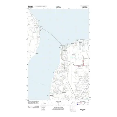 2011 Mukilteo2011 Print · USGSCovers Darlington, including Everett, Mukilteo, and other nearby areas
 - 2014 Map of Mukilteo, 2014 Print
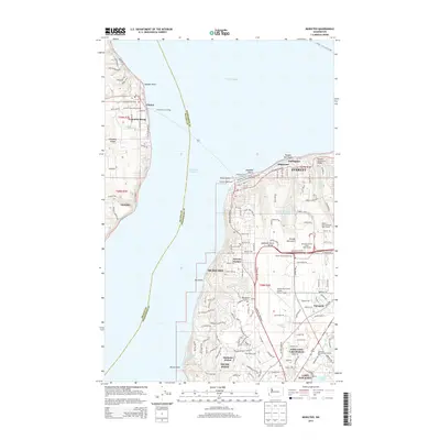 2014 Mukilteo2014 Print · USGSCovers Darlington, including Everett, Mukilteo, and other nearby areas
 - 2017 Map of Mukilteo, 2017 Print
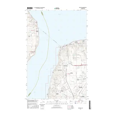 2017 Mukilteo2017 Print · USGSCovers Darlington, including Everett, Mukilteo, and other nearby areas
 - 2020 Map of Mukilteo, 2020 Print
 2020 Mukilteo2020 Print · USGSCovers Darlington, including Everett, Mukilteo, and other nearby areas
 - 2023 Map of Mukilteo, 2023 Print
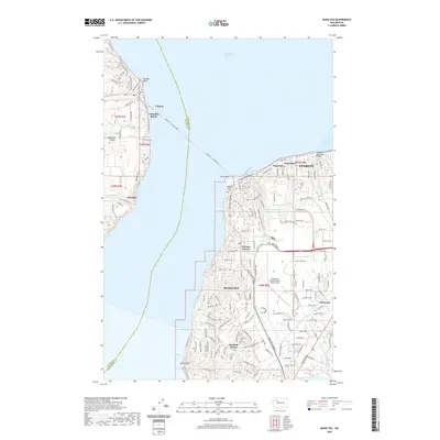
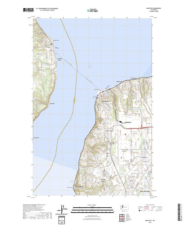 2023 Mukilteo2023 Print · USGSCoastal Snohomish County and Whidbey Island are shown in high detail during the early 2020s. Trace the iconic Mukilteo - Clinton Ferry route, the grounds of Mukilteo Pioneer Cem, and the massive airfield at Paine Field.
End of results
Showing maps 1-14 of 14
Frequently asked questions
- What are the different types of historical maps available for Darlington?
- What is the oldest map of Darlington?
- Where can I purchase historical maps of Darlington for my home or office?
- Where can I download high-res historical maps of Darlington?
- Are there historical topographic maps available for Darlington?
- Is there historical aerial imagery available for Darlington?
- Where are historical maps of Darlington sourced from?