Old Maps of Lacey, Washington
Explore 27 old maps of Lacey, spanning from 1916 to today. These high-resolution historic maps reveal how streets, neighborhoods, landmarks, and natural features evolved over time — perfect for genealogy, metal detecting, research, and local history exploration.
What you can do with these maps:
- See how Lacey changed over time: Compare historical maps to modern-day views to trace roads, homesites, rail lines & more.
- View detailed metadata: Each map includes creators, publishers, year, scale, and archive source.
- Overlay maps with satellite & LiDAR: Visualize the past alongside modern tools to explore terrain & human change.
- Trusted historical sources: Maps sourced from the USGS, Library of Congress, and other archives.
- Access maps your way: View online, download high-res files, or order prints for personal or research use.
Start exploring old maps of Lacey to uncover forgotten places, hidden landmarks, and the deep history beneath your feet.
Lacey, WA maps
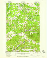
(27)- 1916 Map of Chehalis
 1916 Chehalis1916 Print · USGSCovers Lacey, including Tumwater, Centralia, and other nearby areas4 unique versions available
 - 1937 Map of Olympia
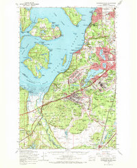
 1937 Olympia1937 Print · USGSCovers Lacey, including Olympia, Tumwater, and other nearby areas2 unique versions available
 - 1940 Map of Tenino
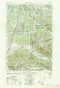
 1940 Tenino1940 Print · USGSCovers Lacey, including Tumwater, Centralia, and other nearby areas
 - 1940 Map of Anderson Island
 1940 Anderson Island1940 Print · USGSCovers Lacey, including Tacoma, Lakewood, and other nearby areas
 - 1944 Map of Tenino
 1944 Tenino1944 Print · USGSCovers Lacey, including Tumwater, Centralia, and other nearby areas
 - 1948 Map of Anderson Island, 1955 Print
 1948 Anderson Island1955 Print · USGSCovers Lacey, including Tacoma, Lakewood, and other nearby areas
 - 1948 Map of Nisqually, 1955 Print
 1948 Nisqually1955 Print · USGSCovers Lacey, including DuPont, Saint Clair, and other nearby areas
 - 1949 Map of Tenino, 1958 Print
 1949 Tenino1958 Print · USGSCovers Lacey, including Tumwater, Centralia, and other nearby areas2 unique versions available
 - 1949 Map of Olympia, 1958 Print
 1949 Olympia1958 Print · USGSCovers Lacey, including Olympia, Tumwater, and other nearby areas3 unique versions available
 - 1953 Map of Hoquiam
 1953 Hoquiam1953 Print · USGSCovers Lacey, including Longview, Graham, and other nearby areas2 unique versions available
 - 1957 Map of Hoquiam
 1957 Hoquiam1957 Print · USGSCovers Lacey, including Longview, Graham, and other nearby areas
 - 1958 Map of Seattle, 1966 Print
 1958 Seattle1966 Print · USGSCovers Lacey, including Seattle, Tacoma, and other nearby areas3 unique versions available
 - 1958 Map of Hoquiam, 1969 Print
 1958 Hoquiam1969 Print · USGSCovers Lacey, including Longview, Graham, and other nearby areas2 unique versions available
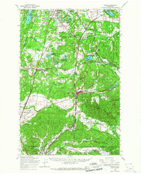
 - 1959 Map of Lacey, 1966 Print
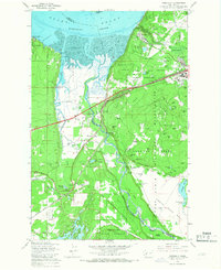
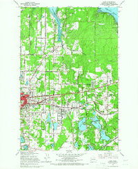 1959 Lacey1966 Print · USGSCovers Lacey, including Olympia, Tanglewilde, and other nearby areas6 unique versions available
 - 1959 Map of East Olympia, 1966 Print
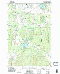
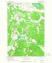 1959 East Olympia1966 Print · USGSCovers Lacey, including Tumwater, Offut Lake, and other nearby areas3 unique versions available
 - 1959 Map of Tenino, 1967 Print
 1959 Tenino1967 Print · USGSCovers Lacey, including Tumwater, Centralia, and other nearby areas
 - 1959 Map of Nisqually, 1967 Print
 1959 Nisqually1967 Print · USGSCovers Lacey, including DuPont, Saint Clair, and other nearby areas6 unique versions available
 - 1959 Map of Anderson Island, 1968 Print
 1959 Anderson Island1968 Print · USGSCovers Lacey, including Tacoma, Lakewood, and other nearby areas
 - 1962 Map of Seattle
 1962 Seattle1962 Print · USGSCovers Lacey, including Seattle, Tacoma, and other nearby areas
 - 1962 Map of Hoquiam
 1962 Hoquiam1962 Print · USGSCovers Lacey, including Longview, Graham, and other nearby areas
 - 1964 Map of Tenino, 1965 Print
 1964 Tenino1965 Print · USGSCovers Lacey, including Tumwater, Centralia, and other nearby areas
 - 1975 Map of Tacoma, 1977 Print
 1975 Tacoma1977 Print · USGSCovers Lacey, including Seattle, Tacoma, and other nearby areas
 - 1980 Map of Centralia
 1980 Centralia1980 Print · USGSCovers Lacey, including Graham, Tumwater, and other nearby areas
 - 1990 Map of East Olympia, 1995 Print
 1990 East Olympia1995 Print · USGSCovers Lacey, including Tumwater, Offut Lake, and other nearby areas
 - 1991 Map of Tacoma
 1991 Tacoma1991 Print · USGSCovers Lacey, including Seattle, Tacoma, and other nearby areas
Showing maps 1-25 of 27
Top cities near Lacey
- Lakewood historical maps
- Olympia historical maps
- University Place historical maps
- Tumwater historical maps
- Yelm historical maps
- DuPont historical maps
See more
Top neighborhoods of Lacey
Frequently asked questions
- What are the different types of historical maps available for Lacey?
- What is the oldest map of Lacey?
- Where can I purchase historical maps of Lacey for my home or office?
- Where can I download high-res historical maps of Lacey?
- Are there historical topographic maps available for Lacey?
- Is there historical aerial imagery available for Lacey?
- Where are historical maps of Lacey sourced from?