Old Maps of Lacey, Washington for Hiking & Exploration
Hike through history with 42 historic maps of Lacey. Explore old trails, ghost towns, and forgotten backroads — perfect for outdoor adventurers and local explorers.
- Rediscover forgotten places: Map out old mining camps, roads, and footpaths that no longer exist on modern maps.
- Layer with modern tools: Combine with LiDAR or satellite views to plan hikes through historical terrain.
- Made for exploration: Popular among hikers, overlanders, and local history lovers.
Use these maps to find adventure and explore the hidden past of Lacey.
Lacey, WA maps
(42)- 1916 Map of Chehalis
 1916 Chehalis1916 Print · USGSDuring a period of rapid development along the Chehalis and Skookumchuck Rivers, these valleys supported a thriving network of timber camps and rail towns. Genealogists can trace family landmarks like Logan Hill School, the Centralia Seminary, and the Salmon Creek Mill.4 unique versions available
 - 1937 Map of Olympia
 1937 Olympia1937 Print · USGSThe state capital and the southern inlets of Puget Sound are captured here during the mid-1930s as the region's rail and maritime networks matured. Genealogists and historians can locate vanished schoolhouses like Plainview Sch, old coastal landings at Boston Harbor, and early industry at Union Mills.2 unique versions available
 - 1940 Map of Tenino
 1940 Tenino1940 Print · USGSThurston County’s rail and timber landscape is documented here at the start of the 1940s, showing a critical intersection of three major railroads. Genealogists and local historians can trace the rural school districts of Spurgeon Creek Sch and the industrial footprint of the Panama Lumber & Shingle Co.
 - 1940 Map of Anderson Island
 1940 Anderson Island1940 Print · USGSCoastal Washington at the start of the 1940s shows a landscape of strategic military installations and island prisons. You can trace the development of Fort Lewis, the boundaries of the Nisqually Indian Reservation, and the layout of the Federal Penitentiary on McNeil Island.
 - 1944 Map of Tenino
 1944 Tenino1944 Print · USGSThurston County and the Lewis County border are captured in the mid-1940s, highlighting a landscape shaped by coal mining and heavy rail. Genealogists and historians can trace the positions of old schools like Cattail Sch, local landmarks such as the Oregon Trail Monument, and mining sites including Tono Mine No 1.
 - 1948 Map of Anderson Island, 1955 Print
 1948 Anderson Island1955 Print · USGSThe South Sound shoreline and its island communities are captured here just after the war as military and suburban footprints expanded. Genealogists and researchers can trace local landmarks from McNeil Island to the Visitation Academy and the rail stops at Nisqually Station.
 - 1948 Map of Nisqually, 1955 Print
 1948 Nisqually1955 Print · USGSThe Nisqually River delta and the South Puget Sound coastline are captured here in the late 1940s. Genealogists and historians can trace the early layout of Dupont, the Fort Lewis Military Reservation, and rail stops like St Clair Sta and Nisqually Sta.
 - 1949 Map of Tenino, 1958 Print
 1949 Tenino1958 Print · USGSThe Tenino region of Washington is captured here in the late 1940s as a bustling corridor of rail lines and expansive prairies. Researchers can trace historic coal mining at Monarch Mines, locate the Oregon Trail Monument, or find rural landmarks like Violet Prairie Church.2 unique versions available
 - 1949 Map of Olympia, 1958 Print
 1949 Olympia1958 Print · USGSThe Puget Sound shoreline and the capital city of Olympia are captured here just after the war. Researchers can trace the rail lines of the Northern Pacific or find local landmarks like St Martins College and Boston Harbor.3 unique versions available
 - 1953 Map of Hoquiam
 1953 Hoquiam1953 Print · USGSSouthwest Washington in the early fifties shows a landscape shaped by timber, rail, and river commerce from the coast to the Cascades. Genealogists and historians can trace the development of timber towns like Ryderwood and the industrial hubs of Hoquiam and Kelso.2 unique versions available
 - 1957 Map of Hoquiam
 1957 Hoquiam1957 Print · USGSCoastal timber ports and inland rail hubs define Southwest Washington during the late fifties. Genealogists can trace early twentieth-century settlements like Bordeaux, Tono, and Cosmopolis alongside the expanding tracks of the Northern Pacific.
 - 1958 Map of Seattle, 1966 Print
 1958 Seattle1966 Print · USGSThe Puget Sound region in the mid-fifties showcases a balance of urban growth and Olympic wilderness. Trace the industrial waterfronts of Tacoma, old naval facilities like Keyport Naval Res, and mountain peaks like Mount Constance.3 unique versions available
 - 1958 Map of Hoquiam, 1969 Print
 1958 Hoquiam1969 Print · USGSSouthwest Washington and the Columbia River estuary appear here in the mid-century, before major landscape shifts. Researchers can trace the rail lines of the Northern Pacific, locate the Fort Henness Site, or explore the Naselle Air Force Station.2 unique versions available
 - 1959 Map of Lacey, 1966 Print
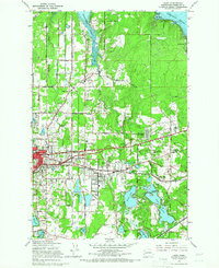 1959 Lacey1966 Print · USGSThurston County’s transition from timbered prairies to suburban communities is captured here in the late fifties as Lacey and Olympia expanded. Genealogists and local historians can trace the grounds of St Martins College and find vanished landmarks like the Drive-in Theater or Union Mill.6 unique versions available
 - 1959 Map of East Olympia, 1966 Print
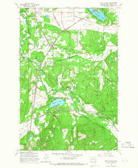 1959 East Olympia1966 Print · USGSThurston County’s rail-and-prairie landscape is captured in the late fifties, showing a vital crossroads of major Pacific Northwest rail lines. Genealogists and historians can trace the tracks and local hubs like East Olympia, Offutt Lake, and Kellys Korner.3 unique versions available
 - 1959 Map of Tenino, 1967 Print
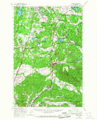 1959 Tenino1967 Print · USGSSouthern Thurston County's river-and-rail corridor is captured here during the late fifties, showing the industrial connection between the coal mines and the valley towns. Genealogists and historians can trace family-named sites like Kellys Korner or locate old community hubs such as Grange Hall and the settlement of Tono.
 - 1959 Map of Nisqually, 1967 Print
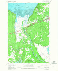 1959 Nisqually1967 Print · USGSThe Nisqually River delta and the northern reaches of the Fort Lewis Military Reservation are captured here during a period of steady military and coastal development. Genealogists and historians can trace family-named landmarks like Foster Hill and Hoffman Hill or locate early infrastructure at Nisqually Station and Dupont.6 unique versions available
 - 1959 Map of Anderson Island, 1968 Print
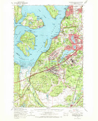 1959 Anderson Island1968 Print · USGSPierce County in the late fifties was a hub of military and institutional activity as suburban communities began to expand south of Tacoma. Trace the mid-century footprints of the Federal Penitentiary on McNeil Island, the Mount Rainier Ordnance Depot, and Lakewood Center.
 - 1962 Map of Seattle
 1962 Seattle1962 Print · USGSThe Puget Sound region and Olympic Peninsula are shown at a peak of mid-century growth. Genealogists and historians can trace rail lines like the Pacific Coast RR or locate landmarks such as Fort Lawton and the Bothell Power Station.
 - 1962 Map of Hoquiam
 1962 Hoquiam1962 Print · USGSSouthwest Washington in the late fifties is defined by the bustling timber ports of Hoquiam and the rail-linked commerce of the interior valleys. Genealogists and historians can trace the early footprints of settlements like Raymond and Pe Ell, or locate family sites at Grand Mound Cem and Odd Fellows Cem.
 - 1964 Map of Tenino, 1965 Print
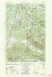 1964 Tenino1965 Print · USGSThurston and Lewis Counties are captured in the mid-1960s as timber, coal mining, and rail transport defined the local economy. Researchers can find old grange halls, several coal operations like the Black Diamond Coal Mine, and the historic Oregon Trail Monument near Tenino.
 - 1975 Map of Tacoma, 1977 Print
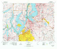 1975 Tacoma1977 Print · USGSThe Puget Sound region in the mid-seventies reveals a landscape of growing urban centers and massive federal installations. Genealogists and historians can trace the development of Tacoma and Olympia, or locate landmarks like the McNeil Island Penitentiary and Fort Lewis Military Reservation.
 - 1980 Map of Centralia
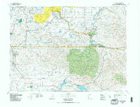 1980 Centralia1980 Print · USGSThe rail and river corridors of southwestern Washington are captured here in the late twentieth century, showing the region's transition from resource extraction to managed forest land. Researchers can trace the industrial footprint of the Stoker Mine, the rails of the Union Pacific, and the early development of Centralia and Chehalis.
 - 1990 Map of East Olympia, 1995 Print
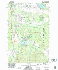 1990 East Olympia1995 Print · USGSThurston County’s prairie and timber lands are captured here in the 1990s as suburban growth reached toward the Deschutes River. Genealogists and historians can trace rail history near Western Junction or explore old settlements like Plumb and Fir Tree.
 - 1991 Map of Tacoma
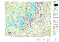 1991 Tacoma1991 Print · USGSThe South Sound and Tacoma waterfront appear here in the early nineties, showing a landscape defined by deep-water inlets and massive federal installations. Researchers can trace the development of Lakewood Center or locate the historic rail lines of the Burlington Northern Railroad and Union Pacific Railroad.
Showing maps 1-25 of 42
Top cities near Lacey
- Lakewood historical maps
- Olympia historical maps
- University Place historical maps
- Tumwater historical maps
- Yelm historical maps
- DuPont historical maps
See more
Top neighborhoods of Lacey
Frequently asked questions
- What are the different types of historical maps available for Lacey?
- What is the oldest map of Lacey?
- Where can I purchase historical maps of Lacey for my home or office?
- Where can I download high-res historical maps of Lacey?
- Are there historical topographic maps available for Lacey?
- Is there historical aerial imagery available for Lacey?
- Where are historical maps of Lacey sourced from?