Old Maps of Barron, Washington for Metal Detecting
Plan your next treasure hunt with 11 historic maps of Barron. Find old homesites, ghost towns, trails, and gathering spots that may be lost to time — perfect for identifying promising metal detecting locations.
- Locate forgotten sites: Uncover places like long-lost settlements, abandoned rail lines, or gathering spots.
- Plan better hunts: Use map overlays combined with LiDAR or satellite views to narrow in on historically rich areas.
- Made for detectorists: Thousands of hobbyists use these maps to discover relics, coins, and hidden history.
Use these historic maps to boost your research and find new opportunities beneath the surface of Barron.
Barron, WA maps
(11)- 1920 Map of Slate Pass
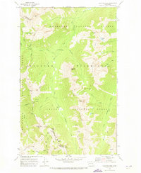
 1920 Slate Pass1920 Print · USGSThe North Cascades high country at the start of the 1920s reveals a wilderness of newly surveyed peaks and vital mountain passes. Trace early forest and mining routes through Slate Pass and Harts Pass or locate the remote Chancellor Power Plant.
 - 1955 Map of Concrete, 1967 Print
 1955 Concrete1967 Print · USGSThe North Cascades in the mid-fifties reveal a landscape of deep glacier-fed lakes and riverside timber towns. You can trace the Great Northern rail lines through Granite Falls or locate remote outposts like Stehekin and Marblemount along the Skagit and Chelan waters.
 - 1958 Map of Concrete
 1958 Concrete1958 Print · USGSThe North Cascades and Skagit Valley are captured here in the late fifties, showing a landscape defined by glacier-carved peaks and river-bottom settlements. Genealogists and historians can locate remote mining sites like Holden Mine and mountain outposts such as Stehekin, Marblemount, and Mazama.2 unique versions available
 - 1962 Map of Concrete
 1962 Concrete1962 Print · USGSThe Northern Cascades in the early sixties reveal a landscape of high alpine peaks and deep river valleys before the modern park era. Genealogists and historians can trace rail-and-river towns like Concrete, Darrington, and Stehekin, alongside industry at the Holden Mine.
 - 1969 Map of Pasayten Peak, 1973 Print
 1969 Pasayten Peak1973 Print · USGSThe Okanogan wilderness in the late sixties remained a primitive landscape of high-mountain passes and remote mining claims. Hikers and historians can trace early routes along the Pacific Crest National Scenic Trail or locate the mines near Indiana Basin.2 unique versions available
 - 2002 Map of Pasayten Peak, 2006 Print
 2002 Pasayten Peak2006 Print · USGSThe high Cascades at the turn of the millennium are captured here, centered on the remote wilderness where Okanogan and Whatcom counties meet. Researchers can trace the historic mining site at Barron or locate old Mines and Prospects near Windy Pass and Foggy Pass.
 - 2011 Map of Pasayten Peak, 2011 Print
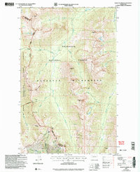
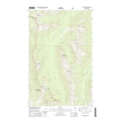
 2011 Pasayten Peak2011 Print · USGSCovers Barron, including Whatcom County, Okanogan County, and other nearby areas
 - 2014 Map of Pasayten Peak, 2014 Print
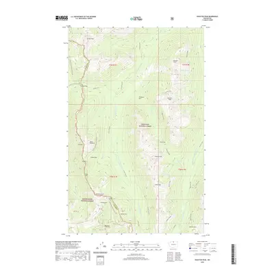
 2014 Pasayten Peak2014 Print · USGSCovers Barron, including Whatcom County, Okanogan County, and other nearby areas
 - 2017 Map of Pasayten Peak, 2017 Print
 2017 Pasayten Peak2017 Print · USGSCovers Barron, including Whatcom County, Okanogan County, and other nearby areas
 - 2020 Map of Pasayten Peak, 2020 Print
 2020 Pasayten Peak2020 Print · USGSCovers Barron, including Whatcom County, Okanogan County, and other nearby areas
 - 2023 Map of Pasayten Peak, 2023 Print
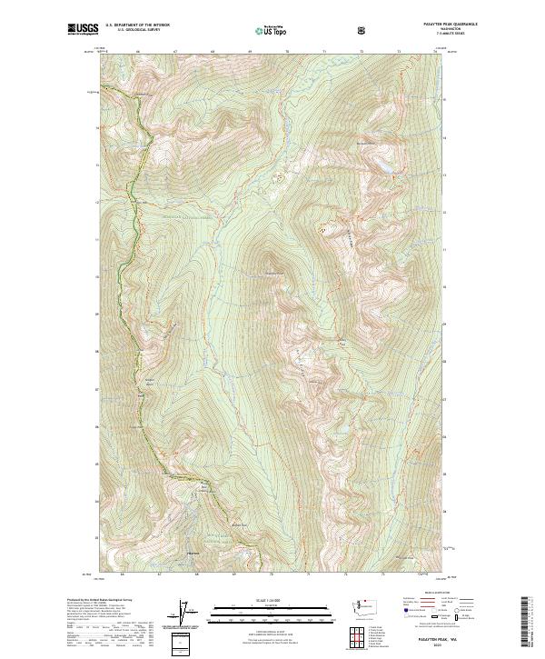 2023 Pasayten Peak2023 Print · USGSThe high Cascades of the Pasayten Wilderness are shown here in 2023, where remote trails and glacial peaks define the landscape. Hikers and historians can trace the Pacific Crest National Scenic Trl through Foggy Pass or locate the site of Barron.
End of results
Showing maps 1-11 of 11
Frequently asked questions
- What are the different types of historical maps available for Barron?
- What is the oldest map of Barron?
- Where can I purchase historical maps of Barron for my home or office?
- Where can I download high-res historical maps of Barron?
- Are there historical topographic maps available for Barron?
- Is there historical aerial imagery available for Barron?
- Where are historical maps of Barron sourced from?