1900-1909 Maps of Bellingham, Washington
Explore 3 historic maps of Bellingham from 1900-1909. These maps offer a rare glimpse into what life looked like during the 1900s — showing old roads, neighborhoods, homes, and landmarks that have changed or disappeared over time.
Whether you're researching your family's past, planning a metal detecting trip, or studying how Bellingham's landscape evolved across the 1900s, these high-resolution maps are a powerful tool for exploring the history of this region.
- Focus on a specific era: All maps on this page are from the 1900s, giving you a focused view of this time period.
- See what’s changed: Compare century-old streets, trails, and buildings to today's modern landscape using overlays and satellite layers.
- Research with precision: Use these maps for genealogy, historical research, land use analysis, or educational projects.
- View, download, or print: Maps are fully viewable online in high resolution, and can be downloaded or printed for your own records.
Start exploring Bellingham's history through authentic maps from the 1900s. This is your window into the past.
Bellingham, WA maps
(3)- 1906 Map of Sumas, 1958 Print
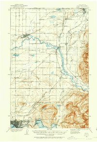 1906 Sumas1958 Print · USGSWhatcom County's northern borderlands are shown in great detail during the early twentieth century, from the international line down to the growing city of Bellingham. Genealogists and historians can trace early school sites like Gerry School, local industry at Larsens Mill, and the path of the Chicago Milwaukee St Paul and Pacific RR.
 - 1907 Map of Blaine
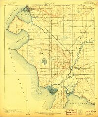 1907 Blaine1907 Print · USGSNorthwest Washington at the dawn of the twentieth century is defined here by the international border and the arrival of the rails. Genealogists and historians can trace the early layouts of Blaine, Ferndale, and Semiahmoo, alongside the Great Northern RR and the Lummi Indian Reservation.3 unique versions available
 - 1908 Map of Sumas
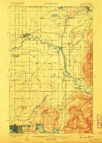 1908 Sumas1908 Print · USGSNorthern Whatcom County comes into focus in the early twentieth century as a bustling network of river towns and timber rails. Genealogists and local historians can trace family roots through sites like Larsens Mill, Geary School, and old stops along the B B and B C R R.3 unique versions available
End of results
Showing maps 1-3 of 3
Top cities near Bellingham
Top neighborhoods of Bellingham
- Fairhaven historical maps
- Red Square historical maps
- Haskell Plaza historical maps
- City Center historical maps
- Lakeway historical maps
- Sehome historical maps
See more
Frequently asked questions
- What are the different types of historical maps available for Bellingham?
- What is the oldest map of Bellingham?
- Where can I purchase historical maps of Bellingham for my home or office?
- Where can I download high-res historical maps of Bellingham?
- Are there historical topographic maps available for Bellingham?
- Is there historical aerial imagery available for Bellingham?
- Where are historical maps of Bellingham sourced from?