Old Maps of Cornwall Park, Bellingham
Explore 11 old maps of Cornwall Park, spanning from 1906 to today. These high-resolution historic maps reveal how streets, neighborhoods, landmarks, and natural features evolved over time — perfect for genealogy, metal detecting, research, and local history exploration.
What you can do with these maps:
- See how Cornwall Park changed over time: Compare historical maps to modern-day views to trace roads, homesites, rail lines & more.
- View detailed metadata: Each map includes creators, publishers, year, scale, and archive source.
- Overlay maps with satellite & LiDAR: Visualize the past alongside modern tools to explore terrain & human change.
- Trusted historical sources: Maps sourced from the USGS, Library of Congress, and other archives.
- Access maps your way: View online, download high-res files, or order prints for personal or research use.
Start exploring old maps of Cornwall Park to uncover forgotten places, hidden landmarks, and the deep history beneath your feet.
Cornwall Park, Bellingham maps
(11)- 1906 Map of Sumas, 1958 Print
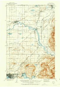 1906 Sumas1958 Print · USGSWhatcom County's northern borderlands are shown in great detail during the early twentieth century, from the international line down to the growing city of Bellingham. Genealogists and historians can trace early school sites like Gerry School, local industry at Larsens Mill, and the path of the Chicago Milwaukee St Paul and Pacific RR.
 - 1908 Map of Sumas
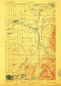 1908 Sumas1908 Print · USGSNorthern Whatcom County comes into focus in the early twentieth century as a bustling network of river towns and timber rails. Genealogists and local historians can trace family roots through sites like Larsens Mill, Geary School, and old stops along the B B and B C R R.3 unique versions available
 - 1954 Map of Bellingham North, 1957 Print
 1954 Bellingham North1957 Print · USGSBellingham and its northern hinterlands are captured here during a period of steady mid-century growth. Researchers can trace the waterfront's industrial footprint at Larson Mill, locate family plots at Bayview Cemetery, or explore the early neighborhoods of Silver Beach.5 unique versions available
 - 1954 Map of Lynden, 1960 Print
 1954 Lynden1960 Print · USGSWhatcom County in the mid-fifties is captured here as a landscape of river-valley farming and border commerce. Genealogists can trace family names and sites across Lynden Cemetery, the Northwood Church, and old school sites like Harmony School.3 unique versions available
 - 1957 Map of Victoria, 1960 Print
 1957 Victoria1960 Print · USGSThe San Juan Islands and the North Cascades coastline are shown in detail during the late fifties, a period of significant military and industrial presence. Researchers can trace historic rail lines like the Great Northern or locate sites such as the Whidbey Island Naval Air Sta and Friday Harbor.4 unique versions available
 - 1975 Map of Bellingham, 1977 Print
 1975 Bellingham1977 Print · USGSNorthwest Washington in the mid-seventies is captured here, from the Canadian border at Blaine to the San Juan Islands. Researchers can trace tribal lands on the Lummi Indian Reservation, find rural settlements like Cokedale, or follow the Burlington Northern rail lines.
 - 2011 Map of Bellingham North, 2011 Print
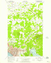
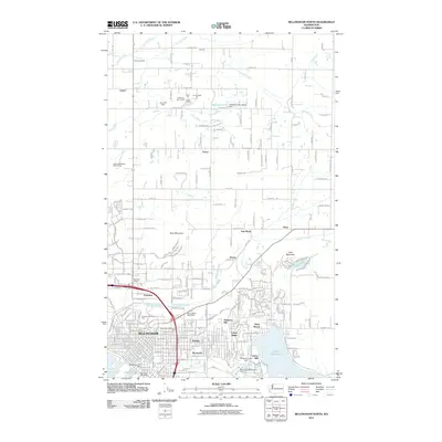 2011 Bellingham North2011 Print · USGSCovers Cornwall Park, including Bellingham, Van Wyck, and other nearby areas
 - 2014 Map of Bellingham North, 2014 Print
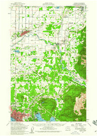
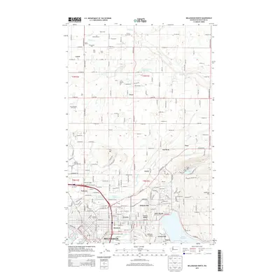 2014 Bellingham North2014 Print · USGSCovers Cornwall Park, including Bellingham, Van Wyck, and other nearby areas
 - 2017 Map of Bellingham North, 2017 Print
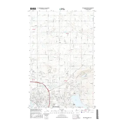 2017 Bellingham North2017 Print · USGSCovers Cornwall Park, including Bellingham, Van Wyck, and other nearby areas
 - 2020 Map of Bellingham North, 2020 Print
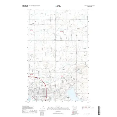 2020 Bellingham North2020 Print · USGSCovers Cornwall Park, including Bellingham, Van Wyck, and other nearby areas
 - 2023 Map of Bellingham North, 2023 Print
 2023 Bellingham North2023 Print · USGSBellingham and its northern hinterlands are captured in this recent survey, showcasing the city's growth from the bay to the mountains. Genealogists and researchers can trace local roots through Bayview Cem, the rural settlement of Laurel, and the industrial heritage of Larson Mill.
End of results
Showing maps 1-11 of 11
Frequently asked questions
- What are the different types of historical maps available for Cornwall Park?
- What is the oldest map of Cornwall Park?
- Where can I purchase historical maps of Cornwall Park for my home or office?
- Where can I download high-res historical maps of Cornwall Park?
- Are there historical topographic maps available for Cornwall Park?
- Is there historical aerial imagery available for Cornwall Park?
- Where are historical maps of Cornwall Park sourced from?