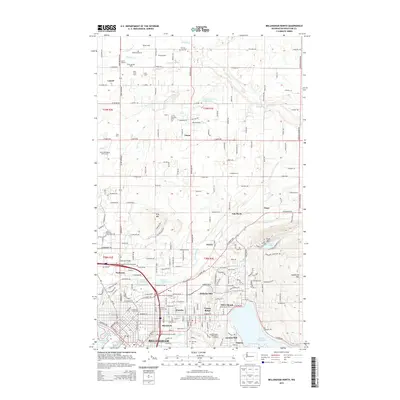
2014 Map of Bellingham North
USGS Topo · Published 2014About this map
Bellingham anchors this 2014 survey, which highlights the northern expansion of the city into neighborhoods like Roosevelt, Alabama Hill, and Forest Ridge. The landscape is a transition between urban density and the agricultural heritage of Whatcom County, characterized by numerous family-named operations such as Kratzig Dairy, Jo Ray Guernsey Farm, and Crandall Farms. The eastern edge of the map rises into the foothills of Squalicum Mountain and Toad Mtn, while the southern portion reaches the shores of Lake Whatcom and Bellingham Bay. Distinctive community landmarks include the Washington Bellingham Hatchery near Larson Mill and the expansive Bayview Cem. These features, alongside major transit corridors like the Mt Baker Hwy and Guide Meridian Rd, illustrate how the city has integrated with the surrounding natural terrain and water bodies.
Find a feature on this map
243 named features on this map. Tap any name to fly to it.
Don’t see what you’re looking for? This feature index may not catch every label — zoom into the map to look around manually.
Map Details
Editions of this 2014 Bellingham North Map
This is the sole edition of this map. No revisions or reprints were ever made.
Other maps of this area

1906 · Sumas
USGS Topo · 1:62,500

1907 · Blaine
USGS Topo · 1:62,500

1908 · Sumas
USGS Topo · 1:62,500

1918 · Samish Lake
USGS Topo · 1:62,500

1943 · Anacortes
USGS Topo · 1:62,500

1951 · Anacortes
USGS Topo · 1:62,500

1952 · Lake Whatcom
USGS Topo · 1:24,000

1952 · Bertrand Creek
USGS Topo · 1:24,000

1952 · Lynden
USGS Topo · 1:24,000

1952 · Lawrence
USGS Topo · 1:24,000