
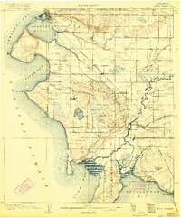
1907 Map of Blaine
USGS Topo · Published 1907About this map
The United States - Canada Boundary Line serves as the northern anchor of this coastal landscape, where the port of Blaine sits perched at the entrance to Drayton Harbor. Early development in the region is closely tied to the Great Northern RR, which cuts a diagonal path through the timber and marshlands, connecting the border to southern hubs through the settlement at Custer. To the south, the Nooksak River winds toward Bellingham Bay, creating a fertile valley where Ferndale and Marietta take root. The southwestern portion of the sheet is dominated by the Lummi Indian Reservation, encompassing the delta of the Lummi River. Distinctive coastal features like Birch Point and Point Whitehorn frame Birch Bay, highlighting a maritime-focused economy and geography before the heavy industrialization of later decades. Interior landmarks like Lake Terrell and Elk Marsh suggest the original wetlands that once characterized this corner of Whatcom County.
Find a feature on this map
46 named features on this map. Tap any name to fly to it.
Don’t see what you’re looking for? This feature index may not catch every label — zoom into the map to look around manually.
Map Details
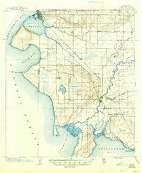
Editions of this 1907 Blaine Map
3 editions found
Other maps of this area

1906 · Sumas
USGS Topo · 1:62,500

1908 · Sumas
USGS Topo · 1:62,500

1918 · Samish Lake
USGS Topo · 1:62,500

1943 · Orcas Island
USGS Topo · 1:62,500

1943 · Anacortes
USGS Topo · 1:62,500

1951 · Anacortes
USGS Topo · 1:62,500

1952 · Bertrand Creek
USGS Topo · 1:24,000

1952 · Lynden
USGS Topo · 1:24,000

1952 · Birch Point
USGS Topo · 1:24,000

1952 · Ferndale
USGS Topo · 1:24,000