
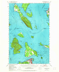
1951 Map of Anacortes
USGS Topo · Published 1953About this map
Anacortes and the surrounding islands of the northern Puget Sound appear here in the early 1950s, revealing a landscape defined by maritime industry and small island settlements. The city of Anacortes sits at the bottom of the sheet, connected to the mainland via the Northern Pacific railroad and serving as a gateway to Guemes Island and beyond. To the north, the Lummi Indian Reservation spans both the mainland and a portion of Lummi Island, where early resorts like Loganita Lodge and The Willows provided coastal retreats. The map provides significant detail for genealogists and local historians, showing the locations of small rural institutions such as the Sinclair Sch on Sinclair Island and the Guemes Sch near Eden Cem. The varied coastline is dotted with smaller locales like Urban and Indian Village, while the waterways of Hale Passage and Bellingham Channel facilitate the region's transport network.
Find a feature on this map
89 named features on this map. Tap any name to fly to it.
Don’t see what you’re looking for? This feature index may not catch every label — zoom into the map to look around manually.
Map Details
Editions of this 1951 Anacortes Map
2 editions found
Other maps of this area

1906 · Sumas
USGS Topo · 1:62,500

1907 · Blaine
USGS Topo · 1:62,500

1908 · Sumas
USGS Topo · 1:62,500

1911 · Mount Vernon
USGS Topo · 1:125,000

1918 · Samish Lake
USGS Topo · 1:62,500

1940 · Mt Vernon
USGS Topo · 1:62,500

1943 · Mt Vernon
USGS Topo · 1:62,500

1943 · Richardson
USGS Topo · 1:62,500

1943 · Orcas Island
USGS Topo · 1:62,500

1943 · Deception Pass
USGS Topo · 1:62,500