
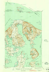
1943 Map of Orcas Island
USGS Topo · Published 1943About this map
Moran State Park dominates the eastern half of the island, where high peaks like Mt Constitution overlook freshwater bodies such as Mountain Lake and Cascade Lake. This 1941 survey captures the maritime connectivity of the San Juan Islands, showing ferry routes weaving through President Channel and Upright Channel to link settlements like Lopez and Port Stanley. Local landmarks such as the CCC Camp and Buckhorn Lodge reflect the development of public lands and early recreation. Along the irregular coastline, small communities and landings like Deer Harbor, Olga, and East Sound are depicted before significant post-war growth. The inclusion of the Port Stanley Sch and a Quarry near Fishing Bay provides a look at the essential infrastructure and industries supporting these island residents during the early 1940s.
Find a feature on this map
149 named features on this map. Tap any name to fly to it.
Don’t see what you’re looking for? This feature index may not catch every label — zoom into the map to look around manually.
Map Details
Editions of this 1943 Orcas Island Map
2 editions found
Other maps of this area

1907 · Blaine
USGS Topo · 1:62,500

1943 · Richardson
USGS Topo · 1:62,500

1943 · Deception Pass
USGS Topo · 1:62,500

1943 · Anacortes
USGS Topo · 1:62,500

1951 · Deception Pass
USGS Topo · 1:62,500

1951 · Anacortes
USGS Topo · 1:62,500

1952 · Lummi Bay
USGS Topo · 1:24,000

1952 · Blaine
USGS Topo · 1:62,500

1954 · Waldron Island
USGS Topo · 1:24,000

1954 · Friday Harbor
USGS Topo · 1:24,000