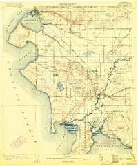
1907 Map of Blaine
USGS Topo · Published 1922About this map
Settlement along the United States-Canada Boundary Line centers on the port of Blaine and its neighbor across Drayton Harbor, Semiahmoo. This northern coastal landscape is defined by the sharp transition from the Georgia Strait to the inland agricultural and timber lands of the early twentieth century. The Great Northern RR provides the primary industrial artery, cutting northwest through Custer toward the border.
Find a feature on this map
48 named features on this map. Tap any name to fly to it.
Don’t see what you’re looking for? This feature index may not catch every label — zoom into the map to look around manually.
Map Details
Editions of this 1907 Blaine Map
3 editions found
Other maps of this area

1906 · Sumas
USGS Topo · 1:62,500

1907 · Blaine
USGS Topo · 1:62,500

1908 · Sumas
USGS Topo · 1:62,500

1918 · Samish Lake
USGS Topo · 1:62,500

1943 · Orcas Island
USGS Topo · 1:62,500

1943 · Anacortes
USGS Topo · 1:62,500

1951 · Anacortes
USGS Topo · 1:62,500

1952 · Bertrand Creek
USGS Topo · 1:24,000

1952 · Lynden
USGS Topo · 1:24,000

1952 · Birch Point
USGS Topo · 1:24,000