Old Maps of City Center, Bellingham for Genealogy
Trace your family roots with 37 historic maps of City Center. These high-res maps reveal old neighborhoods, homesites, landmarks, and streets — helping you uncover where your ancestors lived and how the area evolved over time.
- Explore historic neighborhoods: Identify where your relatives may have lived in the 1800s or 1900s.
- Compare maps over time: Trace the changes in streets, buildings, and landmarks for multi-generational research.
- Perfect for genealogy & ancestry research: Used by family historians and researchers to map out lineage and migration.
These maps are an incredible resource for exploring your personal connection to City Center's past.
City Center, Bellingham maps
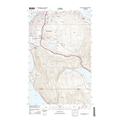
(37)- 1906 Map of Sumas, 1958 Print
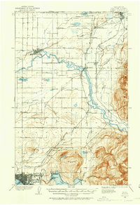 1906 Sumas1958 Print · USGSWhatcom County's northern borderlands are shown in great detail during the early twentieth century, from the international line down to the growing city of Bellingham. Genealogists and historians can trace early school sites like Gerry School, local industry at Larsens Mill, and the path of the Chicago Milwaukee St Paul and Pacific RR.
 - 1907 Map of Blaine
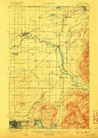
 1907 Blaine1907 Print · USGSNorthwest Washington at the dawn of the twentieth century is defined here by the international border and the arrival of the rails. Genealogists and historians can trace the early layouts of Blaine, Ferndale, and Semiahmoo, alongside the Great Northern RR and the Lummi Indian Reservation.3 unique versions available
 - 1908 Map of Sumas
 1908 Sumas1908 Print · USGSNorthern Whatcom County comes into focus in the early twentieth century as a bustling network of river towns and timber rails. Genealogists and local historians can trace family roots through sites like Larsens Mill, Geary School, and old stops along the B B and B C R R.3 unique versions available
 - 1918 Map of Samish Lake
 1918 Samish Lake1918 Print · USGSCoastal Skagit and Whatcom counties appear here during the height of the early twentieth-century timber and rail era. Researchers can pinpoint long-standing landmarks like the Alger Shingle Mill, Blue Canyon, and the State Fish Hatchery.3 unique versions available
 - 1943 Map of Anacortes
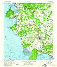
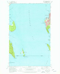
 1943 Anacortes1943 Print · USGSThe San Juan Islands and Skagit coastline appear here in the early 1940s, during an era of remote island schoolhouses and ferry reliance. Genealogists can locate family landmarks like Eden Cem and Guemes Sch, or trace the waterfront of Anacortes and South Bellingham.
 - 1951 Map of Anacortes, 1953 Print
 1951 Anacortes1953 Print · USGSThe northern Puget Sound islands and the city of Anacortes are captured here in the early fifties during a period of steady coastal growth. Researchers can locate vanished landmarks and family roots at Eden Cem, Sinclair Sch, and the Lummi Indian Reservation.2 unique versions available
 - 1952 Map of Ferndale, 1957 Print
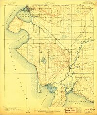
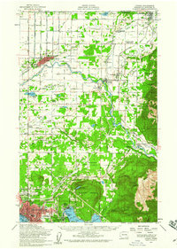
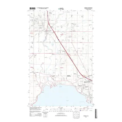
 1952 Ferndale1957 Print · USGSCoastal Whatcom County is captured here in the early fifties as the delta landscape of the Nooksack River meets the growing outskirts of Bellingham. Researchers can trace old property lines near Ferndale, locate the Lummi Sch on the reservation, or find the Drive-in Theater along the highway.4 unique versions available
 - 1952 Map of Blaine, 1960 Print
 1952 Blaine1960 Print · USGSCoastal Whatcom County is shown in the early fifties, from the international border at Blaine down to the Lummi Indian Reservation. Genealogists and local historians can trace rural schoolhouses like Whitehorn School, find family plots at Kulshan Cem, or locate the old Haynie Grange and Birch Bay Circle Grange.
 - 1954 Map of Bellingham North, 1957 Print
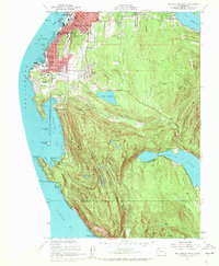
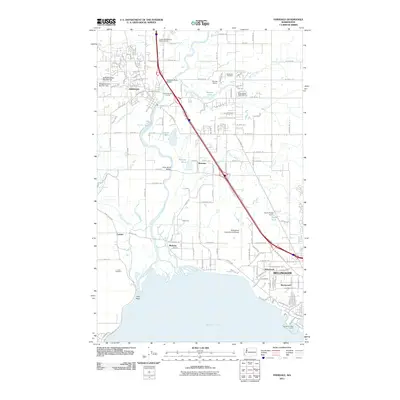
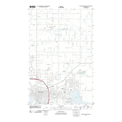
 1954 Bellingham North1957 Print · USGSBellingham and its northern hinterlands are captured here during a period of steady mid-century growth. Researchers can trace the waterfront's industrial footprint at Larson Mill, locate family plots at Bayview Cemetery, or explore the early neighborhoods of Silver Beach.5 unique versions available
 - 1954 Map of Bellingham South, 1959 Print
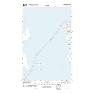
 1954 Bellingham South1959 Print · USGSCoastal Whatcom County is captured mid-century as the city expands toward the wooded heights. Genealogists and historians can trace institutional roots at Western Washington College and find early school sites like Lowell School and Larrabee School.4 unique versions available
 - 1954 Map of Lynden, 1960 Print
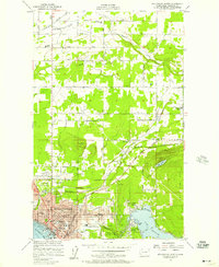
 1954 Lynden1960 Print · USGSWhatcom County in the mid-fifties is captured here as a landscape of river-valley farming and border commerce. Genealogists can trace family names and sites across Lynden Cemetery, the Northwood Church, and old school sites like Harmony School.3 unique versions available
 - 1954 Map of Samish Lake, 1960 Print
 1954 Samish Lake1960 Print · USGSCoastal Skagit and Whatcom Counties are captured here in the mid-fifties as rural settlements like Garden of Eden and Blue Canyon thrived alongside the growing college town of Bellingham. Genealogists can trace family landmarks like Belfast Sch, the Silver Run Grange Hall, and the Pierson Sch.
 - 1957 Map of Victoria, 1960 Print
 1957 Victoria1960 Print · USGSThe San Juan Islands and the North Cascades coastline are shown in detail during the late fifties, a period of significant military and industrial presence. Researchers can trace historic rail lines like the Great Northern or locate sites such as the Whidbey Island Naval Air Sta and Friday Harbor.4 unique versions available
 - 1975 Map of Bellingham, 1977 Print
 1975 Bellingham1977 Print · USGSNorthwest Washington in the mid-seventies is captured here, from the Canadian border at Blaine to the San Juan Islands. Researchers can trace tribal lands on the Lummi Indian Reservation, find rural settlements like Cokedale, or follow the Burlington Northern rail lines.
 - 1977 Map of Eliza Island
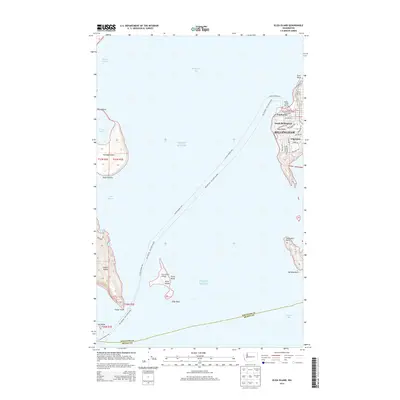
 1977 Eliza Island1977 Print · USGSThe Bellingham waterfront and neighboring islands are captured in the late seventies as the city expanded southward. Researchers can trace the Burlington Northern tracks along the coast and locate local landmarks like Fairhaven Middle Sch and the secluded shoreline of Eliza Island.2 unique versions available
 - 1998 Map of Eliza Island, 2003 Print
 1998 Eliza Island2003 Print · USGSBellingham's southern waterfront and the surrounding San Juan islands are captured here in the late 1990s as coastal development met environmental conservation. Trace the streets of Fairhaven and Edgemoor or locate landmarks like Fairhaven Middle Sch and Eliza Island.
 - 1998 Map of Bellingham South, 2003 Print
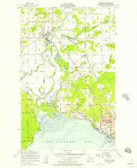
 1998 Bellingham South2003 Print · USGSCoastal Bellingham and the high ridgelines of the Chuckanut Mountains meet here during the late nineties. Researchers can trace local development from the Larrabee School and Bayview Cemetery to the shores of Lake Samish and Chuckanut Village.
 - 2011 Map of Ferndale, 2011 Print
 2011 Ferndale2011 Print · USGSCovers City Center, including Bellingham, Ferndale, and other nearby areas
 - 2011 Map of Eliza Island, 2011 Print
 2011 Eliza Island2011 Print · USGSCovers City Center, including Bellingham, Whatcom County, and other nearby areas
 - 2011 Map of Bellingham South, 2011 Print
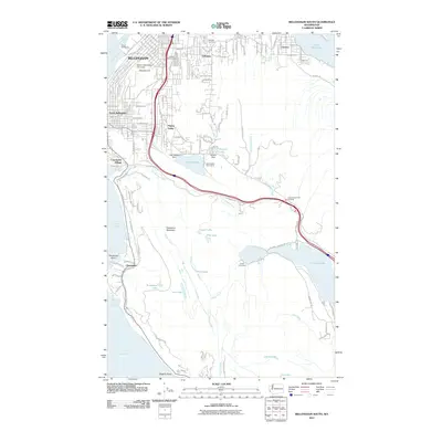 2011 Bellingham South2011 Print · USGSCovers City Center, including Bellingham, Chuckanut, and other nearby areas
 - 2011 Map of Bellingham North, 2011 Print
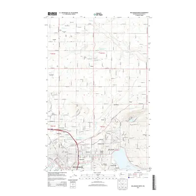
 2011 Bellingham North2011 Print · USGSCovers City Center, including Bellingham, Van Wyck, and other nearby areas
 - 2014 Map of Bellingham North, 2014 Print
 2014 Bellingham North2014 Print · USGSCovers City Center, including Bellingham, Van Wyck, and other nearby areas
 - 2014 Map of Ferndale, 2014 Print
 2014 Ferndale2014 Print · USGSCovers City Center, including Bellingham, Ferndale, and other nearby areas
 - 2014 Map of Eliza Island, 2014 Print
 2014 Eliza Island2014 Print · USGSCovers City Center, including Bellingham, Whatcom County, and other nearby areas
 - 2014 Map of Bellingham South, 2014 Print
 2014 Bellingham South2014 Print · USGSCovers City Center, including Bellingham, Chuckanut, and other nearby areas
Showing maps 1-25 of 37
Frequently asked questions
- What are the different types of historical maps available for City Center?
- What is the oldest map of City Center?
- Where can I purchase historical maps of City Center for my home or office?
- Where can I download high-res historical maps of City Center?
- Are there historical topographic maps available for City Center?
- Is there historical aerial imagery available for City Center?
- Where are historical maps of City Center sourced from?