Old Maps of South Bellingham, Bellingham for Metal Detecting
Plan your next treasure hunt with 11 historic maps of South Bellingham. Find old homesites, ghost towns, trails, and gathering spots that may be lost to time — perfect for identifying promising metal detecting locations.
- Locate forgotten sites: Uncover places like long-lost settlements, abandoned rail lines, or gathering spots.
- Plan better hunts: Use map overlays combined with LiDAR or satellite views to narrow in on historically rich areas.
- Made for detectorists: Thousands of hobbyists use these maps to discover relics, coins, and hidden history.
Use these historic maps to boost your research and find new opportunities beneath the surface of South Bellingham.
South Bellingham, Bellingham maps
(11)- 1918 Map of Samish Lake
 1918 Samish Lake1918 Print · USGSCoastal Skagit and Whatcom counties appear here during the height of the early twentieth-century timber and rail era. Researchers can pinpoint long-standing landmarks like the Alger Shingle Mill, Blue Canyon, and the State Fish Hatchery.3 unique versions available
 - 1954 Map of Bellingham South, 1959 Print
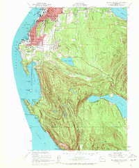 1954 Bellingham South1959 Print · USGSCoastal Whatcom County is captured mid-century as the city expands toward the wooded heights. Genealogists and historians can trace institutional roots at Western Washington College and find early school sites like Lowell School and Larrabee School.4 unique versions available
 - 1954 Map of Samish Lake, 1960 Print
 1954 Samish Lake1960 Print · USGSCoastal Skagit and Whatcom Counties are captured here in the mid-fifties as rural settlements like Garden of Eden and Blue Canyon thrived alongside the growing college town of Bellingham. Genealogists can trace family landmarks like Belfast Sch, the Silver Run Grange Hall, and the Pierson Sch.
 - 1957 Map of Victoria, 1960 Print
 1957 Victoria1960 Print · USGSThe San Juan Islands and the North Cascades coastline are shown in detail during the late fifties, a period of significant military and industrial presence. Researchers can trace historic rail lines like the Great Northern or locate sites such as the Whidbey Island Naval Air Sta and Friday Harbor.4 unique versions available
 - 1975 Map of Bellingham, 1977 Print
 1975 Bellingham1977 Print · USGSNorthwest Washington in the mid-seventies is captured here, from the Canadian border at Blaine to the San Juan Islands. Researchers can trace tribal lands on the Lummi Indian Reservation, find rural settlements like Cokedale, or follow the Burlington Northern rail lines.
 - 1998 Map of Bellingham South, 2003 Print
 1998 Bellingham South2003 Print · USGSCoastal Bellingham and the high ridgelines of the Chuckanut Mountains meet here during the late nineties. Researchers can trace local development from the Larrabee School and Bayview Cemetery to the shores of Lake Samish and Chuckanut Village.
 - 2011 Map of Bellingham South, 2011 Print
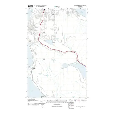 2011 Bellingham South2011 Print · USGSCovers South Bellingham, including Bellingham, Chuckanut, and other nearby areas
 - 2014 Map of Bellingham South, 2014 Print
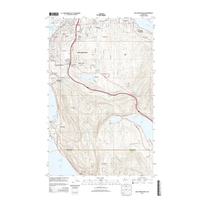 2014 Bellingham South2014 Print · USGSCovers South Bellingham, including Bellingham, Chuckanut, and other nearby areas
 - 2017 Map of Bellingham South, 2017 Print
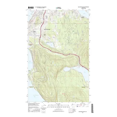 2017 Bellingham South2017 Print · USGSCovers South Bellingham, including Bellingham, Chuckanut, and other nearby areas
 - 2020 Map of Bellingham South, 2020 Print
 2020 Bellingham South2020 Print · USGSCovers South Bellingham, including Bellingham, Chuckanut, and other nearby areas
 - 2023 Map of Bellingham South, 2023 Print
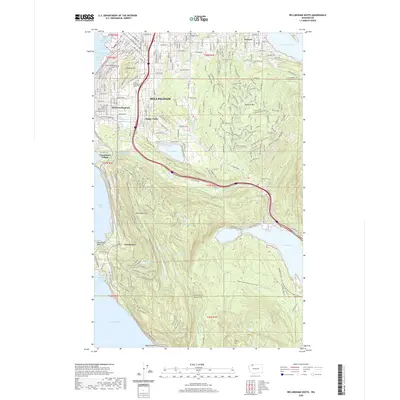
 2023 Bellingham South2023 Print · USGSThe southern reaches of Bellingham and the Chuckanut Range are captured in this modern survey, showing the interface between university life and the Pacific coast. Trace the development of Sudden Valley or explore the trail systems around Lake Padden and Chuckanut Mtn.
End of results
Showing maps 1-11 of 11
Frequently asked questions
- What are the different types of historical maps available for South Bellingham?
- What is the oldest map of South Bellingham?
- Where can I purchase historical maps of South Bellingham for my home or office?
- Where can I download high-res historical maps of South Bellingham?
- Are there historical topographic maps available for South Bellingham?
- Is there historical aerial imagery available for South Bellingham?
- Where are historical maps of South Bellingham sourced from?