1900s (20th Century) Maps of Everson, Washington
Explore 7 historic maps of Everson from the 1900s (20th Century). These maps offer a rare glimpse into what life looked like during the 1900s — showing old roads, neighborhoods, homes, and landmarks that have changed or disappeared over time.
Whether you're researching your family's past, planning a metal detecting trip, or studying how Everson's landscape evolved across the 1900s, these high-resolution maps are a powerful tool for exploring the history of this region.
- Focus on a specific era: All maps on this page are from the 1900s, giving you a focused view of this time period.
- See what’s changed: Compare century-old streets, trails, and buildings to today's modern landscape using overlays and satellite layers.
- Research with precision: Use these maps for genealogy, historical research, land use analysis, or educational projects.
- View, download, or print: Maps are fully viewable online in high resolution, and can be downloaded or printed for your own records.
Start exploring Everson's history through authentic maps from the 1900s. This is your window into the past.
Everson, WA maps
(7)- 1906 Map of Sumas, 1958 Print
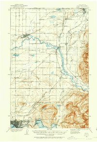 1906 Sumas1958 Print · USGSWhatcom County's northern borderlands are shown in great detail during the early twentieth century, from the international line down to the growing city of Bellingham. Genealogists and historians can trace early school sites like Gerry School, local industry at Larsens Mill, and the path of the Chicago Milwaukee St Paul and Pacific RR.
 - 1908 Map of Sumas
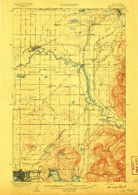 1908 Sumas1908 Print · USGSNorthern Whatcom County comes into focus in the early twentieth century as a bustling network of river towns and timber rails. Genealogists and local historians can trace family roots through sites like Larsens Mill, Geary School, and old stops along the B B and B C R R.3 unique versions available
 - 1952 Map of Lynden, 1954 Print
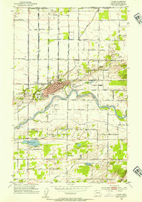 1952 Lynden1954 Print · USGSThe northern Whatcom County borderlands come to life in the early fifties, showing the agricultural heart of the Lynden area and the North Prairie. Researchers can trace old family holdings near the Nooksack River and locate historic sites like the Indian Cemetery and Tenmile Grange.3 unique versions available
 - 1952 Map of Sumas, 1954 Print
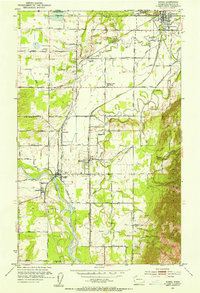 1952 Sumas1954 Print · USGSThe northern border of Whatcom County comes into focus in the early fifties, showing the busy rail junction and international crossing at Sumas. Genealogists and local historians can trace family-named roads like Halverstick Road and Zwashka Rd across a landscape dotted with rural landmarks like the Nooksack Valley High School.5 unique versions available
 - 1954 Map of Lynden, 1960 Print
 1954 Lynden1960 Print · USGSWhatcom County in the mid-fifties is captured here as a landscape of river-valley farming and border commerce. Genealogists can trace family names and sites across Lynden Cemetery, the Northwood Church, and old school sites like Harmony School.3 unique versions available
 - 1957 Map of Victoria, 1960 Print
 1957 Victoria1960 Print · USGSThe San Juan Islands and the North Cascades coastline are shown in detail during the late fifties, a period of significant military and industrial presence. Researchers can trace historic rail lines like the Great Northern or locate sites such as the Whidbey Island Naval Air Sta and Friday Harbor.4 unique versions available
 - 1975 Map of Bellingham, 1977 Print
 1975 Bellingham1977 Print · USGSNorthwest Washington in the mid-seventies is captured here, from the Canadian border at Blaine to the San Juan Islands. Researchers can trace tribal lands on the Lummi Indian Reservation, find rural settlements like Cokedale, or follow the Burlington Northern rail lines.
End of results
Showing maps 1-7 of 7
Top cities near Everson
Top neighborhoods of Everson
Frequently asked questions
- What are the different types of historical maps available for Everson?
- What is the oldest map of Everson?
- Where can I purchase historical maps of Everson for my home or office?
- Where can I download high-res historical maps of Everson?
- Are there historical topographic maps available for Everson?
- Is there historical aerial imagery available for Everson?
- Where are historical maps of Everson sourced from?