Old Maps of Braxton County, West Virginia for Hiking & Exploration
Hike through history with 129 historic maps of Braxton County. Explore old trails, ghost towns, and forgotten backroads — perfect for outdoor adventurers and local explorers.
- Rediscover forgotten places: Map out old mining camps, roads, and footpaths that no longer exist on modern maps.
- Layer with modern tools: Combine with LiDAR or satellite views to plan hikes through historical terrain.
- Made for exploration: Popular among hikers, overlanders, and local history lovers.
Use these maps to find adventure and explore the hidden past of Braxton County.
Braxton County, WV maps
(129)- 1893 Map of Buckhannon
 1893 Buckhannon1893 Print · USGSCentral West Virginia at the end of the nineteenth century shows a network of upland farms and timber-adjacent rail lines. Genealogists can trace family names through landmarks like Alkire Mill, Buckwheat Church, and settlements like Vandalia (Austin).
 - 1893 Map of Sutton
 1893 Sutton1893 Print · USGSCentral West Virginia at the end of the nineteenth century was a world of river-bottom settlements and high mountain ridges. Genealogists can locate family-named landmarks like Bealls Mills, Hickory Knob, and the riverside town of Sutton.3 unique versions available
 - 1896 Map of Buckhannon, 1902 Print
 1896 Buckhannon1902 Print · USGSUpshur and Randolph counties appear here in the late nineteenth century as a landscape of remote mountain settlements and winding river valleys. Genealogists can trace early homesteads and community hubs like Alkires Mill, Hacker Valley, and French Creek before modern development.3 unique versions available
 - 1897 Map of Buckhannon
 1897 Buckhannon1897 Print · USGSUpshur and Randolph counties appear here in the late nineteenth century as a landscape of isolated ridge-top settlements and river-bottom mills. Genealogists can trace family roots through landmarks like Alkires Mill, Goshen Church, and the oddly named Pumpkin Town.
 - 1906 Map of Glenville
 1906 Glenville1906 Print · USGSThe Little Kanawha River valley in the early 1900s was a landscape of remote hills and riverfront hamlets. Genealogists can trace family connections in vanished post offices and creek-side settlements like Stumptown, Lettergap, and Dekalb.2 unique versions available
 - 1906 Map of Burnsville
 1906 Burnsville1906 Print · USGSCentral West Virginia at the turn of the century reveals a landscape of river-fed mills and mountain post offices. Trace family roots and early industry through Burnsville, Bulltown, and the various local works at Falls Mill and Bealls Mills.2 unique versions available
 - 1906 Map of Otter, 1961 Print
 1906 Otter1961 Print · USGSCentral West Virginia at the start of the twentieth century shows a landscape of deep hollows and high ridges before modern highways. Researchers can trace early settlements and family homesteads near Ivydale, Newton, and the remote Redhouse Siding along the Elk River.
 - 1907 Map of Otter
 1907 Otter1907 Print · USGSCentral West Virginia at the turn of the century shows a landscape defined by its river valleys and new industrial rails. Genealogists can trace family homes near Newton, Linden, and Minnora, or follow the path of the Coal and Coke R R through Ivydale.3 unique versions available
 - 1908 Map of Gassaway
 1908 Gassaway1908 Print · USGSCentral West Virginia at the height of the early rail era reveals a landscape of isolated hill settlements and river industry. Genealogists can trace early homesteads and rail stops like Gassaway, Strange Creek, and the many family-named peaks like Davis Knob.
 - 1908 Map of Sutton
 1908 Sutton1908 Print · USGSSutton and the surrounding river valleys are captured at the height of the early twentieth-century rail era. Genealogists and historians can trace defunct mountain post offices and rail stops like Hyer PO, Tesla, and Bakers Run PO along the Baltimore and Ohio Railroad.2 unique versions available
 - 1910 Map of Sutton Special
 1910 Sutton Special1910 Print · USGSCentral West Virginia at the end of the first decade of the 1900s shows a landscape transformed by river-valley railroads. Genealogists can trace family roots through hillside settlements like Flatwoods and Centralia or locate early post offices at Gillespie Hyer PO and Bakers Run Levi PO.3 unique versions available
 - 1910 Map of Gassaway
 1910 Gassaway1910 Print · USGSBraxton County at the peak of its rail-and-river era is captured here, centered on the growing industrial hub of Gassaway. Genealogists and historians can trace early post offices and settlements like Villa Nova Duck PO, Strange Creek, and the Coal and Coke Ry corridor.3 unique versions available
 - 1912 Map of Crawford
 1912 Crawford1912 Print · USGSUpshur County’s rugged interior is captured here in the early twentieth century, showing a landscape shaped by narrow river valleys and high ridges. Genealogists can trace a remarkable network of country schoolhouses like Jewel School and early post offices at Rock Cave PO and Frenchton.2 unique versions available
 - 1913 Map of Hacker Valley
 1913 Hacker Valley1913 Print · USGSWest Virginia's high-country settlements come to life in this early twentieth-century survey of the rugged Elk River headwaters. Researchers can trace the original locations of rural landmarks like Buckwheat Church, Windy Gap School, and the remote Salt Lick Settlement.2 unique versions available
 - 1914 Map of Crawford
 1914 Crawford1914 Print · USGSUpshur and Lewis Counties are shown here just before the First World War, when remote mountain hollows were filled with small schoolhouses and family farms. Trace early rail travel at Roanville Sta or locate family roots near Alkires Mills and the Handkerchief Union School.3 unique versions available
 - 1915 Map of Hacker Valley
 1915 Hacker Valley1915 Print · USGSThe high ridges of Webster and Lewis counties are captured here in the years before the Great War, showing a landscape of isolated mountain settlements and rail-driven timber hubs. Genealogists can trace family footprints at Salisbury Sta Removal PO, Cleveland, and nearly a dozen rural schoolhouses like Snuffville School.4 unique versions available
 - 1925 Map of Glenville, 1962 Print
 1925 Glenville1962 Print · USGSGilmer and Braxton Counties appear in the mid-1920s as a landscape of river-valley hamlets and dozens of one-room schoolhouses. Genealogists can trace family roots through specific landmarks like Otterbein Church, Stumptown, and the Lynch Run School.
 - 1925 Map of Burnsville, 1964 Print
 1925 Burnsville1964 Print · USGSCentral West Virginia's rugged river valleys come alive in the mid-1920s, showing the dense network of hill-country settlements and schools. Genealogists can trace family footprints near Bealls Mills, Stouts Mills, or the many rural schoolhouses like Slidinghill School.
 - 1927 Map of Burnsville
 1927 Burnsville1927 Print · USGSCentral West Virginia in the late twenties was a land of river-side rail hubs and secluded valley schools. Genealogists can trace family lines through dozens of local landmarks like Roalls Mills, St Bernards Church, and the Sand Fork PO.3 unique versions available
 - 1928 Map of Glenville
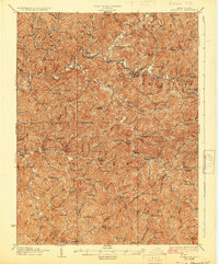 1928 Glenville1928 Print · USGSWest Virginia's central hills in the late twenties are captured here, centered on the Little Kanawha River and its upland communities. Genealogists can locate dozens of country schools and churches, including Peachtree School, Sugar Grove School, and Poplar Tree Church.2 unique versions available
 - 1954 Map of Charleston
 1954 Charleston1954 Print · USGSWest Virginia’s industrial heart and mountain highlands are captured here during the mid-fifties, centered on the capital city. Researchers can trace historic river-and-rail corridors along the Kanawha River and locate remote peaks within the Monongahela National Forest.
 - 1957 Map of Charleston, 1966 Print
 1957 Charleston1966 Print · USGSMid-century West Virginia unfolds along the industrial Kanawha River valley and into the high Allegheny Mountains. Genealogists and historians can trace the vital rail lines of the Chesapeake and Ohio and locate riverside settlements from Saint Albans to Buckhannon.3 unique versions available
 - 1958 Map of Charleston
 1958 Charleston1958 Print · USGSMid-century West Virginia is defined here by the industrial corridor of the Kanawha River and the high ridges of the Allegheny Mountains. Researchers can trace the rail networks of the New York Central or locate remote highland communities like Pickens and Hillsboro.
 - 1961 Map of Charleston
 1961 Charleston1961 Print · USGSWest Virginia's capital region and the highlands to the east are shown in detail during the early sixties. Genealogists and historians can trace rail networks like the Baltimore and Ohio RR and find early state parks such as Watoga State Park.
 - 1965 Map of Gassaway, 1967 Print
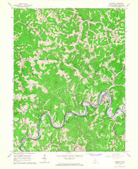 1965 Gassaway1967 Print · USGSBraxton County's river-and-rail corridor is captured here in the mid-sixties, centered on the deep bends of the Elk River. Genealogists and local historians can trace family names at Bealls Mill Cem and Huston-Carr Cem or locate the old Skidmore Sch.2 unique versions available
Showing maps 1-25 of 129
Top cities of Braxton County
Frequently asked questions
- What are the different types of historical maps available for Braxton County?
- What is the oldest map of Braxton County?
- Where can I purchase historical maps of Braxton County for my home or office?
- Where can I download high-res historical maps of Braxton County?
- Are there historical topographic maps available for Braxton County?
- Is there historical aerial imagery available for Braxton County?
- Where are historical maps of Braxton County sourced from?