Old Maps of Oxford, West Virginia for Academic Research
Study the evolution of Oxford with 14 high-resolution historic maps. Whether you're teaching, researching, or modeling changes in land use, these maps provide essential visual documentation of urban, environmental, and geographic change.
- Analyze long-term change: Track patterns in development, transportation, and natural features.
- Ideal for environmental or urban studies: Support academic projects with primary historical map data.
- Use in the classroom or lab: Educators and researchers rely on these maps to bring historical context to life.
These maps are a powerful tool for teaching, research, and visualizing how Oxford has changed over the decades.
Oxford, WV maps
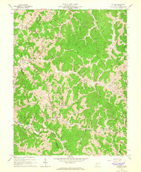
(14)- 1906 Map of Holbrook
 1906 Holbrook1906 Print · USGSRitchie County and the surrounding highlands are captured here at the dawn of the twentieth century. Genealogists can trace family names and early homesteads near Burnt House, the Staunton and Parkersburg Pike, and the village of Pullman.2 unique versions available
 - 1924 Map of Holbrook, 1961 Print
 1924 Holbrook1961 Print · USGSNorth-central West Virginia at the height of its rural settlement density reveals a landscape of ridge-top knobs and narrow hollows. Genealogists and historians can trace dozens of family-named landmarks and local institutions, from Mt Union Church to the many schools like Alum Fork School and Moonrise School.
 - 1926 Map of Holbrook
 1926 Holbrook1926 Print · USGSRitchie and Gilmer Counties are shown here in the mid-1920s, before modern highways altered these mountain valleys. Genealogists can trace family names across dozens of rural institutions, from Fairview Church to the Coal Alum Fork School.2 unique versions available
 - 1949 Map of Clarksburg
 1949 Clarksburg1949 Print · USGSThe upper Ohio River valley and the industrial heart of West Virginia come into focus during this post-war period. Genealogists and researchers can trace the rail corridors of the Baltimore and Ohio and locate centers like Fairmont, Grafton, and Waynesburg.
 - 1956 Map of Clarksburg, 1966 Print
 1956 Clarksburg1966 Print · USGSThe Ohio River valley and the industrial heart of West Virginia are seen here in the mid-1950s as rail and river commerce thrived. Researchers can trace historic transport lines like the Baltimore and Ohio RR and locate ancestral homes in Clarksburg, Moundsville, or Parkersburg.2 unique versions available
 - 1961 Map of Clarksburg
 1961 Clarksburg1961 Print · USGSThe mid-century industrial and river landscapes of West Virginia and Ohio are detailed here, centered on the Ohio River. Researchers can trace the Baltimore and Ohio rail lines connecting towns like Parkersburg, Clarksburg, and Monongah.
 - 1964 Map of Oxford, 1966 Print
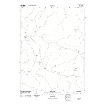
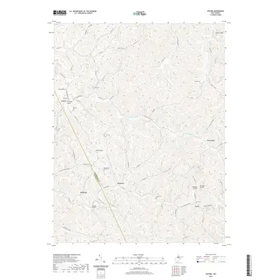
 1964 Oxford1966 Print · USGSMid-century Doddridge County is defined here by its narrow valleys and the gas wells that dot its ridges. Researchers can locate remote family landmarks like Natter Cem and South Branch Cem, or trace early settlements at Oxford and Porto Rico.3 unique versions available
 - 1982 Map of Clarksburg, 1983 Print
 1982 Clarksburg1983 Print · USGSNorth Central West Virginia in the early eighties reveals a landscape deeply connected to its coal and gas resources. Genealogists and researchers can trace family landmarks and historical settlements from Clarksburg to Buckhannon, or locate sites like Quiet Dell and Watters Smith Memorial State Park.
 - 1988 Map of Clarksburg, 1989 Print
 1988 Clarksburg1989 Print · USGSThe central Appalachians are documented in detail during the late eighties, showing the industrial and river-based economies of West Virginia, Ohio, and Pennsylvania. Researchers can trace historic rail routes like the B & O RR and locate river towns from St Marys to Parkersburg.
 - 2011 Map of Oxford, 2011 Print
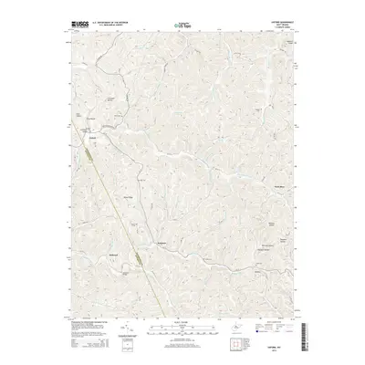
 2011 Oxford2011 Print · USGSCovers Oxford, including Holbrook, Porto Rico, and other nearby areas
 - 2014 Map of Oxford, 2014 Print
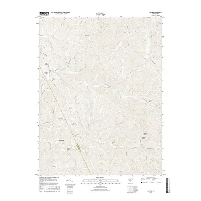
 2014 Oxford2014 Print · USGSCovers Oxford, including Holbrook, Porto Rico, and other nearby areas
 - 2016 Map of Oxford, 2016 Print
 2016 Oxford2016 Print · USGSCovers Oxford, including Holbrook, Porto Rico, and other nearby areas
 - 2019 Map of Oxford, 2019 Print
 2019 Oxford2019 Print · USGSCovers Oxford, including Holbrook, Porto Rico, and other nearby areas
 - 2023 Map of Oxford, 2023 Print
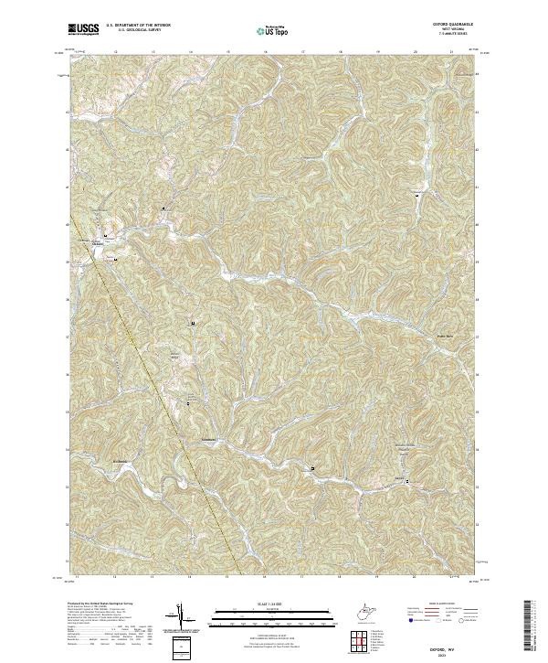 2023 Oxford2023 Print · USGSDoddridge and Ritchie counties are shown in this contemporary survey of West Virginia's dissected plateau. Genealogists can locate several family burial sites and rural communities, including Oxford, Summers, and Grove Cem along the South Fork Hughes River.
End of results
Showing maps 1-14 of 14
Top cities near Oxford
- Harrisville historical maps
- Pennsboro historical maps
- West Union historical maps
- Ellenboro historical maps
- Pullman historical maps
- Auburn historical maps
Frequently asked questions
- What are the different types of historical maps available for Oxford?
- What is the oldest map of Oxford?
- Where can I purchase historical maps of Oxford for my home or office?
- Where can I download high-res historical maps of Oxford?
- Are there historical topographic maps available for Oxford?
- Is there historical aerial imagery available for Oxford?
- Where are historical maps of Oxford sourced from?