2000s (21st Century) Maps of Nallen, West Virginia
Explore 2 historic maps of Nallen from the 2000s (21st Century). These maps offer a rare glimpse into what life looked like during the 2000s — showing old roads, neighborhoods, homes, and landmarks that have changed or disappeared over time.
Whether you're researching your family's past, planning a metal detecting trip, or studying how Nallen's landscape evolved across the 2000s, these high-resolution maps are a powerful tool for exploring the history of this region.
- Focus on a specific era: All maps on this page are from the 2000s, giving you a focused view of this time period.
- See what’s changed: Compare century-old streets, trails, and buildings to today's modern landscape using overlays and satellite layers.
- Research with precision: Use these maps for genealogy, historical research, land use analysis, or educational projects.
- View, download, or print: Maps are fully viewable online in high resolution, and can be downloaded or printed for your own records.
Start exploring Nallen's history through authentic maps from the 2000s. This is your window into the past.
Nallen, WV maps
(2)- 2000 Map of Winona, 2001 Print
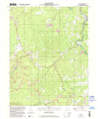 2000 Winona2001 Print · USGSThe coal and timber country of Fayette County is captured here at the start of the new millennium. Local historians and genealogists can trace the communities of Winona and Clifftop, locating landmarks like the Old Stone House, Brackens Creek Ch, and the Air Shaft Mine.
 - 2023 Map of Winona, 2023 Print
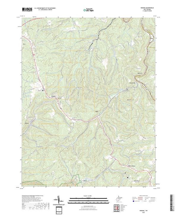 2023 Winona2023 Print · USGSFayette County ridge-top communities are documented here in the early twenty-first century as they overlook the dramatic West Virginia gorges. Researchers can locate family burial sites like Amick Cem and trace the conversion of the old Meadow River Rail-Trl.
End of results
Showing maps 1-2 of 2
Top cities near Nallen
- Oak Hill historical maps
- Summersville historical maps
- Fayetteville historical maps
- Craigsville historical maps
- Ansted historical maps
- Rainelle historical maps
See more
Frequently asked questions
- What are the different types of historical maps available for Nallen?
- What is the oldest map of Nallen?
- Where can I purchase historical maps of Nallen for my home or office?
- Where can I download high-res historical maps of Nallen?
- Are there historical topographic maps available for Nallen?
- Is there historical aerial imagery available for Nallen?
- Where are historical maps of Nallen sourced from?