Old Maps of Ogden, Oak Hill for Academic Research
Study the evolution of Ogden with 18 high-resolution historic maps. Whether you're teaching, researching, or modeling changes in land use, these maps provide essential visual documentation of urban, environmental, and geographic change.
- Analyze long-term change: Track patterns in development, transportation, and natural features.
- Ideal for environmental or urban studies: Support academic projects with primary historical map data.
- Use in the classroom or lab: Educators and researchers rely on these maps to bring historical context to life.
These maps are a powerful tool for teaching, research, and visualizing how Ogden has changed over the decades.
Ogden, Oak Hill maps
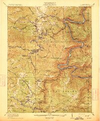
(18)- 1891 Map of Raleigh
 1891 Raleigh1891 Print · USGSRaleigh County and the New River Gorge are captured in the late nineteenth century during the initial rise of the coal industry. Genealogists can trace family holdings along Paint Creek or locate early river settlements such as Quinnimont and Fire Creek.
 - 1897 Map of Raleigh
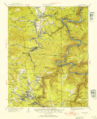
 1897 Raleigh1897 Print · USGSThe New River Gorge area at the height of the coal and rail boom comes to life on this late nineteenth-century sheet. Genealogists and historians can trace riverside rail stops like Thurmond and Glenjean, or explore the high-plateau settlement at Marshes P.O. (Trap Hill).
 - 1902 Map of Raleigh
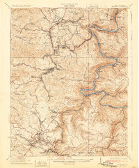
 1902 Raleigh1902 Print · USGSRaleigh County and the New River Gorge were entering their industrial peak when this survey was conducted in the late nineteenth century. Researchers can trace the early rail network of the CHESAPEAKE AND OHIO RR through booming towns like Thurmond, Beury, and East Sewell.3 unique versions available
 - 1911 Map of Beckley
 1911 Beckley1911 Print · USGSThe coal and rail landscape of Raleigh and Fayette counties comes to life in the years before the Great War. Genealogists can trace family roots through numerous remote settlements and rural landmarks like Mount Hope, Silver Cliff School, and the winding New River.
 - 1913 Map of Beckley
 1913 Beckley1913 Print · USGSRaleigh and Fayette counties are shown at the height of the coal era, when the New River canyon hummed with steam power and industry. Genealogists can locate family homesteads near vanished landmarks like the Krise PO Glade, Excelsior School, and the Lanark Sta railroad stop.3 unique versions available
 - 1929 Map of Beckley, 1954 Print
 1929 Beckley1954 Print · USGSRaleigh and Fayette counties are shown in the late 1920s as coal and rail lines transformed the New River Gorge. Genealogists can trace family roots through numerous mining settlements like Minden or Thurmond and identify remote landmarks such as Brooklyn Finlow PO and Miles Sch.2 unique versions available
 - 1932 Map of Beckley
 1932 Beckley1932 Print · USGSThe West Virginia coalfields are shown here at their industrial height in the early 1930s, centered on the rugged gorge of the New River. Genealogists and historians can trace the rail-and-river network connecting towns like Thurmond and Glen Jean or locate rural landmarks such as Brooklyn Finlow PO and Estuary School.2 unique versions available
 - 1955 Map of Bluefield
 1955 Bluefield1955 Print · USGSThe Central Appalachian borderlands come alive in the mid-fifties, showing the coal and rail networks connecting Bluefield to Beckley. Researchers can trace the industrial landscape of the New River Ordnance Plant and the terrain of Burkes Garden.
 - 1957 Map of Bluefield, 1967 Print
 1957 Bluefield1967 Print · USGSThe heart of Central Appalachia in the mid-fifties is defined by the winding rail lines and river valleys of the coalfields. Researchers can trace the industrial footprints of towns like Welch and Princeton or locate landmarks such as the Bluestone Reservoir and Claytor Lake.2 unique versions available
 - 1961 Map of Bluefield
 1961 Bluefield1961 Print · USGSThe coalfields and mountain ridges of southern West Virginia and southwest Virginia are captured in the early sixties. Genealogists can trace family ties through rail-linked towns like Princeton and Richlands or along the shores of Bluestone Reservoir.
 - 1969 Map of Oak Hill, 1973 Print
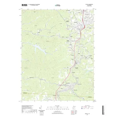
 1969 Oak Hill1973 Print · USGSFayette County coal country is captured here during a period of industrial maturity, showing the intricate rail-and-mine network connecting Oak Hill and Mount Hope. Researchers can trace family roots at the Odd Fellows Cem or locate former schools like New Hope Sch and High Lawn Mem Park (School).3 unique versions available
 - 1982 Map of Beckley, 1984 Print
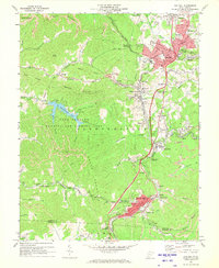
 1982 Beckley1984 Print · USGSSouthern West Virginia coal country is captured here in the early eighties as industrial heritage met new wilderness protections. Genealogists and historians can trace the rail-linked communities of Beckley, Oak Hill, and the coal camps near Macdonald.
 - 1997 Map of Oak Hill, 2001 Print
 1997 Oak Hill2001 Print · USGSFayette County coal country is detailed here in the late twentieth century, showing the enduring footprint of mining and rail. Genealogists and historians can trace family roots through the High Lawn Mem Park, Price Hill, and Glen Jean.
 - 2011 Map of Oak Hill, 2011 Print
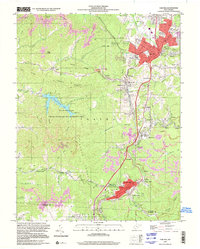
 2011 Oak Hill2011 Print · USGSCovers Ogden, including Oak Hill, Mount Hope, and other nearby areas
 - 2014 Map of Oak Hill, 2014 Print
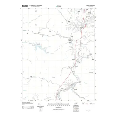
 2014 Oak Hill2014 Print · USGSCovers Ogden, including Oak Hill, Mount Hope, and other nearby areas
 - 2016 Map of Oak Hill, 2016 Print
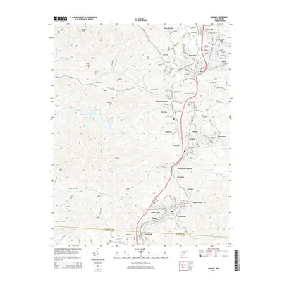
 2016 Oak Hill2016 Print · USGSCovers Ogden, including Oak Hill, Mount Hope, and other nearby areas
 - 2019 Map of Oak Hill, 2019 Print
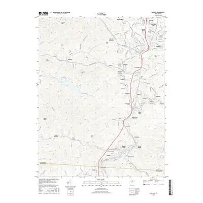
 2019 Oak Hill2019 Print · USGSCovers Ogden, including Oak Hill, Mount Hope, and other nearby areas
 - 2023 Map of Oak Hill, 2023 Print
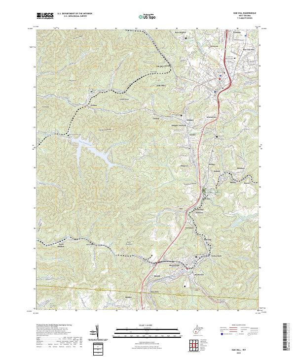 2023 Oak Hill2023 Print · USGSFayette County coal country is captured here in the early twenty-first century, showing the dense network of industrial settlements and rail lines. Genealogists can locate family sites like Davis Homestead Cem or explore the New River Gorge National River and Plum Orchard Lake.
End of results
Showing maps 1-18 of 18
Top cities near Ogden
- Beckley historical maps
- Oak Hill historical maps
- Fayetteville historical maps
- Montgomery historical maps
- Ansted historical maps
- Mount Hope historical maps
See more
Frequently asked questions
- What are the different types of historical maps available for Ogden?
- What is the oldest map of Ogden?
- Where can I purchase historical maps of Ogden for my home or office?
- Where can I download high-res historical maps of Ogden?
- Are there historical topographic maps available for Ogden?
- Is there historical aerial imagery available for Ogden?
- Where are historical maps of Ogden sourced from?