1990s Maps of Grant County, West Virginia
Explore 9 historic maps of Grant County from the 1990s. These maps offer a rare glimpse into what life looked like during the 1990s — showing old roads, neighborhoods, homes, and landmarks that have changed or disappeared over time.
Whether you're researching your family's past, planning a metal detecting trip, or studying how Grant County's landscape evolved across the 1990s, these high-resolution maps are a powerful tool for exploring the history of this region.
- Focus on a specific era: All maps on this page are from the 1990s, giving you a focused view of this time period.
- See what’s changed: Compare century-old streets, trails, and buildings to today's modern landscape using overlays and satellite layers.
- Research with precision: Use these maps for genealogy, historical research, land use analysis, or educational projects.
- View, download, or print: Maps are fully viewable online in high resolution, and can be downloaded or printed for your own records.
Start exploring Grant County's history through authentic maps from the 1990s. This is your window into the past.
Grant County, WV maps
(9)- 1995 Map of Davis, 1998 Print
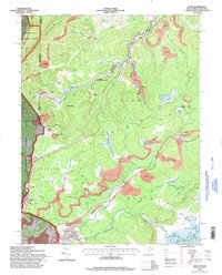 1995 Davis1998 Print · USGSThe West Virginia highlands in the mid-nineties reveal a landscape shaped by coal and timber along the Blackwater River. Trace family history at Thomas Cem or locate industrial sites like the strip mines and tipple near Henry.
 - 1995 Map of Blackbird Knob, 1998 Print
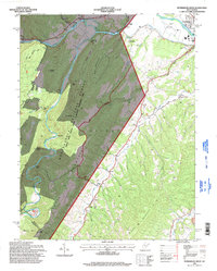
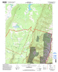 1995 Blackbird Knob1998 Print · USGSThe West Virginia high country in the mid-1990s is captured here, showing the protected landscapes of the Dolly Sods Wilderness. Researchers can trace old paths like the Northland Loop Interpretive Trail or locate landmarks such as Blackbird Knob and Bear Rocks.
 - 1995 Map of Mozer, 1998 Print
 1995 Mozer1998 Print · USGSPendleton and Grant counties are captured in the mid-1990s, showing a landscape of high ridges and narrow valley settlements. Genealogists and hikers can trace the rural homes and mountain gaps near Mozer, Mt Horeb Ch, and the rugged peaks of Cave Mtn.
 - 1995 Map of Hopeville, 1998 Print
 1995 Hopeville1998 Print · USGSThe West Virginia highlands in the mid-1990s reveal a landscape of deep river valleys and high wilderness plateaus. Researchers can trace remote mountain communities like Hopeville and Ketterman, as well as landmarks like Smoke Hole Caverns and Pleasant Valley Ch.
 - 1995 Map of Petersburg West, 1998 Print
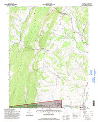
 1995 Petersburg West1998 Print · USGSIn the mid-nineties, the South Branch Potomac River valley outside Petersburg supported a mix of mountain recreation and rural community life. Genealogists and hikers can trace historical landmarks like Marvin Chapel, the Petersburg Airport, and the peaks of Dayton Knob.
 - 1995 Map of Maysville, 1998 Print
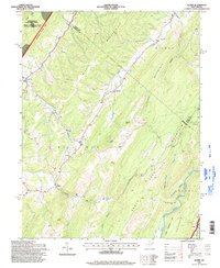
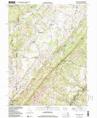
 1995 Maysville1998 Print · USGSGrant County in the mid-1990s presents a landscape of deep ridges and creek valleys defined by the towering Knobly Mountain. Researchers can trace local heritage through the scattered rural settlements of Streby and Maysville or locate family sites at Harmony Ch and the South Branch Memorial Gardens.
 - 1997 Map of Mount Storm Lake, 2001 Print
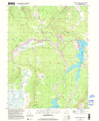 1997 Mount Storm Lake2001 Print · USGSThe West Virginia highlands are shown here in the late 1990s as a hub of energy production and mountain wilderness. Trace the industrial footprint of Mount Storm Lake alongside remote landmarks like Camp Seventy-two and Snowy Point.
 - 1997 Map of Mount Storm, 2001 Print
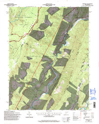
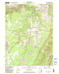 1997 Mount Storm2001 Print · USGSMount Storm and the West Virginia-Maryland borderlands appear in the late nineties, showing a landscape defined by ridge-top highways and industrial activity. Genealogists can trace family landmarks at Nethkin Cem, White Hall Sch, and Rehoboth Ch.
 - 1997 Map of Table Rock, 2001 Print
 1997 Table Rock2001 Print · USGSHigh atop the Maryland and West Virginia border in the late twentieth century, this area reveals a landscape of mountain ridges and rural hamlets. Genealogists can locate family landmarks like Sunnyside Grange Hall, Beckman Cemetery, and Swan Meadow School.2 unique versions available
End of results
Showing maps 1-9 of 9
Top cities of Grant County
Frequently asked questions
- What are the different types of historical maps available for Grant County?
- What is the oldest map of Grant County?
- Where can I purchase historical maps of Grant County for my home or office?
- Where can I download high-res historical maps of Grant County?
- Are there historical topographic maps available for Grant County?
- Is there historical aerial imagery available for Grant County?
- Where are historical maps of Grant County sourced from?