Old Maps of Petersburg, West Virginia for Genealogy
Trace your family roots with 43 historic maps of Petersburg. These high-res maps reveal old neighborhoods, homesites, landmarks, and streets — helping you uncover where your ancestors lived and how the area evolved over time.
- Explore historic neighborhoods: Identify where your relatives may have lived in the 1800s or 1900s.
- Compare maps over time: Trace the changes in streets, buildings, and landmarks for multi-generational research.
- Perfect for genealogy & ancestry research: Used by family historians and researchers to map out lineage and migration.
These maps are an incredible resource for exploring your personal connection to Petersburg's past.
Petersburg, WV maps
(43)- 1892 Map of Franklin
 1892 Franklin1892 Print · USGSPendleton County and the Potomac Highlands are shown here in the 1890s, organized by the dramatic ridges and river valleys of the Alleghanies. Researchers can trace historic homesteads and early post offices at Fort Seybert, Upper Tract, and the riverside crossroads of Kline Cross Roads.
 - 1895 Map of Piedmont
 1895 Piedmont1895 Print · USGSThe West Virginia and Maryland borderlands come to life in the 1890s, when coal and timber drove the expansion of the Potomac River valleys. Genealogists can trace the early industrial roots of Piedmont, locate the historic Fairfax Stone, or find the long-lost operations at Rees Tannery.4 unique versions available
 - 1896 Map of Franklin, 1907 Print
 1896 Franklin1907 Print · USGSThe Potomac River's headwaters and the high ridges of the Alleghenies are documented here in the final years of the nineteenth century. Genealogists and local historians can trace early valley communities like Fort Seybert, Sugar Grove, and the mills at Harper Mill.4 unique versions available
 - 1920 Map of Petersburg
 1920 Petersburg1920 Print · USGSThe West Virginia and Virginia borderlands were a network of tight-knit mountain communities just after the Great War. Genealogists can locate family-named sites like Schmuckers School and Sites Chapel or trace the early Smoke Hole Settlement.3 unique versions available
 - 1921 Map of Petersburg
 1921 Petersburg1921 Print · USGSEastern West Virginia at the start of the twenties shows a landscape of mountain hollows tied together by the Baltimore and Ohio at Petersburg. Genealogists can trace family names through landmarks like Hedrick Church, Crites School, and Ketterman.
 - 1921 Map of Greenland Gap
 1921 Greenland Gap1921 Print · USGSWest Virginia's Grant County highlands are documented here during the early twenties, showing a landscape of isolated mountain hollows and ridge-top schools. Genealogists can locate family landmarks like Locust Grove Church, Maysville, and over a dozen rural schoolhouses including Mountain Top School.3 unique versions available
 - 1922 Map of Petersburg
 1922 Petersburg1922 Print · USGSThe West Virginia highlands in the early 1920s are centered here on the river valley at Petersburg. Researchers can locate dozens of rural schools and mountain churches, including Royal Glen Mill, Hedrick Church, and Mountaindale School.2 unique versions available
 - 1948 Map of Cumberland
 1948 Cumberland1948 Print · USGSMid-century Appalachia and the Shenandoah Valley are shown in detail, documenting the industrial and transportation hubs of the tri-state area. Genealogists can trace family roots through settlements like Double Tollgate and Bunker Hill or along the Baltimore & Ohio RR.3 unique versions available
 - 1949 Map of Charlottesville
 1949 Charlottesville1949 Print · USGSThe Shenandoah Valley and Blue Ridge appear in the late 1940s as a thriving corridor of rail and river commerce. Researchers can trace the mid-century footprints of Harrisonburg, Staunton, and Culpeper alongside the historic routes of the Southern Railway.2 unique versions available
 - 1952 Map of Cumberland
 1952 Cumberland1952 Print · USGSThe Potomac Highlands and the Shenandoah Valley are revealed in this early 1950s survey of the Appalachian interior. Researchers can trace the river-and-rail corridors connecting Cumberland, Winchester, and the recreational waters of Deep Creek Lake.
 - 1956 Map of Cumberland, 1966 Print
 1956 Cumberland1966 Print · USGSThe tri-state Highlands in the mid-1950s show a landscape shaped by coal, timber, and the massive presence of the Baltimore & Ohio RR. Researchers can trace the industrial corridor from Cumberland through the Allegheny Mountains to mountain retreats like Deep Creek Lake.6 unique versions available
 - 1956 Map of Charlottesville, 1966 Print
 1956 Charlottesville1966 Print · USGSThe Shenandoah Valley and Blue Ridge are captured in detail during the mid-1960s as the modern interstate system began to emerge. Genealogists and historians can trace rail-connected hubs like Waynesboro or follow the river paths of the Rapidan River and Rivanna River.4 unique versions available
 - 1957 Map of Cumberland
 1957 Cumberland1957 Print · USGSThe Potomac River valley and the ridges of the Allegheny Front define this mid-century landscape at the intersection of Maryland, West Virginia, and Pennsylvania. Trace the steam-era rail lines of the Baltimore and Ohio RR or locate rural landmarks like St Stephens Church and Stony River Dam.
 - 1961 Map of Cumberland
 1961 Cumberland1961 Print · USGSThe tri-state highlands of Maryland, West Virginia, and Pennsylvania are shown in the mid-twentieth century as a complex landscape of ridges and river valleys. Researchers can trace the winding Potomac River and find old rail-and-river towns like Cumberland, Keyser, and Morgantown.
 - 1962 Map of Cumberland
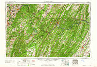 1962 Cumberland1962 Print · USGSThe central Appalachians meet at the height of the mid-century industrial era, showing the rugged topography between Morgantown and Winchester. Genealogists can trace family lands near Fort Necessity or along the vital Baltimore & Ohio RR corridors.
 - 1967 Map of Maysville, 1972 Print
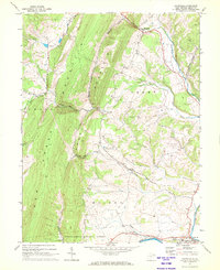 1967 Maysville1972 Print · USGSGrant County is defined by the sharp ridges of the Potomac Highlands during the late sixties, where small gaps provide the only passage for mountain roads. Researchers can locate family landmarks like Harmony Ch, the Drive-in Theater near Petersburg, and the rural settlement of Maysville.3 unique versions available
 - 1967 Map of Rig, 1972 Print
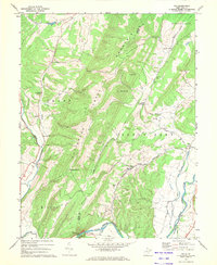 1967 Rig1972 Print · USGSThe West Virginia highlands between Grant and Hardy counties are captured here in the late sixties, showing a landscape shaped by the Potomac's forks. Researchers can trace rural lineages through local landmarks like Mt Olive Ch, the Baltimore and Ohio rail line, and settlements at Old Arthur and Rig.2 unique versions available
 - 1969 Map of Petersburg West, 1973 Print
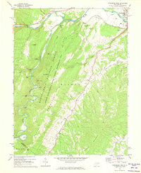 1969 Petersburg West1973 Print · USGSThe Potomac Highlands in the late sixties were a landscape of steep ridges and valley settlements like Petersburg and Cabins. Genealogists can trace family roots through numerous remote cemeteries and rural landmarks like North Mill Creek Ch and Gordon Chapel.4 unique versions available
 - 1969 Map of Petersburg East, 1973 Print
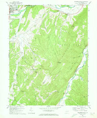 1969 Petersburg East1973 Print · USGSThe South Branch Potomac River and its rugged gaps dominate this Hardy and Grant County landscape in the late sixties. Genealogists and local historians can trace rural communities through landmarks like Masonville, Boot Hill Ch, and the Spring Run Fish Hatchery.3 unique versions available
 - 1981 Map of Kingwood, 1982 Print
 1981 Kingwood1982 Print · USGSThe West Virginia highlands in the early eighties were a hub of mountain railroading and wilderness conservation. Trace the path of the Baltimore & Ohio RR through Kingwood or explore the early footprints of Canaan Valley State Park and Dolly Sods.
 - 1981 Map of Elkins, 1983 Print
 1981 Elkins1983 Print · USGSThe West Virginia mountains in the early eighties were a hub of rail-based industry and emerging conservation lands. Genealogists and historians can trace the paths of the Western Maryland RR through Elkins and locate small upland communities like Harpertown, Bowden, and Wymer.
 - 1995 Map of Petersburg West, 1998 Print
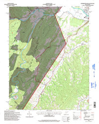 1995 Petersburg West1998 Print · USGSIn the mid-nineties, the South Branch Potomac River valley outside Petersburg supported a mix of mountain recreation and rural community life. Genealogists and hikers can trace historical landmarks like Marvin Chapel, the Petersburg Airport, and the peaks of Dayton Knob.
 - 1995 Map of Maysville, 1998 Print
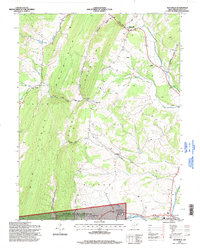 1995 Maysville1998 Print · USGSGrant County in the mid-1990s presents a landscape of deep ridges and creek valleys defined by the towering Knobly Mountain. Researchers can trace local heritage through the scattered rural settlements of Streby and Maysville or locate family sites at Harmony Ch and the South Branch Memorial Gardens.
 - 2011 Map of Rig, 2011 Print
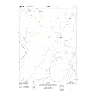 2011 Rig2011 Print · USGSWest Virginia's Potomac Highlands are documented here in the early twenty-first century, showing the enduring rural character of Grant County. Researchers can pinpoint long-standing community centers like the Arthur Post Office and Seymourville, or trace the winding paths of Hutton Run and Walnut Bottom Run.
 - 2011 Map of Petersburg East, 2011 Print
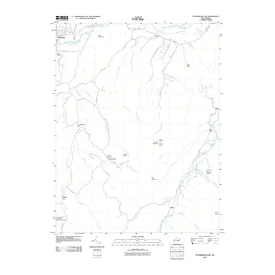 2011 Petersburg East2011 Print · USGSThe West Virginia highlands near the South Branch Potomac River are mapped here in the early twenty-first century. Local historians can locate the Dorcas Post Office, the Spring Run Fish Hatchery, and the high Elkhorn Lookout Tower atop the mountain ridges.
Showing maps 1-25 of 43
Top cities near Petersburg
Top neighborhoods of Petersburg
Frequently asked questions
- What are the different types of historical maps available for Petersburg?
- What is the oldest map of Petersburg?
- Where can I purchase historical maps of Petersburg for my home or office?
- Where can I download high-res historical maps of Petersburg?
- Are there historical topographic maps available for Petersburg?
- Is there historical aerial imagery available for Petersburg?
- Where are historical maps of Petersburg sourced from?