Old Maps of Asbury, West Virginia for Academic Research
Study the evolution of Asbury with 17 high-resolution historic maps. Whether you're teaching, researching, or modeling changes in land use, these maps provide essential visual documentation of urban, environmental, and geographic change.
- Analyze long-term change: Track patterns in development, transportation, and natural features.
- Ideal for environmental or urban studies: Support academic projects with primary historical map data.
- Use in the classroom or lab: Educators and researchers rely on these maps to bring historical context to life.
These maps are a powerful tool for teaching, research, and visualizing how Asbury has changed over the decades.
Asbury, WV maps
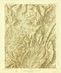
(17)- 1887 Map of Hinton
 1887 Hinton1887 Print · USGSSouthern West Virginia’s rugged river corridors and mineral spring resorts come alive in this late nineteenth-century survey. Trace the rail-and-river economy through the Big Bend Tunnel, the Greenbrier Stock Yards, and the historic springs at Red Sulphur Springs.
 - 1892 Map of Hinton
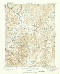
 1892 Hinton1892 Print · USGSSouthern West Virginia in the late nineteenth century centers on the river-and-rail hub of Hinton and the high ridges of the Alleghenies. Researchers can trace early railroad engineering at the Big Bend Tunnel or locate historic mineral spring resorts like Salt Sulphur Springs and Blue Sulphur Springs.5 unique versions available
 - 1921 Map of Clintonville
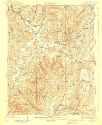
 1921 Clintonville1921 Print · USGSGreenbrier County is captured in the early twentieth century as a landscape of mountain ridges and valley settlements connected by the historic James River and Kanawha Turnpike. Researchers can locate dozens of family-named landmarks, including Baker Mill, Maude Chapel, and the famous mineral waters at Blue Sulphur Springs.
 - 1923 Map of Clintonville
 1923 Clintonville1923 Print · USGSGreenbrier County in the early twenties was a landscape of remote mountain valleys and thermal springs connected by early turnpikes. Researchers can trace ancestral farmsteads near Blue Sulphur Springs, Sam Black Church, and the many district schools like Sugar Grove School.2 unique versions available
 - 1935 Map of Clintonville, 1962 Print
 1935 Clintonville1962 Print · USGSGreenbrier County is captured here in the mid-1930s, showing a landscape defined by small farming hamlets and a remarkable density of rural schools. Researchers can locate family landmarks like Berrys Mill, the landmark Sam Black Church, and the mineral waters of Blue Sulphur Springs.
 - 1939 Map of Clintonville
 1939 Clintonville1939 Print · USGSGreenbrier County's high ridges and creek valleys are documented here in the late 1930s, showing a landscape thick with local institutions. Genealogists can locate dozens of historic schools and churches, from Sam Black Church and Berrys Mill to the remote Sawmill Hollow School.2 unique versions available
 - 1955 Map of Bluefield
 1955 Bluefield1955 Print · USGSThe Central Appalachian borderlands come alive in the mid-fifties, showing the coal and rail networks connecting Bluefield to Beckley. Researchers can trace the industrial landscape of the New River Ordnance Plant and the terrain of Burkes Garden.
 - 1957 Map of Bluefield, 1967 Print
 1957 Bluefield1967 Print · USGSThe heart of Central Appalachia in the mid-fifties is defined by the winding rail lines and river valleys of the coalfields. Researchers can trace the industrial footprints of towns like Welch and Princeton or locate landmarks such as the Bluestone Reservoir and Claytor Lake.2 unique versions available
 - 1961 Map of Bluefield
 1961 Bluefield1961 Print · USGSThe coalfields and mountain ridges of southern West Virginia and southwest Virginia are captured in the early sixties. Genealogists can trace family ties through rail-linked towns like Princeton and Richlands or along the shores of Bluestone Reservoir.
 - 1964 Map of Asbury, 1984 Print
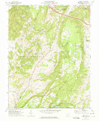
 1964 Asbury1984 Print · USGSWest Virginia's extraction landscape and small valley settlements are captured here in the mid-1960s. Researchers can locate numerous family-named landmarks and rural centers like Coxs Mills, Mt Union Ch, and the Lowther Cem.
 - 1972 Map of Asbury, 1974 Print
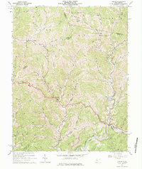
 1972 Asbury1974 Print · USGSGreenbrier County in the early seventies remains a landscape of steep hollows and historic mill sites. Genealogists can trace family roots through Hanger Cem or locate the rural communities of Asbury, Blaker Mills, and Kitchen.2 unique versions available
 - 1984 Map of Lewisburg, 1985 Print
 1984 Lewisburg1985 Print · USGSThe Greenbrier Valley in the mid-eighties shows a landscape of river-town commerce, mountain agriculture, and major institutional landmarks. Researchers can trace the rail corridors of the Chesapeake and Ohio and locate sites like the Federal Reformatory for Women and the Sam Black Church.2 unique versions available
 - 2011 Map of Asbury, 2011 Print
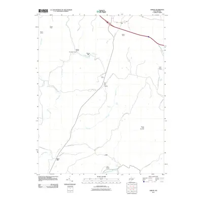 2011 Asbury2011 Print · USGSCovers Asbury, including Alta, Blaker Mills, and other nearby areas
 - 2014 Map of Asbury, 2014 Print
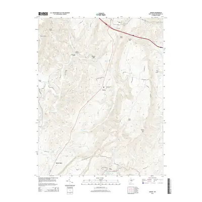 2014 Asbury2014 Print · USGSCovers Asbury, including Alta, Blaker Mills, and other nearby areas
 - 2016 Map of Asbury, 2016 Print
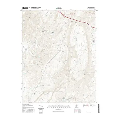 2016 Asbury2016 Print · USGSCovers Asbury, including Alta, Blaker Mills, and other nearby areas
 - 2019 Map of Asbury, 2019 Print
 2019 Asbury2019 Print · USGSCovers Asbury, including Alta, Blaker Mills, and other nearby areas
 - 2023 Map of Asbury, 2023 Print
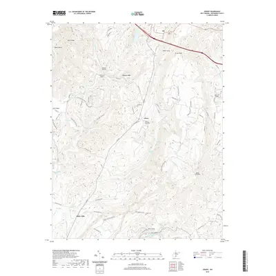
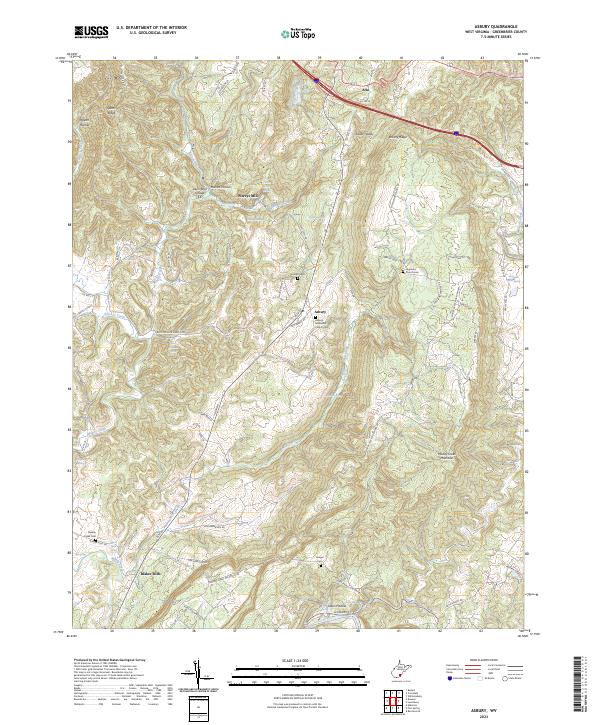 2023 Asbury2023 Print · USGSGreenbrier County’s rural uplands are shown in this contemporary study of the area surrounding Asbury. Genealogists and local historians can trace family landmarks and burial sites like Highland Church Cem, Blaker Mills, and Harrah Cem.
End of results
Showing maps 1-17 of 17
Top cities near Asbury
- Lewisburg historical maps
- White Sulphur Springs historical maps
- Fairlea historical maps
- Ronceverte historical maps
- Rainelle historical maps
- Rupert historical maps
See more
Frequently asked questions
- What are the different types of historical maps available for Asbury?
- What is the oldest map of Asbury?
- Where can I purchase historical maps of Asbury for my home or office?
- Where can I download high-res historical maps of Asbury?
- Are there historical topographic maps available for Asbury?
- Is there historical aerial imagery available for Asbury?
- Where are historical maps of Asbury sourced from?