Old Maps of Calis, West Virginia for Metal Detecting
Plan your next treasure hunt with 15 historic maps of Calis. Find old homesites, ghost towns, trails, and gathering spots that may be lost to time — perfect for identifying promising metal detecting locations.
- Locate forgotten sites: Uncover places like long-lost settlements, abandoned rail lines, or gathering spots.
- Plan better hunts: Use map overlays combined with LiDAR or satellite views to narrow in on historically rich areas.
- Made for detectorists: Thousands of hobbyists use these maps to discover relics, coins, and hidden history.
Use these historic maps to boost your research and find new opportunities beneath the surface of Calis.
Calis, WV maps
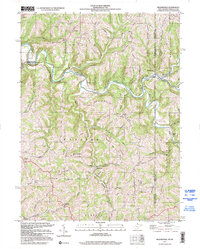
(15)- 1904 Map of Cameron
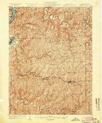 1904 Cameron1904 Print · USGSMarshall County's river-and-rail economy is frozen in time at the dawn of the century, showing the dense settlement patterns of the West Virginia panhandle. Researchers can trace the Baltimore and Ohio R R through Rosbys Rock or locate rural landmarks like Beelers Station and the Waynesburg Turnpike.4 unique versions available
 - 1935 Map of Cameron, 1957 Print
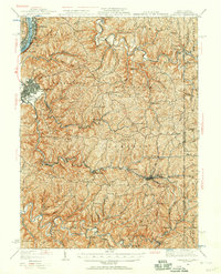 1935 Cameron1957 Print · USGSMarshall County in the mid-thirties was a landscape of deep hollows and high ridges linked by the Baltimore and Ohio RR. Genealogists and historians can locate dozens of country institutions like Wood Hill Ch, Beeler's Station, and Adaline Sch during the era of one-room schoolhouses.2 unique versions available
 - 1942 Map of Cameron
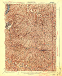 1942 Cameron1942 Print · USGSThe northern panhandle in the early 1940s reveals a landscape of riverfront industry and remote ridge-top schools. Genealogists can locate family landmarks like Beelers Station, Blairs Ridge Ch, and the curiously named Squirrel Alley Sch.2 unique versions available
 - 1949 Map of Clarksburg
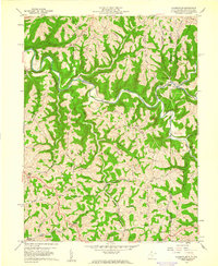
 1949 Clarksburg1949 Print · USGSThe upper Ohio River valley and the industrial heart of West Virginia come into focus during this post-war period. Genealogists and researchers can trace the rail corridors of the Baltimore and Ohio and locate centers like Fairmont, Grafton, and Waynesburg.
 - 1956 Map of Clarksburg, 1966 Print
 1956 Clarksburg1966 Print · USGSThe Ohio River valley and the industrial heart of West Virginia are seen here in the mid-1950s as rail and river commerce thrived. Researchers can trace historic transport lines like the Baltimore and Ohio RR and locate ancestral homes in Clarksburg, Moundsville, or Parkersburg.2 unique versions available
 - 1959 Map of Majorsville, 1961 Print
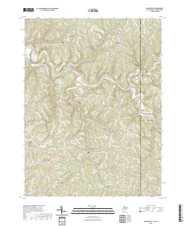
 1959 Majorsville1961 Print · USGSThe Northern Panhandle borderlands are captured here in the late fifties, showing a landscape of high ridges and winding creek valleys. Researchers can trace rural heritage through local landmarks like Beelers Station, Mt Hope Sch, and the Upper Wolf Run Ch.4 unique versions available
 - 1961 Map of Clarksburg
 1961 Clarksburg1961 Print · USGSThe mid-century industrial and river landscapes of West Virginia and Ohio are detailed here, centered on the Ohio River. Researchers can trace the Baltimore and Ohio rail lines connecting towns like Parkersburg, Clarksburg, and Monongah.
 - 1984 Map of Moundsville
 1984 Moundsville1984 Print · USGSThe Ohio River valley and the Appalachian interior meet in the mid-eighties as a hub of rail and river commerce. Genealogists and historians can trace the development of river towns like New Martinsville, inland hubs like Waynesburg, and the path of the B & O RR.
 - 1988 Map of Clarksburg, 1989 Print
 1988 Clarksburg1989 Print · USGSThe central Appalachians are documented in detail during the late eighties, showing the industrial and river-based economies of West Virginia, Ohio, and Pennsylvania. Researchers can trace historic rail routes like the B & O RR and locate river towns from St Marys to Parkersburg.
 - 1997 Map of Majorsville, 2000 Print
 1997 Majorsville2000 Print · USGSThe West Virginia and Pennsylvania borderlands come into focus in the late nineties, documenting the high ridges and deep hollows of Marshall County. Genealogists can trace family footprints through sites like Beelers Station Ch, Earlywine Cem, and the vanished site of Crows Mills.
 - 2011 Map of Majorsville, 2011 Print
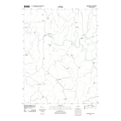 2011 Majorsville2011 Print · USGSCovers Calis, including West Finley Township, Alley Grove, and other nearby areas
 - 2014 Map of Majorsville, 2014 Print
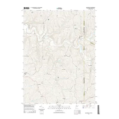 2014 Majorsville2014 Print · USGSCovers Calis, including West Finley Township, Alley Grove, and other nearby areas
 - 2016 Map of Majorsville, 2016 Print
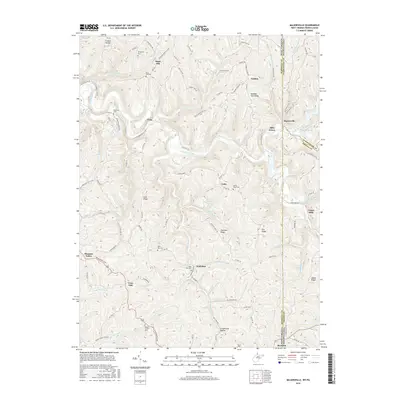 2016 Majorsville2016 Print · USGSCovers Calis, including West Finley Township, Alley Grove, and other nearby areas
 - 2019 Map of Majorsville, 2019 Print
 2019 Majorsville2019 Print · USGSCovers Calis, including West Finley Township, Alley Grove, and other nearby areas
 - 2023 Map of Majorsville, 2023 Print
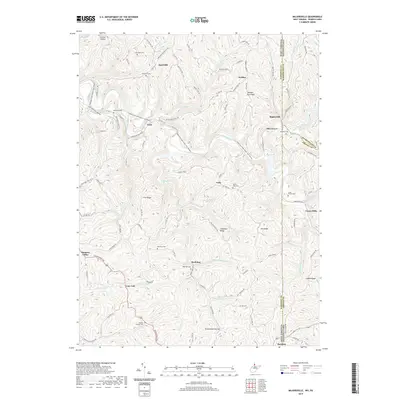
 2023 Majorsville2023 Print · USGSThe West Virginia and Pennsylvania borderlands come alive in this detailed look at Marshall County and its eastern neighbors. Researchers can trace ancestral roots through numerous family burial sites like Earlywine Cem and Crow Family Cem or locate old crossroads at Calis and Majorsville.
End of results
Showing maps 1-15 of 15
Top cities near Calis
- Wheeling historical maps
- Moundsville historical maps
- Martins Ferry historical maps
- Bellaire historical maps
- Shadyside historical maps
- Bethlehem historical maps
See more
Frequently asked questions
- What are the different types of historical maps available for Calis?
- What is the oldest map of Calis?
- Where can I purchase historical maps of Calis for my home or office?
- Where can I download high-res historical maps of Calis?
- Are there historical topographic maps available for Calis?
- Is there historical aerial imagery available for Calis?
- Where are historical maps of Calis sourced from?