Old Maps of Marshall County, West Virginia
Explore 44 old maps of Marshall County, spanning from 1902 to today. These high-resolution historic maps reveal how streets, neighborhoods, landmarks, and natural features evolved over time — perfect for genealogy, metal detecting, research, and local history exploration.
What you can do with these maps:
- See how Marshall County changed over time: Compare historical maps to modern-day views to trace roads, homesites, rail lines & more.
- View detailed metadata: Each map includes creators, publishers, year, scale, and archive source.
- Overlay maps with satellite & LiDAR: Visualize the past alongside modern tools to explore terrain & human change.
- Trusted historical sources: Maps sourced from the USGS, Library of Congress, and other archives.
- Access maps your way: View online, download high-res files, or order prints for personal or research use.
Start exploring old maps of Marshall County to uncover forgotten places, hidden landmarks, and the deep history beneath your feet.
Marshall County, WV maps
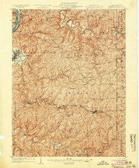
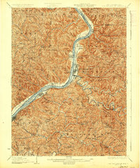
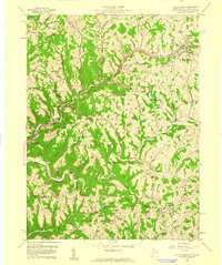
(44)- 1902 Map of Wheeling
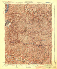
 1902 Wheeling1902 Print · USGSCovers Marshall County, including Wheeling, Martins Ferry, and other nearby areas7 unique versions available
 - 1903 Map of Littleton
 1903 Littleton1903 Print · USGSCovers Marshall County, including Pine Grove, Littleton, and other nearby areas
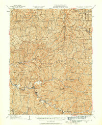
 - 1904 Map of Cameron
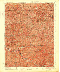
 1904 Cameron1904 Print · USGSCovers Marshall County, including Moundsville, Bellaire, and other nearby areas4 unique versions available
 - 1905 Map of Littleton
 1905 Littleton1905 Print · USGSCovers Marshall County, including Pine Grove, Littleton, and other nearby areas2 unique versions available
 - 1905 Map of Clarington, 1913 Print
 1905 Clarington1913 Print · USGSCovers Marshall County, including Moundsville, Shadyside, and other nearby areas
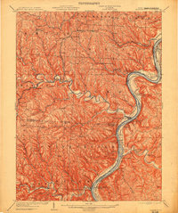
 - 1906 Map of New Martinsville
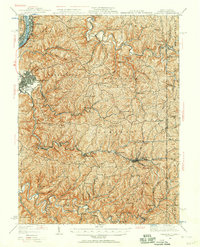
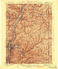
 1906 New Martinsville1906 Print · USGSCovers Marshall County, including New Martinsville, Sistersville, and other nearby areas2 unique versions available
 - 1924 Map of New Martinsville, 1956 Print
 1924 New Martinsville1956 Print · USGSCovers Marshall County, including New Martinsville, Sistersville, and other nearby areas2 unique versions available
 - 1924 Map of Littleton, 1957 Print
 1924 Littleton1957 Print · USGSCovers Marshall County, including Pine Grove, Littleton, and other nearby areas
 - 1926 Map of Littleton
 1926 Littleton1926 Print · USGSCovers Marshall County, including Pine Grove, Littleton, and other nearby areas2 unique versions available
 - 1926 Map of New Martinsville
 1926 New Martinsville1926 Print · USGSCovers Marshall County, including New Martinsville, Sistersville, and other nearby areas2 unique versions available
 - 1935 Map of Cameron, 1957 Print
 1935 Cameron1957 Print · USGSCovers Marshall County, including Moundsville, Bellaire, and other nearby areas2 unique versions available
 - 1935 Map of Clarington, 1957 Print
 1935 Clarington1957 Print · USGSCovers Marshall County, including Moundsville, Shadyside, and other nearby areas2 unique versions available
 - 1935 Map of Wheeling, 1957 Print
 1935 Wheeling1957 Print · USGSCovers Marshall County, including Wheeling, Martins Ferry, and other nearby areas
 - 1940 Map of Clarington
 1940 Clarington1940 Print · USGSCovers Marshall County, including Moundsville, Shadyside, and other nearby areas
 - 1942 Map of Cameron
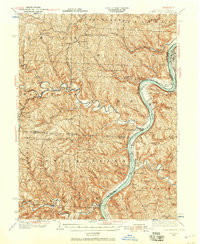
 1942 Cameron1942 Print · USGSCovers Marshall County, including Moundsville, Bellaire, and other nearby areas2 unique versions available
 - 1942 Map of Wheeling
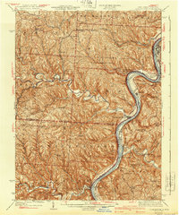
 1942 Wheeling1942 Print · USGSCovers Marshall County, including Wheeling, Martins Ferry, and other nearby areas2 unique versions available
 - 1949 Map of Clarksburg
 1949 Clarksburg1949 Print · USGSCovers Marshall County, including Parkersburg, Zanesville, and other nearby areas
 - 1951 Map of Canton
 1951 Canton1951 Print · USGSCovers Marshall County, including Pittsburgh, Akron, and other nearby areas
 - 1953 Map of Canton
 1953 Canton1953 Print · USGSCovers Marshall County, including Pittsburgh, Akron, and other nearby areas
 - 1956 Map of Wheeling, 1958 Print
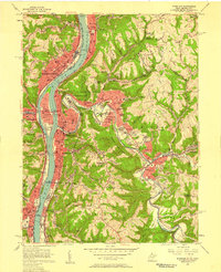 1956 Wheeling1958 Print · USGSCovers Marshall County, including Wheeling, Martins Ferry, and other nearby areas2 unique versions available
 - 1956 Map of Clarksburg, 1966 Print
 1956 Clarksburg1966 Print · USGSCovers Marshall County, including Parkersburg, Zanesville, and other nearby areas2 unique versions available
 - 1957 Map of Canton, 1971 Print
 1957 Canton1971 Print · USGSCovers Marshall County, including Pittsburgh, Akron, and other nearby areas3 unique versions available
 - 1959 Map of Majorsville, 1961 Print
 1959 Majorsville1961 Print · USGSCovers Marshall County, including West Finley Township, Majorsville, and other nearby areas4 unique versions available
 - 1959 Map of Valley Grove, 1961 Print
 1959 Valley Grove1961 Print · USGSCovers Marshall County, including West Finley Township, Triadelphia, and other nearby areas2 unique versions available
 - 1960 Map of Moundsville, 1961 Print
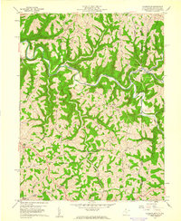
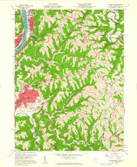 1960 Moundsville1961 Print · USGSCovers Marshall County, including Moundsville, Bellaire, and other nearby areas4 unique versions available
Showing maps 1-25 of 44
Top cities of Marshall County
- Moundsville historical maps
- McMechen historical maps
- Glen Dale historical maps
- Benwood historical maps
- Cameron historical maps
- Bartlett historical maps
Frequently asked questions
- What are the different types of historical maps available for Marshall County?
- What is the oldest map of Marshall County?
- Where can I purchase historical maps of Marshall County for my home or office?
- Where can I download high-res historical maps of Marshall County?
- Are there historical topographic maps available for Marshall County?
- Is there historical aerial imagery available for Marshall County?
- Where are historical maps of Marshall County sourced from?