Old Maps of Mineral County, West Virginia
Explore 154 old maps of Mineral County, spanning from 1891 to today. These high-resolution historic maps reveal how streets, neighborhoods, landmarks, and natural features evolved over time — perfect for genealogy, metal detecting, research, and local history exploration.
What you can do with these maps:
- See how Mineral County changed over time: Compare historical maps to modern-day views to trace roads, homesites, rail lines & more.
- View detailed metadata: Each map includes creators, publishers, year, scale, and archive source.
- Overlay maps with satellite & LiDAR: Visualize the past alongside modern tools to explore terrain & human change.
- Trusted historical sources: Maps sourced from the USGS, Library of Congress, and other archives.
- Access maps your way: View online, download high-res files, or order prints for personal or research use.
Start exploring old maps of Mineral County to uncover forgotten places, hidden landmarks, and the deep history beneath your feet.
Mineral County, WV maps
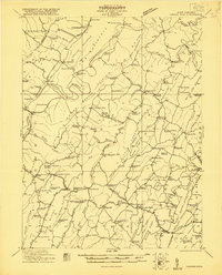
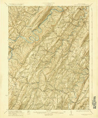
(154)- 1891 Map of Romney, 1897 Print
 1891 Romney1897 Print · USGSHampshire, Hardy, and Mineral counties are captured here in the 1880s as the river valleys were transitioning from frontier outposts to connected industrial hubs. Genealogists and historians can trace family locations near Capon Iron Works, Adams Mill, and the many hamlets along Patterson Creek.5 unique versions available
 - 1895 Map of Piedmont
 1895 Piedmont1895 Print · USGSThe West Virginia and Maryland borderlands come to life in the 1890s, when coal and timber drove the expansion of the Potomac River valleys. Genealogists can trace the early industrial roots of Piedmont, locate the historic Fairfax Stone, or find the long-lost operations at Rees Tannery.4 unique versions available
 - 1898 Map of Frostburg
 1898 Frostburg1898 Print · USGSMaryland's coal country and the Potomac borderlands are captured here at the height of the Victorian industrial era. Researchers can trace the extensive rail lines and mining infrastructure connecting settlements like Eckhart Mines, Mount Savage, and the historic C & O Canal.
 - 1899 Map of Flintstone
 1899 Flintstone1899 Print · USGSThe Maryland, West Virginia, and Pennsylvania borders converge here during the late nineteenth century as industry follows the river. Genealogists can trace family footprints near Oldtown or locate vanished infrastructure like Patterson Depot and the C. & O. Canal.
 - 1899 Map of Oakland, 1961 Print
 1899 Oakland1961 Print · USGSGarrett County highlands at the end of the nineteenth century reveal a landscape of mountain resorts and timber railroads. Trace the B. & O. R. R. through Oakland or locate early landmarks like Fort Pendleton and Gnegy Church.
 - 1900 Map of Oakland
 1900 Oakland1900 Print · USGSGarrett County and the West Virginia borderlands appear at the turn of the century as a landscape of mountain resorts and rail towns. Genealogists can trace family names at Gnegy Church, locate old stations like Altamont, and explore early settlements from Crellin to Bayard.5 unique versions available
 - 1900 Map of Flintstone
 1900 Flintstone1900 Print · USGSThe Maryland and West Virginia border at the close of the nineteenth century centers on the vital Potomac River transportation corridor. Researchers can trace the Chesapeake and Ohio Canal, the B. & O. R. R., and early settlements like Oldtown, Flintstone, and Wolf Mill.6 unique versions available
 - 1901 Map of Frostburg
 1901 Frostburg1901 Print · USGSMaryland's coal country and the critical mountain pass at Cumberland are shown in detail at the turn of the century. Genealogists and industrial historians can locate old mining works at Eckhart Mines, the path of the C. & O. Canal, and the early layout of Frostburg.2 unique versions available
 - 1908 Map of Frostburg
 1908 Frostburg1908 Print · USGSAllegany County mining and rail networks are in full view at the turn of the century. Trace the old coal patches and rail spurs from Eckhart Mines to Borden Shaft, and follow the C & O Canal along the North Branch Potomac River.5 unique versions available
 - 1919 Map of Elk Garden
 1919 Elk Garden1919 Print · USGSThe Potomac River corridor in the years following the Great War reveals a landscape defined by rail and ridge. Genealogists can trace family names at Rehoboth Church or locate vanished school sites like Terra Firma School and Empire School.2 unique versions available
 - 1920 Map of Elk Garden
 1920 Elk Garden1920 Print · USGSThe West Virginia highlands and the Potomac River border are captured here just after the Great War, during the peak of the rail-and-coal era. Genealogists can locate numerous rural landmarks including Elk Garden, Rehoboth Church, and the Nethken School.
 - 1920 Map of Moorefield, 1958 Print
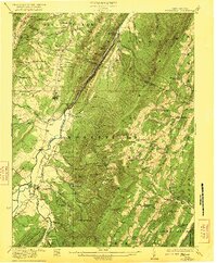
 1920 Moorefield1958 Print · USGSHardy and Hampshire Counties come alive in the 1920s as the Baltimore and Ohio RR winds through the Trough. Genealogists can locate family homesteads near dozens of rural landmarks like Old Pine Church, Sector PO, and the Hines School.2 unique versions available
 - 1920 Map of Keyser, 1964 Print
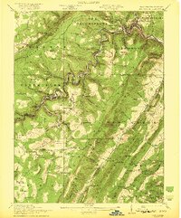
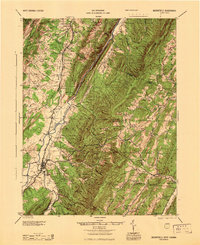
 1920 Keyser1964 Print · USGSMineral and Hampshire counties in the 1920s reveal a landscape of deep river valleys and prominent ridges tied together by the Baltimore and Ohio RR. Researchers can locate dozens of country schools and churches, from Trinity Church to the Pancake School and Reeses Mill.
 - 1921 Map of Keyser
 1921 Keyser1921 Print · USGSThe Potomac River valley and the ridges of Mineral and Hampshire counties are captured here in the early twenties. Researchers can locate vanished landmarks like the Russellville PO, industrial sites at Ochre, and dozens of rural schoolhouses from Red Star School to Knobly School.2 unique versions available
 - 1921 Map of Hanging Rock
 1921 Hanging Rock1921 Print · USGSHampshire County in the early twentieth century is captured here as a landscape of isolated mountain hollows and river settlements. Genealogists can locate dozens of neighborhood landmarks like Milesons Mill, Tearcoat Church, and schools such as Shady Grove School.3 unique versions available
 - 1921 Map of Greenland Gap
 1921 Greenland Gap1921 Print · USGSWest Virginia's Grant County highlands are documented here during the early twenties, showing a landscape of isolated mountain hollows and ridge-top schools. Genealogists can locate family landmarks like Locust Grove Church, Maysville, and over a dozen rural schoolhouses including Mountain Top School.3 unique versions available
 - 1921 Map of Moorefield
 1921 Moorefield1921 Print · USGSHardy and Hampshire counties come to life in the early 1920s as mountain settlements like Needmore and Oldfields cluster along the river gaps. Researchers can locate dozens of vanished rural schoolhouses and churches, from Thrasher Spring School to Old Pine Church.2 unique versions available
 - 1922 Map of Elk Garden
 1922 Elk Garden1922 Print · USGSThe Potomac River highlands come to life in the early 1920s as rail and river industry define the border between Maryland and West Virginia. Genealogists and local historians can trace family roots through numerous small schools and churches like Sunnyside School, Mt Pisgah Church, and Hartmansville.2 unique versions available
 - 1922 Map of Moorefield
 1922 Moorefield1922 Print · USGSHardy and Hampshire counties come into focus in the early 1920s as the river-and-rail economy defined the Potomac Highlands. Genealogists can trace family names through landmarks like Potter Spring Knob and rural centers such as Old Pine Church and Globe PO.2 unique versions available
 - 1922 Map of Keyser
 1922 Keyser1922 Print · USGSThe Potomac borderlands in the early 1920s reveal a landscape of deep valleys and vital rail connections along the West Virginia-Maryland line. Genealogists and local historians can trace rural family life through dozens of named schools like Red Star School and historic landmarks such as Trinity Church and Vanderlip P.O.3 unique versions available
 - 1923 Map of Hanging Rock
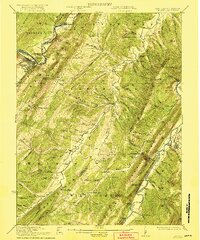
 1923 Hanging Rock1923 Print · USGSHampshire County at the start of the twenties is captured here as a landscape of ridge-top schools and valley mills. Researchers can trace the Northwestern Turnpike or locate vanished landmarks like Millesons Mill, Three Churches, and the Baltimore and Ohio RR.4 unique versions available
 - 1945 Map of Moorefield
 1945 Moorefield1945 Print · USGSHardy and Hampshire counties at the close of World War II reveal a landscape defined by the Potomac river-and-rail economy. Genealogists can locate family landmarks like Reynolds Gap and rural centers such as Old Pine Ch and Bethel Sch.
 - 1948 Map of Cumberland
 1948 Cumberland1948 Print · USGSMid-century Appalachia and the Shenandoah Valley are shown in detail, documenting the industrial and transportation hubs of the tri-state area. Genealogists can trace family roots through settlements like Double Tollgate and Bunker Hill or along the Baltimore & Ohio RR.3 unique versions available
 - 1948 Map of Kitzmiller, 1966 Print
 1948 Kitzmiller1966 Print · USGSThe Potomac River valley and the heights of Backbone Mountain are captured here in the late 1940s. Genealogists and historians can trace the coal-country settlements of Kitzmiller, Elk Garden, and East Vindex alongside several family-named cemeteries and landmarks like Mt Zion Sch.7 unique versions available
 - 1949 Map of Cumberland, 1955 Print
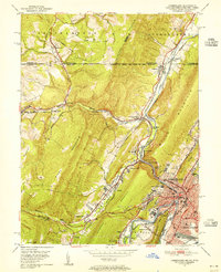 1949 Cumberland1955 Print · USGSCumberland and the Potomac River valley are shown in detail at mid-century, just as the region's rail and coal infrastructure reached its post-war peak. Local historians can trace the Mason and Dixon Line and locate historic landmarks like Sixmile House and The Narrows.10 unique versions available
Showing maps 1-25 of 154
Top cities of Mineral County
- Keyser historical maps
- Wiley Ford historical maps
- Carpendale historical maps
- Piedmont historical maps
- Ridgeley historical maps
- Elk Garden historical maps
Frequently asked questions
- What are the different types of historical maps available for Mineral County?
- What is the oldest map of Mineral County?
- Where can I purchase historical maps of Mineral County for my home or office?
- Where can I download high-res historical maps of Mineral County?
- Are there historical topographic maps available for Mineral County?
- Is there historical aerial imagery available for Mineral County?
- Where are historical maps of Mineral County sourced from?