2020s Maps of Mineral County, West Virginia
Explore 17 historic maps of Mineral County from the 2020s. These maps offer a rare glimpse into what life looked like during the 2020s — showing old roads, neighborhoods, homes, and landmarks that have changed or disappeared over time.
Whether you're researching your family's past, planning a metal detecting trip, or studying how Mineral County's landscape evolved across the 2020s, these high-resolution maps are a powerful tool for exploring the history of this region.
- Focus on a specific era: All maps on this page are from the 2020s, giving you a focused view of this time period.
- See what’s changed: Compare century-old streets, trails, and buildings to today's modern landscape using overlays and satellite layers.
- Research with precision: Use these maps for genealogy, historical research, land use analysis, or educational projects.
- View, download, or print: Maps are fully viewable online in high resolution, and can be downloaded or printed for your own records.
Start exploring Mineral County's history through authentic maps from the 2020s. This is your window into the past.
Mineral County, WV maps
(17)- 2023 Map of Westernport, 2023 Print
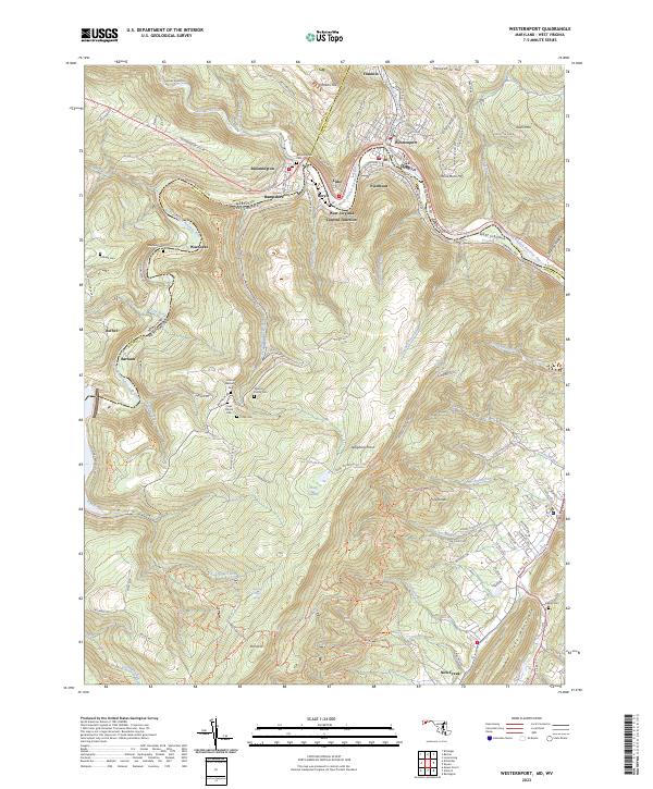 2023 Westernport2023 Print · USGSModern Westernport and the surrounding Potomac River valley appear in high detail at the junction of Maryland and West Virginia. Researchers can trace ancestral sites at Bloomington Cem or explore the mountain settlements of Warnocks and Barnum.
 - 2023 Map of Gorman, 2023 Print
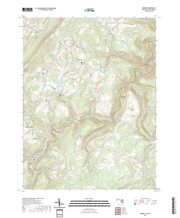 2023 Gorman2023 Print · USGSThe Potomac highlands come alive in this survey of the river-border communities between Maryland and West Virginia. Genealogists can trace family-named sites like Harvey-Wilson Cem and the small settlements of Gormania and Steyer.
 - 2023 Map of Kitzmiller, 2023 Print
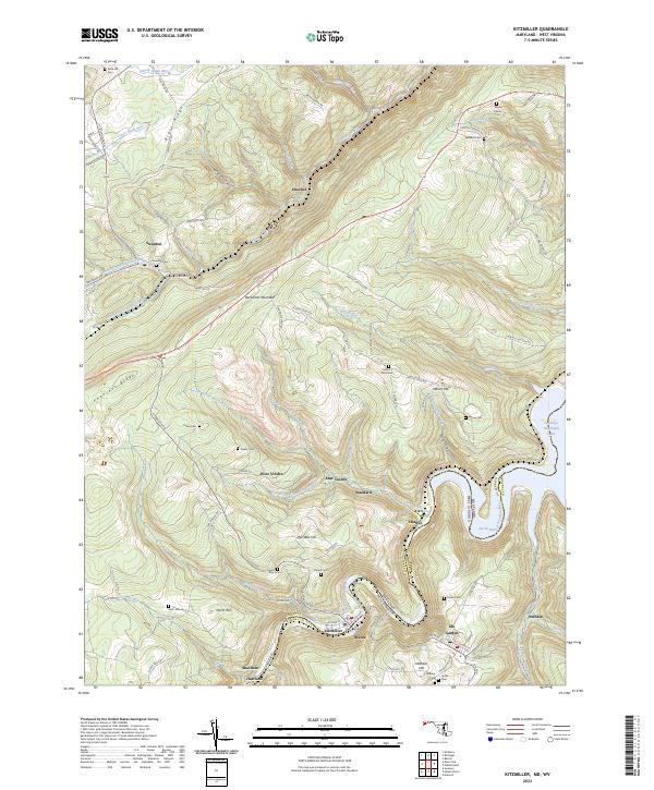 2023 Kitzmiller2023 Print · USGSThe industrial river towns of the Maryland and West Virginia border come alive in this detailed recent study. Genealogists can trace family burial sites like Evans Cem and Dixon Cem or locate former mining hubs at West Vindex and Shallmar.
 - 2023 Map of Lonaconing, 2023 Print
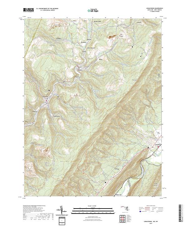 2023 Lonaconing2023 Print · USGSMaryland's mountain mining corridor along Georges Creek appears here in high detail, showing the modern layout of historic coal-country hamlets. Researchers can trace family ties through Saint Marys Cem, locate sites in Borden Shaft, or follow the CSX TRANSPORTATION line.
 - 2023 Map of Evitts Creek, 2023 Print
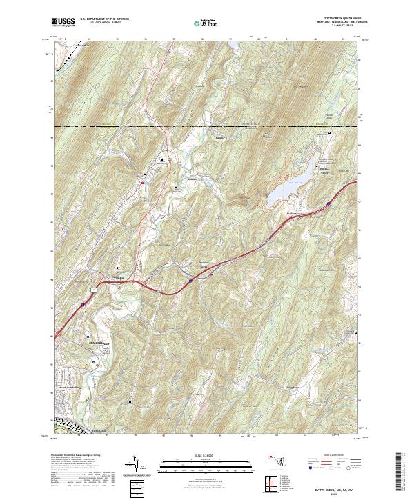 2023 Evitts Creek2023 Print · USGSThe rugged ridge-and-valley landscape east of Cumberland comes into focus in this recent survey. Local historians can trace family roots through sites like the Robinette Family Cem and Wolfe Mill or follow the path of Evitts Creek toward Lake Habeeb.
 - 2023 Map of Cumberland, 2023 Print
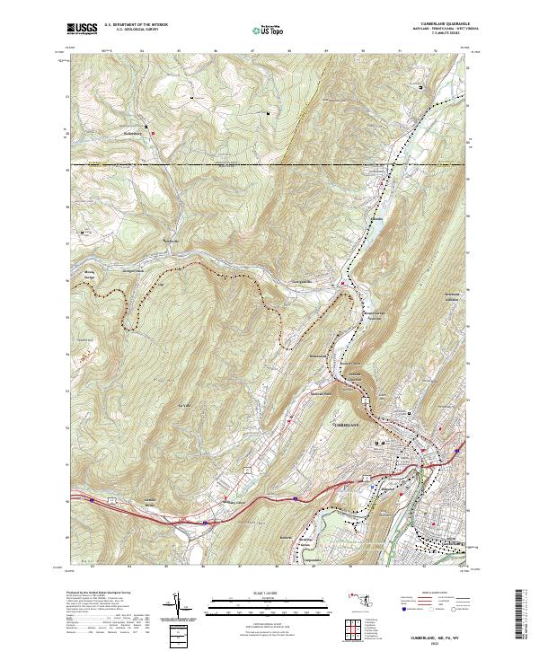 2023 Cumberland2023 Print · USGSCumberland and the Potomac River valley are shown in high detail at the dawn of the 2020s. Genealogists can locate family sites like Wellersburg Church Cem and Sixmile House near the historic passage of The Narrows.
 - 2023 Map of Mount Storm, 2023 Print
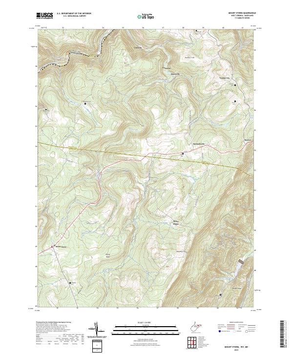 2023 Mount Storm2023 Print · USGSThe Potomac headwaters and the steep rise of the Allegheny Front define this corner of West Virginia. Researchers can trace family history through a network of small burial grounds like Murphy Cem and Evans Cem near the mountain community of Mount Storm.
 - 2023 Map of Antioch, 2023 Print
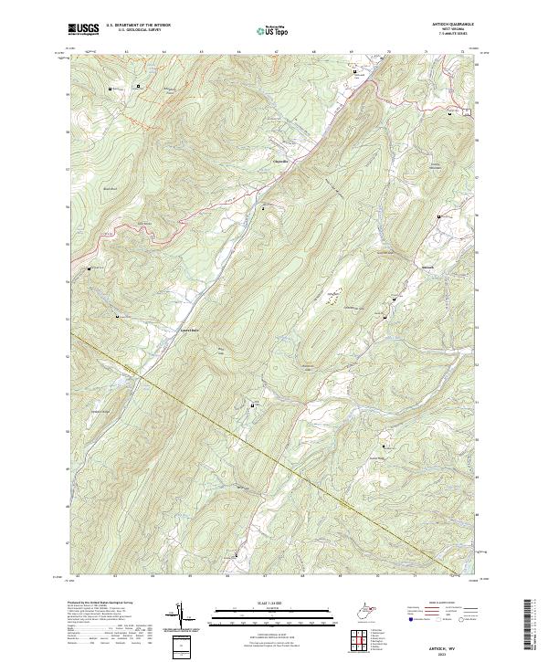 2023 Antioch2023 Print · USGSMineral County in the early 2020s is defined by its deep ridge-and-valley topography and small mountain crossroads. Genealogists can locate family landmarks like Ward Cem, Thrush Cem, and the old settlement at Laurel Dale.
 - 2023 Map of Medley, 2023 Print
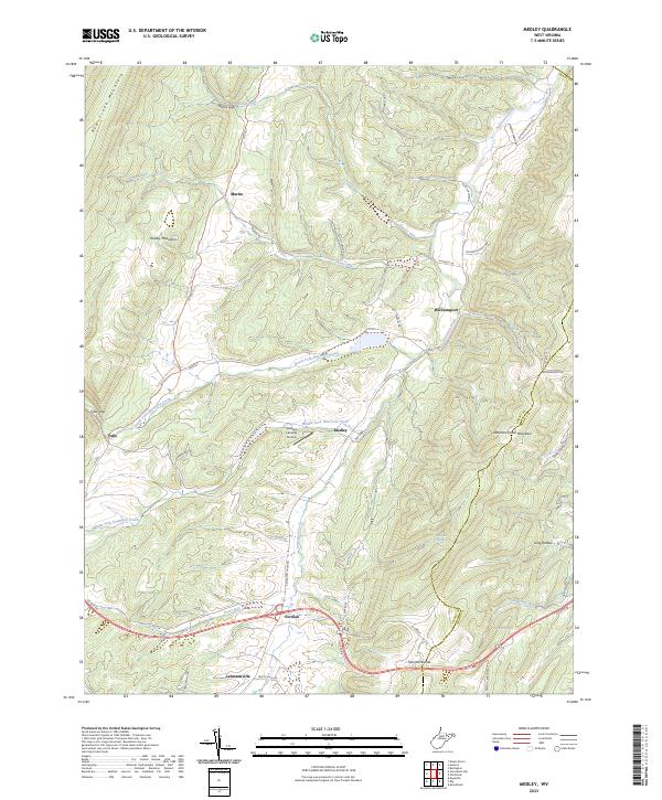 2023 Medley2023 Print · USGSGrant County is captured in this recent survey, showcasing a landscape of high ridges and deep valley settlements. Researchers can trace family ties and landmarks from the Popular School to rural centers like Medley and Lahmansville.
 - 2023 Map of Headsville, 2023 Print
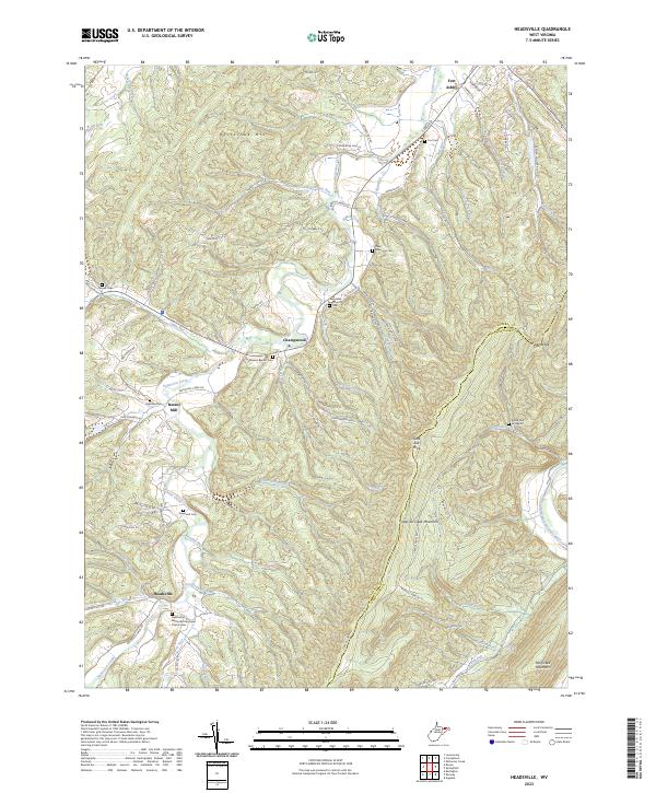 2023 Headsville2023 Print · USGSIn the early twenty-first century, this Mineral and Hampshire County borderland remains a landscape of valley settlements and high ridges. Genealogists can trace family names through numerous burial sites like Greenwall Cem, while local history comes alive at Reeses Mill and Fort Ashby.
 - 2023 Map of Burlington, 2023 Print
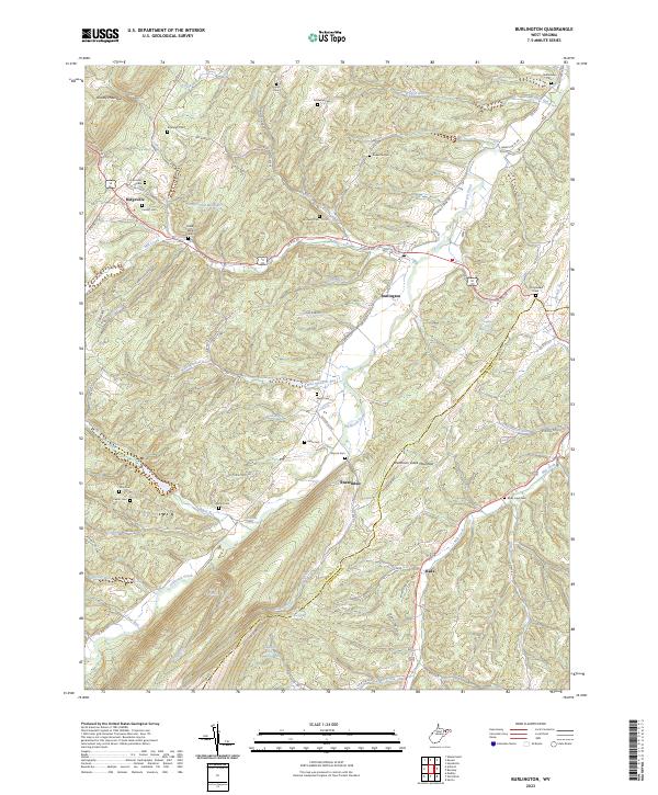 2023 Burlington2023 Print · USGSThe West Virginia panhandle highlands and the Patterson Creek valley come to life in this contemporary 2023 survey. Genealogists and local historians can locate many family burial grounds like Leatherman Cem and Elijah High Cem near Burlington.
 - 2023 Map of Old Fields, 2023 Print
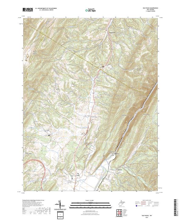 2023 Old Fields2023 Print · USGSThe Potomac Highlands south of Purgitsville are captured in this modern survey of the river valley. Genealogists and hikers can locate several burial grounds including Old Pine Cem and landmarks like The Sycamore and Old Fields Church.
 - 2023 Map of Romney, 2023 Print
 2023 Romney2023 Print · USGSHampshire County and the South Branch Potomac River are captured here in the early 2020s, showing the intersection of mountain geography and deep-rooted settlements. Researchers can locate family landmarks like Indian Mound Cem, Whip Cem, and the historic judicial center in Romney.
 - 2023 Map of Springfield, 2023 Print
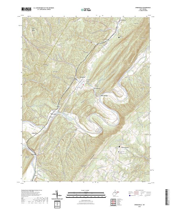 2023 Springfield2023 Print · USGSHampshire County at the start of the 2020s shows a landscape where the river and mountain ridges dictate the local geography. Family historians can trace local landmarks like Millesons Mill, Springfield Hill Cem, and the community of Three Churches.
 - 2023 Map of Cresaptown, 2023 Print
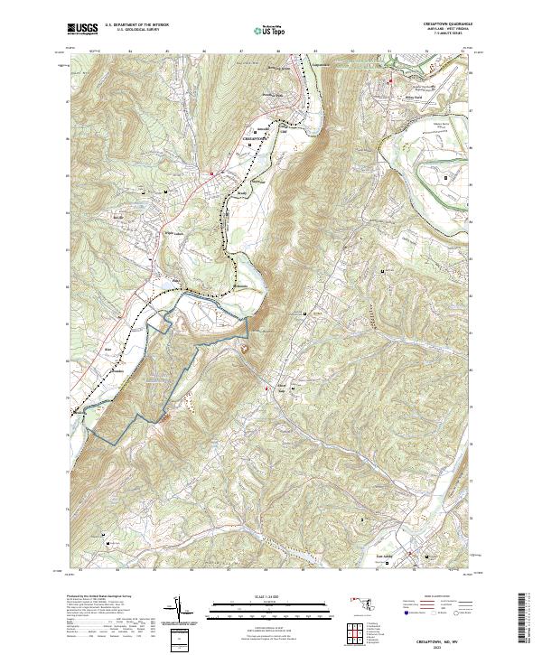 2023 Cresaptown2023 Print · USGSThe Potomac River valley on the Maryland-West Virginia border shows a complex mix of industrial history and modern aviation in this recent survey. Researchers can trace family plots like Abe Cem and Inkeep Cem or locate the sprawling Allegany Ballistics Lab.
 - 2023 Map of Patterson Creek, 2023 Print
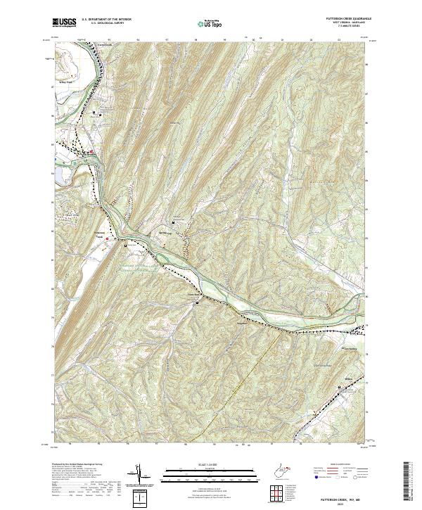 2023 Patterson Creek2023 Print · USGSMaryland and West Virginia meet along the North Branch Potomac River in this 2020s survey of the ridge-and-valley landscape. Genealogists can locate several historic cemeteries like Saint Marys Cem and Hardy Cem near the Patterson Creek valley.
 - 2023 Map of Keyser, 2023 Print
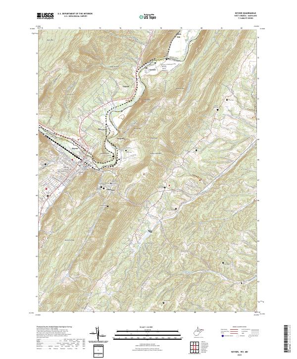 2023 Keyser2023 Print · USGSKeyser and the Potomac valley are shown here in the early 2020s, highlighting the area's deep institutional and family history. Genealogists can trace roots at Saint Marys Cem and Mount Zion Cem, while researchers will find Mineral County Courthouse at the heart of the settlement.
End of results
Showing maps 1-17 of 17
Top cities of Mineral County
- Keyser historical maps
- Wiley Ford historical maps
- Carpendale historical maps
- Piedmont historical maps
- Ridgeley historical maps
- Elk Garden historical maps
Frequently asked questions
- What are the different types of historical maps available for Mineral County?
- What is the oldest map of Mineral County?
- Where can I purchase historical maps of Mineral County for my home or office?
- Where can I download high-res historical maps of Mineral County?
- Are there historical topographic maps available for Mineral County?
- Is there historical aerial imagery available for Mineral County?
- Where are historical maps of Mineral County sourced from?