Old Maps of Naugatuck, West Virginia for Metal Detecting
Plan your next treasure hunt with 19 historic maps of Naugatuck. Find old homesites, ghost towns, trails, and gathering spots that may be lost to time — perfect for identifying promising metal detecting locations.
- Locate forgotten sites: Uncover places like long-lost settlements, abandoned rail lines, or gathering spots.
- Plan better hunts: Use map overlays combined with LiDAR or satellite views to narrow in on historically rich areas.
- Made for detectorists: Thousands of hobbyists use these maps to discover relics, coins, and hidden history.
Use these historic maps to boost your research and find new opportunities beneath the surface of Naugatuck.
Naugatuck, WV maps
(19)- 1887 Map of Warfield
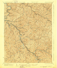
 1887 Warfield1887 Print · USGSThe West Virginia and Kentucky borderlands come into focus in the late nineteenth century along the winding Tug Fork of Big Sandy River. Genealogists and historians can trace early valley life through sites like Warfield, Chapmansville, and the remote White Post settlement.
 - 1891 Map of Warfield
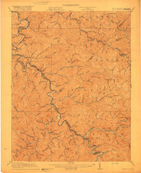
 1891 Warfield1891 Print · USGSThe Tug Fork valley in the 1880s is captured here at the intersection of Kentucky and West Virginia. Researchers can trace the early Appalachian landscape through riverfront settlements like Warfield and White Post, or find family-named hubs such as Hatfield and Mate.7 unique versions available
 - 1910 Map of Naugatuck
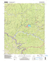
 1910 Naugatuck1910 Print · USGSMingo and Wayne Counties come into focus in the early twentieth century as the coal and timber industry transformed these hollows. Genealogists and researchers can trace the Norfolk and Western rail line through early settlements like Kermit, Breeden, and Naugatuck.
 - 1912 Map of Naugatuck
 1912 Naugatuck1912 Print · USGSMingo and Wayne County borderlands are shown here in the early twentieth century, as the river-and-rail economy transformed these Appalachian hollows. Genealogists and historians can trace family-named sites along the Tug Fork and Norfolk and Western Ry, including Kermit, Naugatuck, and Breeden.
 - 1915 Map of Naugatuck
 1915 Naugatuck1915 Print · USGSThe Tug Fork valley in the early twentieth century appears in fine detail here along the Kentucky and West Virginia border. Genealogists and historians can trace early settlements and valley schools including Warfield, Naugatuck, and the Priest School.
 - 1917 Map of Naugatuck
 1917 Naugatuck1917 Print · USGSThe Tug Fork borderlands of Mingo and Wayne counties were defined by the rail-and-river economy during the early twentieth century. Genealogists and historians can trace riverside settlements like Kermit and Naugatuck, or search for upland landmarks such as Priest School and the Breeden Breading Post Office.3 unique versions available
 - 1926 Map of Naugatuck, 1957 Print
 1926 Naugatuck1957 Print · USGSThe Tug Fork valley hums with activity in the 1920s as the rail-and-river economy shapes the West Virginia and Kentucky border. Genealogists and historians can trace numerous rural schools and early settlements like Kermit, Warfield, and the Cassie post office.
 - 1928 Map of Naugatuck
 1928 Naugatuck1928 Print · USGSThe Tug Fork valley at the close of the 1920s reveals a landscape defined by the Norfolk and Western RR and riverside coal towns. Genealogists can trace family footprints through remote schoolhouses like The Bend Sch and rural post offices at Cassie Po and Kermit.2 unique versions available
 - 1954 Map of Naugatuck, 1955 Print
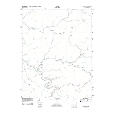
 1954 Naugatuck1955 Print · USGSThe Tug Fork valley on the Kentucky-West Virginia border appears in the mid-1950s, showing a landscape shaped by narrow hollows and river bends. Trace local roots at Winco Block, the Marcum Cem, and several schoolhouses including Taylor Sch.
 - 1957 Map of Jenkins, 1974 Print
 1957 Jenkins1974 Print · USGSThe Cumberland Plateau in the mid-twentieth century reveals a complex landscape of winding river valleys and deep-seated industry. Genealogists and historians can trace the development of Hazard, Jenkins, and Pikeville alongside extensive Numerous Oil and Gas Fields and the routes of the Chesapeake & Ohio Railway.
 - 1960 Map of Jenkins
 1960 Jenkins1960 Print · USGSEastern Kentucky and the West Virginia borderlands are captured at a mid-century peak of the coal and rail era. Trace the industrial corridors of the Chesapeake and Ohio RR through mountain hubs like Hazard and Jenkins.
 - 1963 Map of Naugatuck, 1965 Print
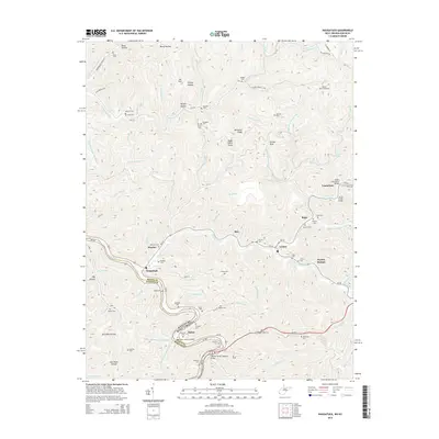
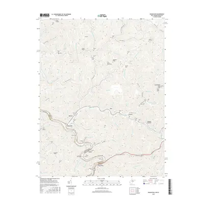
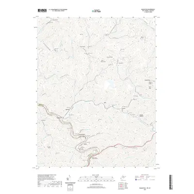
 1963 Naugatuck1965 Print · USGSMingo County in the early sixties remains a hub of river-and-rail industry along the Tug River valley. Genealogists can trace family names across dozens of small sites like Hensley Cem or Waldron Cem, and locate the Wince Block Sch and Old Zion Ch.3 unique versions available
 - 1982 Map of Williamson, 1983 Print
 1982 Williamson1983 Print · USGSThe Central Appalachian coalfields of West Virginia and Kentucky come into sharp focus here during the early eighties. Genealogists and researchers can trace the valley rail networks of the Norfolk and Western RR through Matewan, Williamson, and Blackberry City.
 - 1997 Map of Naugatuck, 2003 Print
 1997 Naugatuck2003 Print · USGSThe Tug River borderlands of Mingo County appear in detail here during the late nineties, showing the winding valleys of the West Virginia-Kentucky line. Researchers can trace family history through local sites like Parsley Bottom, Waldron Cem, and Mouth of Long Branch Sch.
 - 2010 Map of Naugatuck, 2010 Print
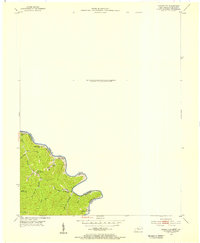
 2010 Naugatuck2010 Print · USGSCovers Naugatuck, including Maher, Parsley Bottom, and other nearby areas
 - 2014 Map of Naugatuck, 2014 Print
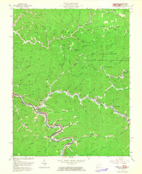
 2014 Naugatuck2014 Print · USGSCovers Naugatuck, including Maher, Parsley Bottom, and other nearby areas
 - 2016 Map of Naugatuck, 2016 Print
 2016 Naugatuck2016 Print · USGSCovers Naugatuck, including Maher, Parsley Bottom, and other nearby areas
 - 2019 Map of Naugatuck, 2019 Print
 2019 Naugatuck2019 Print · USGSCovers Naugatuck, including Maher, Parsley Bottom, and other nearby areas
 - 2023 Map of Naugatuck, 2023 Print
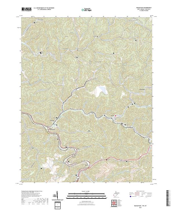 2023 Naugatuck2023 Print · USGSThe borderlands of Mingo County and Kentucky come alive in this recent survey of the Tug Fork valley. Genealogists can trace family heritage through dozens of documented burial sites including Waldron Cem, Stepp Cem, and Hensley Cem.
End of results
Showing maps 1-19 of 19
Top cities near Naugatuck
- Pikeville historical maps
- Williamson historical maps
- Chattaroy historical maps
- Red Jacket historical maps
- Matewan historical maps
- Inez historical maps
See more
Frequently asked questions
- What are the different types of historical maps available for Naugatuck?
- What is the oldest map of Naugatuck?
- Where can I purchase historical maps of Naugatuck for my home or office?
- Where can I download high-res historical maps of Naugatuck?
- Are there historical topographic maps available for Naugatuck?
- Is there historical aerial imagery available for Naugatuck?
- Where are historical maps of Naugatuck sourced from?