Old Maps of Morgantown, West Virginia
Explore 17 old maps of Morgantown, spanning from 1902 to today. These high-resolution historic maps reveal how streets, neighborhoods, landmarks, and natural features evolved over time — perfect for genealogy, metal detecting, research, and local history exploration.
What you can do with these maps:
- See how Morgantown changed over time: Compare historical maps to modern-day views to trace roads, homesites, rail lines & more.
- View detailed metadata: Each map includes creators, publishers, year, scale, and archive source.
- Overlay maps with satellite & LiDAR: Visualize the past alongside modern tools to explore terrain & human change.
- Trusted historical sources: Maps sourced from the USGS, Library of Congress, and other archives.
- Access maps your way: View online, download high-res files, or order prints for personal or research use.
Start exploring old maps of Morgantown to uncover forgotten places, hidden landmarks, and the deep history beneath your feet.
Morgantown, WV maps
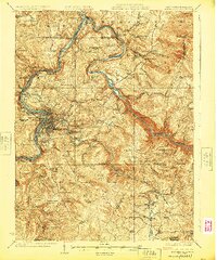
(17)- 1902 Map of Morgantown
 1902 Morgantown1902 Print · USGSCovers Morgantown, including Westover, Springhill Township, and other nearby areas5 unique versions available
 - 1925 Map of Morgantown
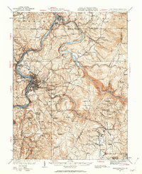
 1925 Morgantown1925 Print · USGSCovers Morgantown, including Westover, Springhill Township, and other nearby areas2 unique versions available
 - 1931 Map of Morgantown, 1962 Print
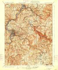
 1931 Morgantown1962 Print · USGSCovers Morgantown, including Westover, Springhill Township, and other nearby areas
 - 1933 Map of Morgantown
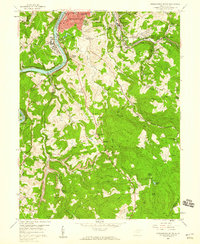
 1933 Morgantown1933 Print · USGSCovers Morgantown, including Westover, Springhill Township, and other nearby areas3 unique versions available
 - 1948 Map of Cumberland
 1948 Cumberland1948 Print · USGSCovers Morgantown, including Winchester, Cumberland, and other nearby areas3 unique versions available
 - 1952 Map of Cumberland
 1952 Cumberland1952 Print · USGSCovers Morgantown, including Winchester, Cumberland, and other nearby areas
 - 1956 Map of Cumberland, 1966 Print
 1956 Cumberland1966 Print · USGSCovers Morgantown, including Winchester, Cumberland, and other nearby areas6 unique versions available
 - 1957 Map of Cumberland
 1957 Cumberland1957 Print · USGSCovers Morgantown, including Winchester, Cumberland, and other nearby areas
 - 1957 Map of Morgantown South, 1959 Print
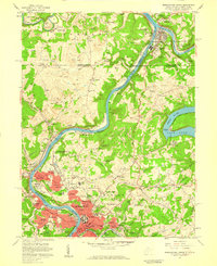
 1957 Morgantown South1959 Print · USGSCovers Morgantown, including Westover, Richard, and other nearby areas3 unique versions available
 - 1957 Map of Morgantown North, 1959 Print
 1957 Morgantown North1959 Print · USGSCovers Morgantown, including Westover, Springhill Township, and other nearby areas4 unique versions available
 - 1961 Map of Cumberland
 1961 Cumberland1961 Print · USGSCovers Morgantown, including Winchester, Cumberland, and other nearby areas
 - 1962 Map of Cumberland
 1962 Cumberland1962 Print · USGSCovers Morgantown, including Winchester, Cumberland, and other nearby areas
 - 1976 Map of Morgantown South, 1979 Print
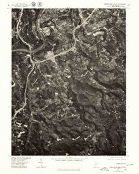 1976 Morgantown South1979 Print · USGSCovers Morgantown, including Westover, Richard, and other nearby areas
 - 1976 Map of Morgantown North, 1979 Print
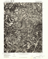 1976 Morgantown North1979 Print · USGSCovers Morgantown, including Westover, Springhill Township, and other nearby areas
 - 1979 Map of Morgantown, 1983 Print
 1979 Morgantown1983 Print · USGSCovers Morgantown, including Uniontown, Somerset, and other nearby areas
 - 1994 Map of Morgantown North, 2000 Print
 1994 Morgantown North2000 Print · USGSCovers Morgantown, including Westover, Springhill Township, and other nearby areas
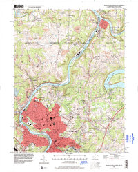
 - 1997 Map of Morgantown South, 2001 Print
 1997 Morgantown South2001 Print · USGSCovers Morgantown, including Westover, Richard, and other nearby areas
End of results
Showing maps 1-17 of 17
Top cities near Morgantown
- Fairmont historical maps
- Westover historical maps
- Masontown historical maps
- Pleasant Valley historical maps
- Springhill Township historical maps
- Dunkard Township historical maps
See more
Top neighborhoods of Morgantown
- West Sabraton historical maps
- Fieldcrest historical maps
- South Hills historical maps
- Evansdale historical maps
- Suncrest historical maps
- Sunnyside historical maps
See more
Frequently asked questions
- What are the different types of historical maps available for Morgantown?
- What is the oldest map of Morgantown?
- Where can I purchase historical maps of Morgantown for my home or office?
- Where can I download high-res historical maps of Morgantown?
- Are there historical topographic maps available for Morgantown?
- Is there historical aerial imagery available for Morgantown?
- Where are historical maps of Morgantown sourced from?