Old Maps of Roxalia, West Virginia for Hiking & Exploration
Hike through history with 16 historic maps of Roxalia. Explore old trails, ghost towns, and forgotten backroads — perfect for outdoor adventurers and local explorers.
- Rediscover forgotten places: Map out old mining camps, roads, and footpaths that no longer exist on modern maps.
- Layer with modern tools: Combine with LiDAR or satellite views to plan hikes through historical terrain.
- Made for exploration: Popular among hikers, overlanders, and local history lovers.
Use these maps to find adventure and explore the hidden past of Roxalia.
Roxalia, WV maps
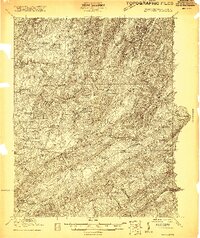
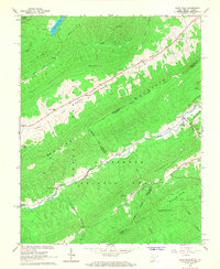
(16)- 1887 Map of Lewisburg
 1887 Lewisburg1887 Print · USGSThe Greenbrier Valley and the Virginia borderlands are captured here in the late nineteenth century during a period of significant rail expansion. Genealogists and historians can trace early mountain settlements like White Sulphur Springs and Ronceverte, or locate specific landmarks like Van Staverns Mill and the Half Way House.
 - 1891 Map of Lewisburg
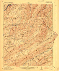
 1891 Lewisburg1891 Print · USGSThe Virginia and West Virginia borderlands are captured here in the late 1880s, documenting a landscape of mountain ridges and burgeoning rail infrastructure. Genealogists and historians can trace family-named landmarks like Van Staverns Mill or follow the route of the Chesapeake and Ohio Railroad through the Alleghany Tunnel.8 unique versions available
 - 1921 Map of Ronceverte
 1921 Ronceverte1921 Print · USGSThe West Virginia and Virginia borderlands come alive in this early 1920s record of the Greenbrier Valley and Allegheny ridges. Genealogists can trace family roots through numerous local landmarks like Organ Cave, Red Mill, and the Highland Green School.2 unique versions available
 - 1923 Map of Ronceverte
 1923 Ronceverte1923 Print · USGSSoutheast West Virginia in the early twenties is a landscape of mountain ridges and remote hollows. Genealogists can trace the rural communities of Gap Mills and Sweet Springs, alongside dozens of landmarks like Organ Cave and Schley School.4 unique versions available
 - 1948 Map of Ronceverte, 1964 Print
 1948 Ronceverte1964 Print · USGSThe West Virginia and Virginia borderlands come into focus in the late 1940s, showing the mountain communities between the Greenbrier River and the Jefferson National Forest. Genealogists can locate family-named landmarks like McGlone and Gutes, or trace rural institutions such as Pleasant Valley Sch and Red Mill.
 - 1952 Map of Ronceverte
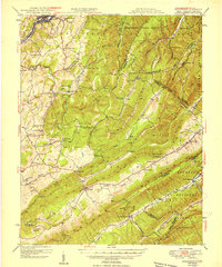 1952 Ronceverte1952 Print · USGSThe West Virginia and Virginia borderlands come alive in the early fifties, showing a rugged landscape of high ridges and narrow valleys. Genealogists can trace family roots through numerous local landmarks like Dowdy Cem, Organ Cave, and rural centers such as Gap Mills or Paint Bank.
 - 1955 Map of Bluefield
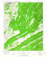
 1955 Bluefield1955 Print · USGSThe Central Appalachian borderlands come alive in the mid-fifties, showing the coal and rail networks connecting Bluefield to Beckley. Researchers can trace the industrial landscape of the New River Ordnance Plant and the terrain of Burkes Garden.
 - 1957 Map of Bluefield, 1967 Print
 1957 Bluefield1967 Print · USGSThe heart of Central Appalachia in the mid-fifties is defined by the winding rail lines and river valleys of the coalfields. Researchers can trace the industrial footprints of towns like Welch and Princeton or locate landmarks such as the Bluestone Reservoir and Claytor Lake.2 unique versions available
 - 1961 Map of Bluefield
 1961 Bluefield1961 Print · USGSThe coalfields and mountain ridges of southern West Virginia and southwest Virginia are captured in the early sixties. Genealogists can trace family ties through rail-linked towns like Princeton and Richlands or along the shores of Bluestone Reservoir.
 - 1966 Map of Paint Bank, 1968 Print
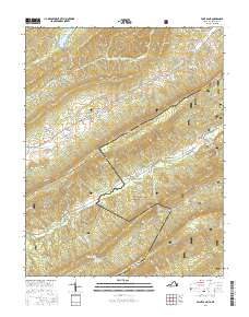
 1966 Paint Bank1968 Print · USGSThe West Virginia and Virginia borderlands around Monroe County are captured here in the mid-sixties, showing a landscape defined by high ridges and narrow valley settlements. Researchers can trace the Old RR Grade near Paint Bank or locate rural landmarks like Pine Grove Ch and Mountain View Cem.2 unique versions available
 - 1984 Map of Lewisburg, 1985 Print
 1984 Lewisburg1985 Print · USGSThe Greenbrier Valley in the mid-eighties shows a landscape of river-town commerce, mountain agriculture, and major institutional landmarks. Researchers can trace the rail corridors of the Chesapeake and Ohio and locate sites like the Federal Reformatory for Women and the Sam Black Church.2 unique versions available
 - 2011 Map of Paint Bank, 2011 Print
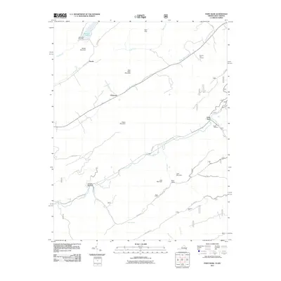 2011 Paint Bank2011 Print · USGSCovers Roxalia, including Centennial, Laurel Branch, and other nearby areas
 - 2013 Map of Paint Bank, 2013 Print
 2013 Paint Bank2013 Print · USGSCovers Roxalia, including Centennial, Laurel Branch, and other nearby areas
 - 2016 Map of Paint Bank, 2016 Print
 2016 Paint Bank2016 Print · USGSCovers Roxalia, including Centennial, Laurel Branch, and other nearby areas
 - 2019 Map of Paint Bank, 2019 Print
 2019 Paint Bank2019 Print · USGSCovers Roxalia, including Centennial, Laurel Branch, and other nearby areas
 - 2022 Map of Paint Bank, 2022 Print
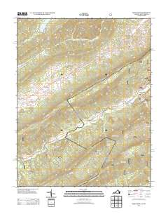
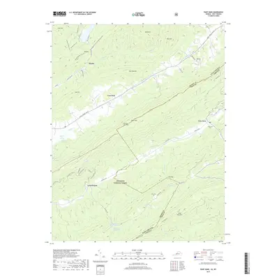
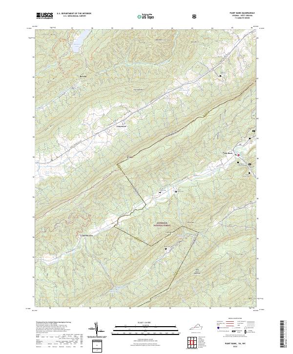 2022 Paint Bank2022 Print · USGSThe Virginia and West Virginia borderlands are revealed in this recent survey of the ridges and valleys near the Jefferson National Forest. Genealogists can locate several family landmarks, including the Rowan Family Cem, Bostic Cem, and the settlement of Paint Bank.
End of results
Showing maps 1-16 of 16
Top cities near Roxalia
- Lewisburg historical maps
- White Sulphur Springs historical maps
- Fairlea historical maps
- Ronceverte historical maps
- Union historical maps
Frequently asked questions
- What are the different types of historical maps available for Roxalia?
- What is the oldest map of Roxalia?
- Where can I purchase historical maps of Roxalia for my home or office?
- Where can I download high-res historical maps of Roxalia?
- Are there historical topographic maps available for Roxalia?
- Is there historical aerial imagery available for Roxalia?
- Where are historical maps of Roxalia sourced from?