Old Maps of Doe Gully, West Virginia for Hiking & Exploration
Hike through history with 18 historic maps of Doe Gully. Explore old trails, ghost towns, and forgotten backroads — perfect for outdoor adventurers and local explorers.
- Rediscover forgotten places: Map out old mining camps, roads, and footpaths that no longer exist on modern maps.
- Layer with modern tools: Combine with LiDAR or satellite views to plan hikes through historical terrain.
- Made for exploration: Popular among hikers, overlanders, and local history lovers.
Use these maps to find adventure and explore the hidden past of Doe Gully.
Doe Gully, WV maps
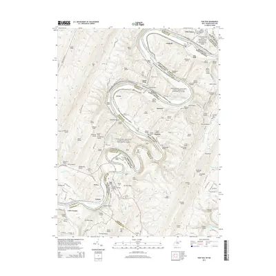
(18)- 1898 Map of Paw Paw, 1982 Print
 1898 Paw Paw1982 Print · USGSThe Potomac River meanders through the Appalachian ridges at the turn of the century, where Maryland, West Virginia, and Pennsylvania meet. Genealogists and historians can trace the early industrial corridor of the Chesapeake and Ohio Canal and find old rail stops like Magnolia and Doe Gully.
 - 1900 Map of Pawpaw
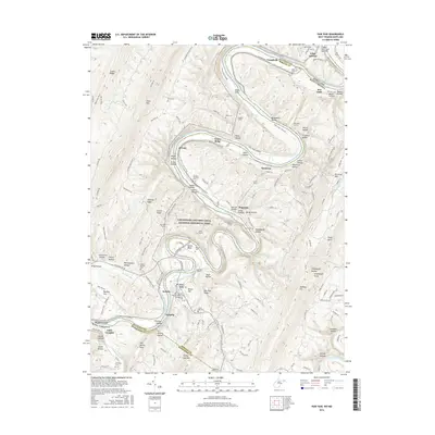
 1900 Pawpaw1900 Print · USGSThe Potomac River's intricate meanders define this borderland at the close of the nineteenth century. Researchers can trace the parallel routes of the Chesapeake and Ohio Canal and the Baltimore and Ohio Railroad past Magnolia, Dam No. 6, and Fisher Ford.8 unique versions available
 - 1910 Map of Paw Paw, 1959 Print
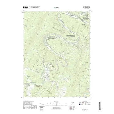
 1910 Paw Paw1959 Print · USGSMaryland and West Virginia meet along the serpentine Potomac River in the early twentieth century as railroads and canals compete for the valley. Trace the industrial landscape from the Ohio and Chesapeake Canal to the river towns of Paw Paw and Little Orleans.
 - 1948 Map of Cumberland
 1948 Cumberland1948 Print · USGSMid-century Appalachia and the Shenandoah Valley are shown in detail, documenting the industrial and transportation hubs of the tri-state area. Genealogists can trace family roots through settlements like Double Tollgate and Bunker Hill or along the Baltimore & Ohio RR.3 unique versions available
 - 1950 Map of Paw Paw, 1967 Print
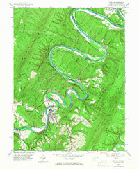 1950 Paw Paw1967 Print · USGSThe Potomac River oxbows at the West Virginia-Maryland border in the mid-century, where the rail-and-canal economy shaped the mountain landscape. Trace the historic route of the Baltimore and Ohio Railroad past Magnolia and find rural sites like Milo School and Sulphur Springs Ch.3 unique versions available
 - 1951 Map of Paw Paw
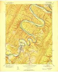 1951 Paw Paw1951 Print · USGSThe Potomac River's serpentine bends at the West Virginia-Maryland border define this mid-century landscape of heavy rail and mountain ridges. Genealogists and industrial historians can trace the Chesapeake and Ohio Canal and family sites like Cherry Orchard Cem or the Milo School.
 - 1952 Map of Cumberland
 1952 Cumberland1952 Print · USGSThe Potomac Highlands and the Shenandoah Valley are revealed in this early 1950s survey of the Appalachian interior. Researchers can trace the river-and-rail corridors connecting Cumberland, Winchester, and the recreational waters of Deep Creek Lake.
 - 1956 Map of Cumberland, 1966 Print
 1956 Cumberland1966 Print · USGSThe tri-state Highlands in the mid-1950s show a landscape shaped by coal, timber, and the massive presence of the Baltimore & Ohio RR. Researchers can trace the industrial corridor from Cumberland through the Allegheny Mountains to mountain retreats like Deep Creek Lake.6 unique versions available
 - 1957 Map of Cumberland
 1957 Cumberland1957 Print · USGSThe Potomac River valley and the ridges of the Allegheny Front define this mid-century landscape at the intersection of Maryland, West Virginia, and Pennsylvania. Trace the steam-era rail lines of the Baltimore and Ohio RR or locate rural landmarks like St Stephens Church and Stony River Dam.
 - 1961 Map of Cumberland
 1961 Cumberland1961 Print · USGSThe tri-state highlands of Maryland, West Virginia, and Pennsylvania are shown in the mid-twentieth century as a complex landscape of ridges and river valleys. Researchers can trace the winding Potomac River and find old rail-and-river towns like Cumberland, Keyser, and Morgantown.
 - 1962 Map of Cumberland
 1962 Cumberland1962 Print · USGSThe central Appalachians meet at the height of the mid-century industrial era, showing the rugged topography between Morgantown and Winchester. Genealogists can trace family lands near Fort Necessity or along the vital Baltimore & Ohio RR corridors.
 - 1981 Map of Cumberland, 1982 Print
 1981 Cumberland1982 Print · USGSThe tri-state region of Maryland, Pennsylvania, and West Virginia is captured here in the early eighties as a landscape of industrial history and ridgeline geography. Researchers can trace the heritage of the C & O Canal and the B & O RR through mountain gaps and coal towns like Eckhart Mines and Frostburg.2 unique versions available
 - 1996 Map of Paw Paw, 2001 Print
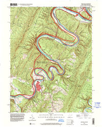 1996 Paw Paw2001 Print · USGSThe Potomac River meanders through the mountainous West Virginia and Maryland borderlands in the mid-1990s. Genealogists and historians can trace the paths of the C & O Canal and locate rural landmarks like Sulphur Springs Ch and the Milo School.
 - 2011 Map of Paw Paw, 2011 Print
 2011 Paw Paw2011 Print · USGSCovers Doe Gully, including Paw Paw, Keifers, and other nearby areas
 - 2014 Map of Paw Paw, 2014 Print
 2014 Paw Paw2014 Print · USGSCovers Doe Gully, including Paw Paw, Keifers, and other nearby areas
 - 2016 Map of Paw Paw, 2016 Print
 2016 Paw Paw2016 Print · USGSCovers Doe Gully, including Paw Paw, Keifers, and other nearby areas
 - 2019 Map of Paw Paw, 2019 Print
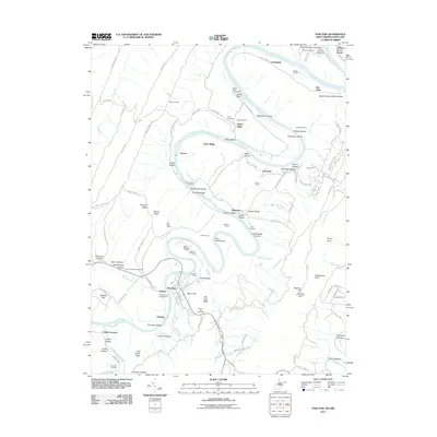
 2019 Paw Paw2019 Print · USGSCovers Doe Gully, including Paw Paw, Keifers, and other nearby areas
 - 2023 Map of Paw Paw, 2023 Print
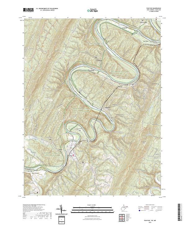 2023 Paw Paw2023 Print · USGSThe Potomac River meanders through the rugged borderlands of West Virginia and Maryland in this recent topographic survey. Researchers can trace historic family burial sites like Martin Cem and Ginevan Cem or explore the canal-side communities of Paw Paw and Magnolia.
End of results
Showing maps 1-18 of 18
Top cities near Doe Gully
- Hancock historical maps
- Berkeley Springs historical maps
- Paw Paw historical maps
- Flintstone historical maps
- Little Orleans historical maps
Frequently asked questions
- What are the different types of historical maps available for Doe Gully?
- What is the oldest map of Doe Gully?
- Where can I purchase historical maps of Doe Gully for my home or office?
- Where can I download high-res historical maps of Doe Gully?
- Are there historical topographic maps available for Doe Gully?
- Is there historical aerial imagery available for Doe Gully?
- Where are historical maps of Doe Gully sourced from?