Old Maps of Carmel, West Virginia for Metal Detecting
Plan your next treasure hunt with 18 historic maps of Carmel. Find old homesites, ghost towns, trails, and gathering spots that may be lost to time — perfect for identifying promising metal detecting locations.
- Locate forgotten sites: Uncover places like long-lost settlements, abandoned rail lines, or gathering spots.
- Plan better hunts: Use map overlays combined with LiDAR or satellite views to narrow in on historically rich areas.
- Made for detectorists: Thousands of hobbyists use these maps to discover relics, coins, and hidden history.
Use these historic maps to boost your research and find new opportunities beneath the surface of Carmel.
Carmel, WV maps
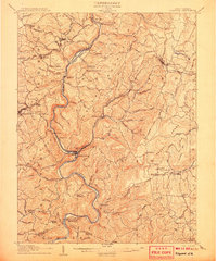
(18)- 1886 Map of St. George
 1886 St. George1886 Print · USGSNorthern West Virginia’s rugged river valleys and early rail corridors are mapped here in the mid-1880s. Genealogists can trace family roots in settlements like St George or Terra Alta, while following the path of the Baltimore and Ohio Railroad.
 - 1891 Map of St. George, 1895 Print
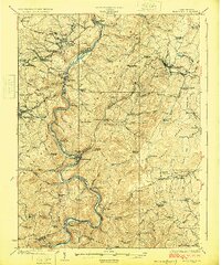
 1891 St. George1895 Print · USGSNorthern West Virginia at the end of the nineteenth century was defined by the expansion of the Baltimore and Ohio Railroad. Genealogists can trace early homesteads and landmarks like Valley Furnace, St George, and Terra Alta.3 unique versions available
 - 1907 Map of Kingwood
 1907 Kingwood1907 Print · USGSPreston County at the start of the twentieth century was defined by the deep gorges of the Cheat River and a network of historic turnpikes. Researchers can trace the early mountain economy through landmarks like Fairfax Ferry, the Buffalo Schoolhouse, and the Baltimore and Ohio RR corridor.2 unique versions available
 - 1925 Map of Kingwood
 1925 Kingwood1925 Print · USGSPreston County in the mid-twenties shows a landscape shaped by the Baltimore and Ohio Railroad and the winding Cheat River. Genealogists can locate dozens of country schools and churches, from St Josephs Church to the Washington Manor School and the Pleasant Valley Ford.3 unique versions available
 - 1948 Map of Cumberland
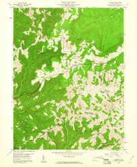
 1948 Cumberland1948 Print · USGSMid-century Appalachia and the Shenandoah Valley are shown in detail, documenting the industrial and transportation hubs of the tri-state area. Genealogists can trace family roots through settlements like Double Tollgate and Bunker Hill or along the Baltimore & Ohio RR.3 unique versions available
 - 1952 Map of Cumberland
 1952 Cumberland1952 Print · USGSThe Potomac Highlands and the Shenandoah Valley are revealed in this early 1950s survey of the Appalachian interior. Researchers can trace the river-and-rail corridors connecting Cumberland, Winchester, and the recreational waters of Deep Creek Lake.
 - 1956 Map of Cumberland, 1966 Print
 1956 Cumberland1966 Print · USGSThe tri-state Highlands in the mid-1950s show a landscape shaped by coal, timber, and the massive presence of the Baltimore & Ohio RR. Researchers can trace the industrial corridor from Cumberland through the Allegheny Mountains to mountain retreats like Deep Creek Lake.6 unique versions available
 - 1957 Map of Cumberland
 1957 Cumberland1957 Print · USGSThe Potomac River valley and the ridges of the Allegheny Front define this mid-century landscape at the intersection of Maryland, West Virginia, and Pennsylvania. Trace the steam-era rail lines of the Baltimore and Ohio RR or locate rural landmarks like St Stephens Church and Stony River Dam.
 - 1959 Map of Aurora, 1960 Print
 1959 Aurora1960 Print · USGSPreston County's highland ridges and timbered hollows are captured here in the late fifties as traditional mountain life met modern state conservation. Genealogists can trace family names through landmarks like Stemple Ridge Church, Accident School, and the Eglon Cemetery.4 unique versions available
 - 1961 Map of Cumberland
 1961 Cumberland1961 Print · USGSThe tri-state highlands of Maryland, West Virginia, and Pennsylvania are shown in the mid-twentieth century as a complex landscape of ridges and river valleys. Researchers can trace the winding Potomac River and find old rail-and-river towns like Cumberland, Keyser, and Morgantown.
 - 1962 Map of Cumberland
 1962 Cumberland1962 Print · USGSThe central Appalachians meet at the height of the mid-century industrial era, showing the rugged topography between Morgantown and Winchester. Genealogists can trace family lands near Fort Necessity or along the vital Baltimore & Ohio RR corridors.
 - 1981 Map of Kingwood, 1982 Print
 1981 Kingwood1982 Print · USGSThe West Virginia highlands in the early eighties were a hub of mountain railroading and wilderness conservation. Trace the path of the Baltimore & Ohio RR through Kingwood or explore the early footprints of Canaan Valley State Park and Dolly Sods.
 - 1995 Map of Aurora, 1998 Print
 1995 Aurora1998 Print · USGSSoutheastern Preston County communities appear at the end of the century as a blend of forest conservation and upland farming. Trace family roots at Accident Cemetery or locate old community hubs like Amboy Ch and Stemple Ridge School.2 unique versions available
 - 2011 Map of Aurora, 2011 Print
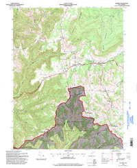
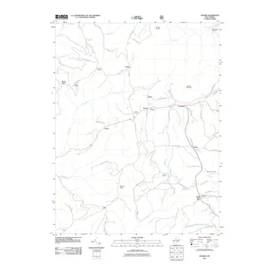 2011 Aurora2011 Print · USGSCovers Carmel, including Horse Shoe Run, Eglon, and other nearby areas
 - 2014 Map of Aurora, 2014 Print
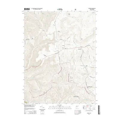 2014 Aurora2014 Print · USGSCovers Carmel, including Horse Shoe Run, Eglon, and other nearby areas
 - 2016 Map of Aurora, 2016 Print
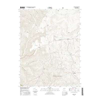 2016 Aurora2016 Print · USGSCovers Carmel, including Horse Shoe Run, Eglon, and other nearby areas
 - 2019 Map of Aurora, 2019 Print
 2019 Aurora2019 Print · USGSCovers Carmel, including Horse Shoe Run, Eglon, and other nearby areas
 - 2023 Map of Aurora, 2023 Print
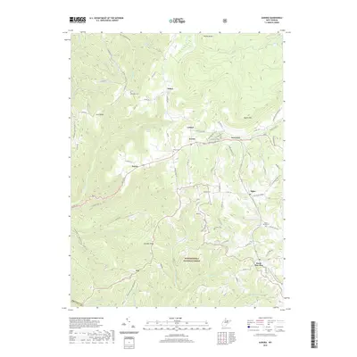
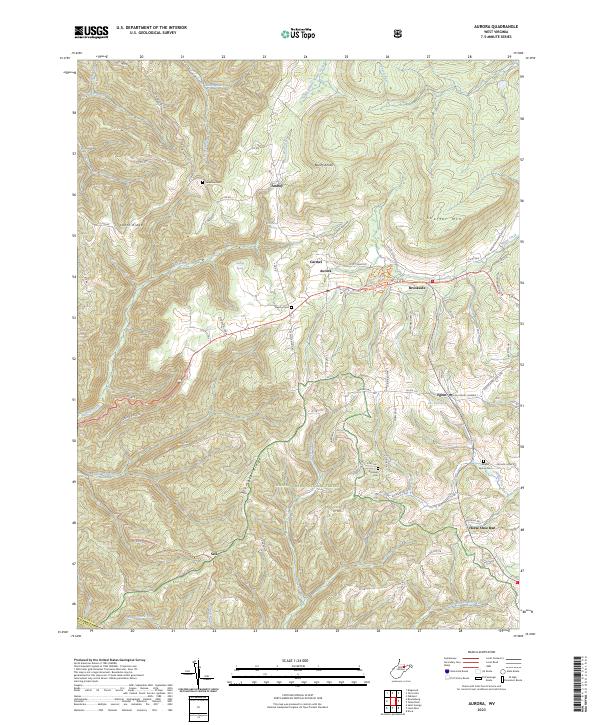 2023 Aurora2023 Print · USGSPreston County's high ridges and small crossroads communities are captured here in the early twenty-first century. Researchers can trace family sites and local landmarks like Grange Hall, Accident Cem, and the Maryland border along Rhine Creek.
End of results
Showing maps 1-18 of 18
Top cities near Carmel
- Kingwood historical maps
- Mountain Lake Park historical maps
- Oakland historical maps
- Terra Alta historical maps
- Rowlesburg historical maps
- Davis historical maps
See more
Frequently asked questions
- What are the different types of historical maps available for Carmel?
- What is the oldest map of Carmel?
- Where can I purchase historical maps of Carmel for my home or office?
- Where can I download high-res historical maps of Carmel?
- Are there historical topographic maps available for Carmel?
- Is there historical aerial imagery available for Carmel?
- Where are historical maps of Carmel sourced from?