2020s Maps of Kanes Creek, West Virginia
Explore 1 historic maps of Kanes Creek from the 2020s. These maps offer a rare glimpse into what life looked like during the 2020s — showing old roads, neighborhoods, homes, and landmarks that have changed or disappeared over time.
Whether you're researching your family's past, planning a metal detecting trip, or studying how Kanes Creek's landscape evolved across the 2020s, these high-resolution maps are a powerful tool for exploring the history of this region.
- Focus on a specific era: All maps on this page are from the 2020s, giving you a focused view of this time period.
- See what’s changed: Compare century-old streets, trails, and buildings to today's modern landscape using overlays and satellite layers.
- Research with precision: Use these maps for genealogy, historical research, land use analysis, or educational projects.
- View, download, or print: Maps are fully viewable online in high resolution, and can be downloaded or printed for your own records.
Start exploring Kanes Creek's history through authentic maps from the 2020s. This is your window into the past.
Kanes Creek, WV maps
(1)- 2023 Map of Masontown, 2023 Print
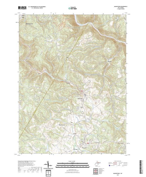 2023 Masontown2023 Print · USGSMasontown and Reedsville are shown here as they appeared recently, following the conversion of old industrial corridors into trails. Local historians can trace the development of small mining and farming hubs like Bretz, Guseman, and the historic planned community of Arthurdale.
End of results
Showing maps 1-1 of 1
Top cities near Kanes Creek
- Morgantown historical maps
- Westover historical maps
- Kingwood historical maps
- Springhill Township historical maps
- Dunkard Township historical maps
- Terra Alta historical maps
See more
Frequently asked questions
- What are the different types of historical maps available for Kanes Creek?
- What is the oldest map of Kanes Creek?
- Where can I purchase historical maps of Kanes Creek for my home or office?
- Where can I download high-res historical maps of Kanes Creek?
- Are there historical topographic maps available for Kanes Creek?
- Is there historical aerial imagery available for Kanes Creek?
- Where are historical maps of Kanes Creek sourced from?