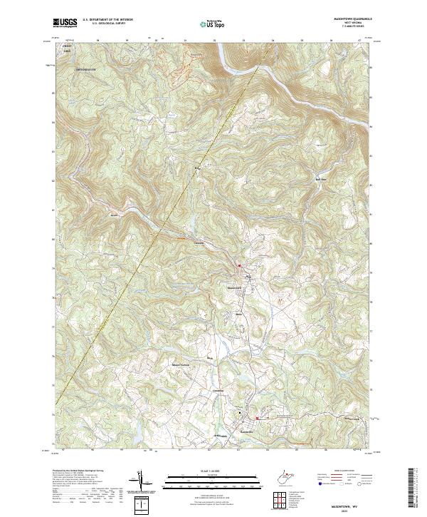
2023 Map of Masontown
USGS Topo · Published 2023About this map
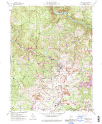
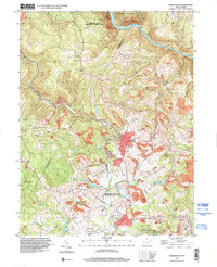
Masontown and the surrounding Preston County landscape are defined by a series of small, closely linked settlements including Reedsville, Bretz, and Arthurdale. The region reflects a transition from industrial roots to recreational use, most notably where the Deckers Creek Rail-Trl now follows the path of former rail lines through the creek valley. This corridor once supported local industry, evidenced by the Miller Mine and the various runs and creeks that carve the plateau. To the north, the Cheat River flows past the overlook at Cheat View, while the local infrastructure is anchored by landmarks like the Sturgis Church and the Reedsville Cem. The presence of the Town of Masontown Water Supply D Lake illustrates the critical management of water resources for these upland communities.
Find a feature on this map
137 named features on this map. Tap any name to fly to it.
Don’t see what you’re looking for? This feature index may not catch every label — zoom into the map to look around manually.
Map Details
Editions of this 2023 Masontown Map
This is the sole edition of this map. No revisions or reprints were ever made.
Historical Maps of Kanes Creek Through Time
3 maps found