Old Maps of Elkins, West Virginia
Explore 20 old maps of Elkins, spanning from 1889 to today. These high-resolution historic maps reveal how streets, neighborhoods, landmarks, and natural features evolved over time — perfect for genealogy, metal detecting, research, and local history exploration.
What you can do with these maps:
- See how Elkins changed over time: Compare historical maps to modern-day views to trace roads, homesites, rail lines & more.
- View detailed metadata: Each map includes creators, publishers, year, scale, and archive source.
- Overlay maps with satellite & LiDAR: Visualize the past alongside modern tools to explore terrain & human change.
- Trusted historical sources: Maps sourced from the USGS, Library of Congress, and other archives.
- Access maps your way: View online, download high-res files, or order prints for personal or research use.
Start exploring old maps of Elkins to uncover forgotten places, hidden landmarks, and the deep history beneath your feet.
Elkins, WV maps
(20)- 1889 Map of Beverly
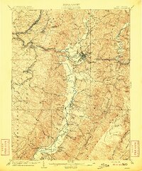
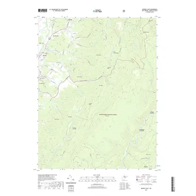
 1889 Beverly1889 Print · USGSThe high Allegheny ridges and river forks of West Virginia are mapped here in the late 1880s, highlighting the rugged settlement patterns of Randolph and Pocahontas counties. Researchers can trace early family-named locations such as Days Mills, locate the Boundary Line In Dispute, and find remote outposts like Traveller's Repose.
 - 1892 Map of Beverly
 1892 Beverly1892 Print · USGSCentral West Virginia's high-mountain settlements and disputed county lines are captured here in the late nineteenth century. Genealogists and historians can trace family locations and early industry near Beverly, Huttonsville, and the remote Days Mills.5 unique versions available
 - 1909 Map of Elkins
 1909 Elkins1909 Print · USGSRandolph County's river valleys and mountain ridges are captured here during the peak of the regional railroad and timber era. Genealogists can trace family roots through numerous named schools and churches, from Trinity Church to the Goff School, while following the paths of the Coal and Coke Ry and Staunton and Parkersburg Pike.4 unique versions available
 - 1949 Map of Charlottesville
 1949 Charlottesville1949 Print · USGSThe Shenandoah Valley and Blue Ridge appear in the late 1940s as a thriving corridor of rail and river commerce. Researchers can trace the mid-century footprints of Harrisonburg, Staunton, and Culpeper alongside the historic routes of the Southern Railway.2 unique versions available
 - 1956 Map of Charlottesville, 1966 Print
 1956 Charlottesville1966 Print · USGSThe Shenandoah Valley and Blue Ridge are captured in detail during the mid-1960s as the modern interstate system began to emerge. Genealogists and historians can trace rail-connected hubs like Waynesboro or follow the river paths of the Rapidan River and Rivanna River.4 unique versions available
 - 1969 Map of Beverly East, 1971 Print
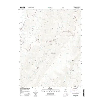
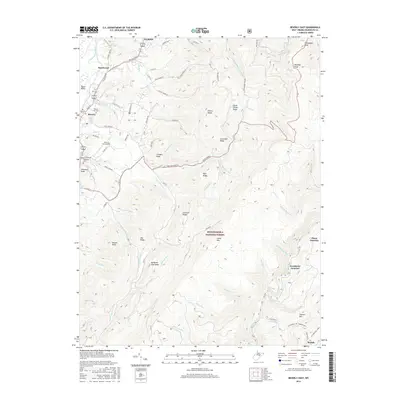
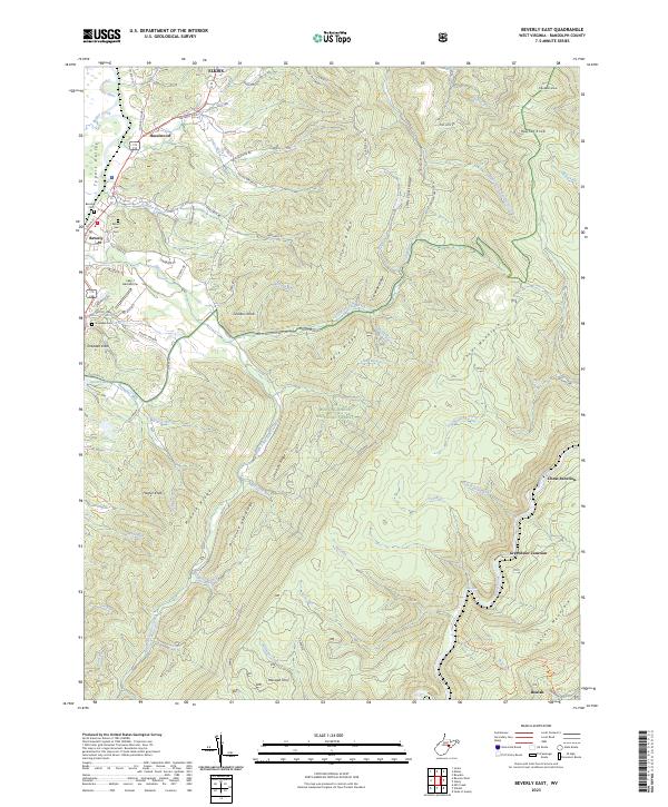
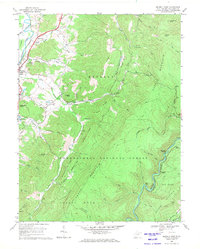 1969 Beverly East1971 Print · USGSThe Tygart Valley and the high ridges of the Monongahela National Forest are captured here in the late sixties. Genealogists and historians can trace the rural landscape of Beverly and Hazelwood, or locate remote points like Elk River Junction and Mt Vernon Ch.3 unique versions available
 - 1969 Map of Elkins, 1971 Print
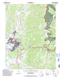
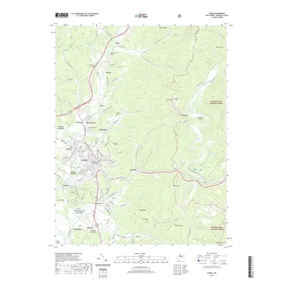
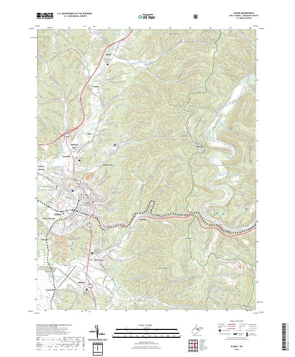
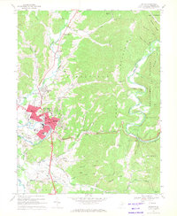 1969 Elkins1971 Print · USGSElkins serves as a bustling rail and mountain hub in the late sixties, where the river valley meets the high forest ridges. Researchers can trace the lines of the Baltimore and Ohio Railroad or locate local landmarks like Davis and Elkins College and Maplewood Cem.2 unique versions available
 - 1981 Map of Elkins, 1983 Print
 1981 Elkins1983 Print · USGSThe West Virginia mountains in the early eighties were a hub of rail-based industry and emerging conservation lands. Genealogists and historians can trace the paths of the Western Maryland RR through Elkins and locate small upland communities like Harpertown, Bowden, and Wymer.
 - 1995 Map of Beverly East, 1998 Print
 1995 Beverly East1998 Print · USGSThe Randolph County highlands are captured here in the mid-1990s as the river-and-rail landscape of the Alleghenies continues to evolve. Genealogists and hikers can trace the Allegheny Trail through the Monongahela National Forest and locate points like Elk River Junction or Hazelwood.
 - 1995 Map of Elkins, 1998 Print
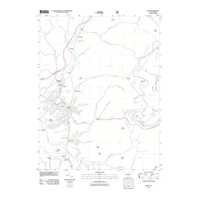
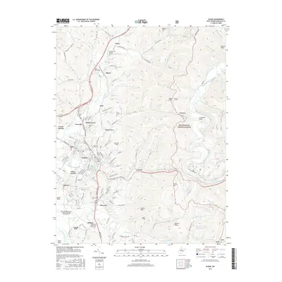
 1995 Elkins1998 Print · USGSThe Tygart Valley and the ridges of the Monongahela National Forest meet at Elkins in the 1990s. Trace local history at Davis and Elkins College, the Elkins-Randolph County Airport, and the IOOF Cem.
 - 2011 Map of Beverly East, 2011 Print
 2011 Beverly East2011 Print · USGSCovers Elkins, including Beverly, Hazelwood, and other nearby areas
 - 2011 Map of Elkins, 2011 Print
 2011 Elkins2011 Print · USGSCovers Elkins, including Fairview, Whyte, and other nearby areas
 - 2014 Map of Elkins, 2014 Print
 2014 Elkins2014 Print · USGSCovers Elkins, including Fairview, Whyte, and other nearby areas
 - 2014 Map of Beverly East, 2014 Print
 2014 Beverly East2014 Print · USGSCovers Elkins, including Beverly, Hazelwood, and other nearby areas
 - 2016 Map of Elkins, 2016 Print
 2016 Elkins2016 Print · USGSCovers Elkins, including Fairview, Whyte, and other nearby areas
 - 2016 Map of Beverly East, 2016 Print
 2016 Beverly East2016 Print · USGSCovers Elkins, including Beverly, Hazelwood, and other nearby areas
 - 2019 Map of Elkins, 2019 Print
 2019 Elkins2019 Print · USGSCovers Elkins, including Fairview, Whyte, and other nearby areas
 - 2019 Map of Beverly East, 2019 Print
 2019 Beverly East2019 Print · USGSCovers Elkins, including Beverly, Hazelwood, and other nearby areas
 - 2023 Map of Elkins, 2023 Print
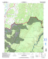
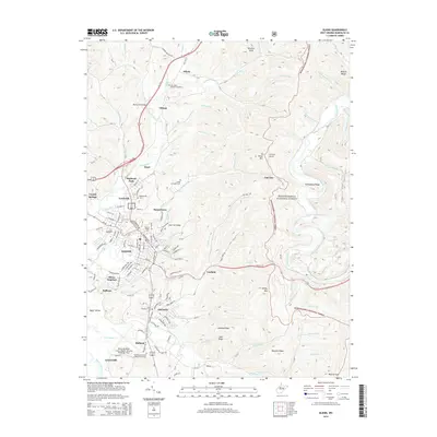
 2023 Elkins2023 Print · USGSElkins and the Tygart Valley are shown here in the contemporary era, illustrating the growth of the Randolph county seat alongside its rail and mountain corridors. Genealogists and local historians can trace the grounds of Davis and Elkins College, Maplewood Cem, and the historic Randolph County Courthouse.
 - 2023 Map of Beverly East, 2023 Print
 2023 Beverly East2023 Print · USGSThe Tygart Valley and the high ridges of the Monongahela National Forest meet here in recent years. Genealogists and historians can trace family locations near Beverly Cem, identify the Lazy J Aerodrome, and locate old transit points like Cheat Junction.
End of results
Showing maps 1-20 of 20
Top cities near Elkins
- Philippi historical maps
- Parsons historical maps
- Beverly historical maps
- Mill Creek historical maps
- Valley Bend historical maps
- East Dailey historical maps
See more
Top neighborhoods of Elkins
Frequently asked questions
- What are the different types of historical maps available for Elkins?
- What is the oldest map of Elkins?
- Where can I purchase historical maps of Elkins for my home or office?
- Where can I download high-res historical maps of Elkins?
- Are there historical topographic maps available for Elkins?
- Is there historical aerial imagery available for Elkins?
- Where are historical maps of Elkins sourced from?