Old Maps of Randolph County, West Virginia
Explore 259 old maps of Randolph County, spanning from 1886 to today. These high-resolution historic maps reveal how streets, neighborhoods, landmarks, and natural features evolved over time — perfect for genealogy, metal detecting, research, and local history exploration.
What you can do with these maps:
- See how Randolph County changed over time: Compare historical maps to modern-day views to trace roads, homesites, rail lines & more.
- View detailed metadata: Each map includes creators, publishers, year, scale, and archive source.
- Overlay maps with satellite & LiDAR: Visualize the past alongside modern tools to explore terrain & human change.
- Trusted historical sources: Maps sourced from the USGS, Library of Congress, and other archives.
- Access maps your way: View online, download high-res files, or order prints for personal or research use.
Start exploring old maps of Randolph County to uncover forgotten places, hidden landmarks, and the deep history beneath your feet.
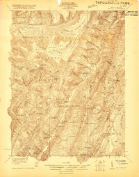
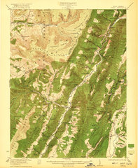
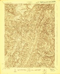
Randolph County, WV maps
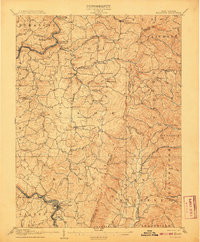
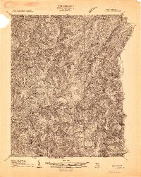
(259)- 1886 Map of St. George
 1886 St. George1886 Print · USGSNorthern West Virginia’s rugged river valleys and early rail corridors are mapped here in the mid-1880s. Genealogists can trace family roots in settlements like St George or Terra Alta, while following the path of the Baltimore and Ohio Railroad.
 - 1889 Map of Beverly
 1889 Beverly1889 Print · USGSThe high Allegheny ridges and river forks of West Virginia are mapped here in the late 1880s, highlighting the rugged settlement patterns of Randolph and Pocahontas counties. Researchers can trace early family-named locations such as Days Mills, locate the Boundary Line In Dispute, and find remote outposts like Traveller's Repose.
 - 1891 Map of Huntersville
 1891 Huntersville1891 Print · USGSPocahontas County in the 1890s is a land of steep ridges and early river settlements before the arrival of modern highways. Researchers can trace ancestral locations along the Greenbrier River, identifying early sites like Hillsboro Academy P.O. and Marlinton.
 - 1891 Map of St. George, 1895 Print
 1891 St. George1895 Print · USGSNorthern West Virginia at the end of the nineteenth century was defined by the expansion of the Baltimore and Ohio Railroad. Genealogists can trace early homesteads and landmarks like Valley Furnace, St George, and Terra Alta.3 unique versions available
 - 1892 Map of Beverly
 1892 Beverly1892 Print · USGSCentral West Virginia's high-mountain settlements and disputed county lines are captured here in the late nineteenth century. Genealogists and historians can trace family locations and early industry near Beverly, Huttonsville, and the remote Days Mills.5 unique versions available
 - 1892 Map of Franklin
 1892 Franklin1892 Print · USGSPendleton County and the Potomac Highlands are shown here in the 1890s, organized by the dramatic ridges and river valleys of the Alleghanies. Researchers can trace historic homesteads and early post offices at Fort Seybert, Upper Tract, and the riverside crossroads of Kline Cross Roads.
 - 1893 Map of Buckhannon
 1893 Buckhannon1893 Print · USGSCentral West Virginia at the end of the nineteenth century shows a network of upland farms and timber-adjacent rail lines. Genealogists can trace family names through landmarks like Alkire Mill, Buckwheat Church, and settlements like Vandalia (Austin).
 - 1894 Map of Huntersville
 1894 Huntersville1894 Print · USGSPocahontas and Webster counties are captured in the late nineteenth century as a network of mountain settlements and river headwaters. Researchers can trace old mountain homesteads and community sites like Hillsboro Academy, Hunter Place, and Aylmer.5 unique versions available
 - 1896 Map of Buckhannon, 1902 Print
 1896 Buckhannon1902 Print · USGSUpshur and Randolph counties appear here in the late nineteenth century as a landscape of remote mountain settlements and winding river valleys. Genealogists can trace early homesteads and community hubs like Alkires Mill, Hacker Valley, and French Creek before modern development.3 unique versions available
 - 1896 Map of Franklin, 1907 Print
 1896 Franklin1907 Print · USGSThe Potomac River's headwaters and the high ridges of the Alleghenies are documented here in the final years of the nineteenth century. Genealogists and local historians can trace early valley communities like Fort Seybert, Sugar Grove, and the mills at Harper Mill.4 unique versions available
 - 1897 Map of Buckhannon
 1897 Buckhannon1897 Print · USGSUpshur and Randolph counties appear here in the late nineteenth century as a landscape of isolated ridge-top settlements and river-bottom mills. Genealogists can trace family roots through landmarks like Alkires Mill, Goshen Church, and the oddly named Pumpkin Town.
 - 1901 Map of Monterey, 1905 Print
 1901 Monterey1905 Print · USGSThe high Allegheny ridges of Highland and Bath Counties are shown at the turn of the century when isolated valley settlements were linked by winding mountain gaps. Genealogists can trace early homesteads and commerce centers like Cleeks Mills, Mountaingrove, and New Hampden.8 unique versions available
 - 1907 Map of Belington
 1907 Belington1907 Print · USGSBelington was a bustling railway hub at the turn of the century where multiple rail lines met the Tygart River. Genealogists can locate family homesteads near landmarks like Olive Hill Schoolhouse, Wilmoth Ford, and the old Turnpike.2 unique versions available
 - 1908 Map of Parsons
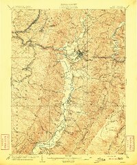
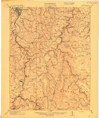
 1908 Parsons1908 Print · USGSThe West Virginia high country comes to life in this early century survey of the Parsons area. Genealogists and historians can trace the early rail networks of the W M R R and LUMBER R R connecting settlements like Thomas and St George.
 - 1909 Map of Elkins
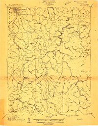
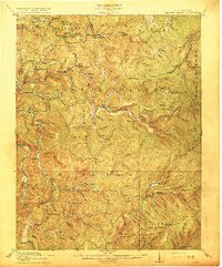
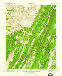
 1909 Elkins1909 Print · USGSRandolph County's river valleys and mountain ridges are captured here during the peak of the regional railroad and timber era. Genealogists can trace family roots through numerous named schools and churches, from Trinity Church to the Goff School, while following the paths of the Coal and Coke Ry and Staunton and Parkersburg Pike.4 unique versions available
 - 1912 Map of Sago
 1912 Sago1912 Print · USGSThe Buckhannon River valley was a bustling corridor for the Baltimore and Ohio Railroad in the early twentieth century. Genealogists can trace family names and remote post offices at Beans Mill Indian Camp PO, Sago, and Kingsville PO.4 unique versions available
 - 1913 Map of Hacker Valley
 1913 Hacker Valley1913 Print · USGSWest Virginia's high-country settlements come to life in this early twentieth-century survey of the rugged Elk River headwaters. Researchers can trace the original locations of rural landmarks like Buckwheat Church, Windy Gap School, and the remote Salt Lick Settlement.2 unique versions available
 - 1913 Map of Pickens
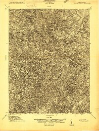
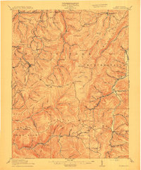
 1913 Pickens1913 Print · USGSRandolph and Webster counties are shown here just before the Great War, during a peak era for mountain logging and rail expansion. Researchers can trace the routes of the Pickens and Hacker Valley RR and find local landmarks like Palace Valley, Lewis School, and Big Laurel Thicket.4 unique versions available
 - 1914 Map of Sago
 1914 Sago1914 Print · USGSUpshur and Randolph counties thrive as centers of the timber and rail trade during the early twentieth century. Genealogists can trace family names through dozens of rural landmarks like Beans Mill Indian Camp, Tallmansville, and the Hanging Run School.4 unique versions available
 - 1915 Map of Hacker Valley
 1915 Hacker Valley1915 Print · USGSThe high ridges of Webster and Lewis counties are captured here in the years before the Great War, showing a landscape of isolated mountain settlements and rail-driven timber hubs. Genealogists can trace family footprints at Salisbury Sta Removal PO, Cleveland, and nearly a dozen rural schoolhouses like Snuffville School.4 unique versions available
 - 1915 Map of Pickens
 1915 Pickens1915 Print · USGSWest Virginia's highland timber country comes into focus during the early twentieth century as logging railroads began to penetrate the deep hollows. Trace the history of mountain settlements and schools like Helvetia, Pickens, and the Haslebacher School amidst the ridges of Beech Mountain.4 unique versions available
 - 1920 Map of Onego, 1959 Print
 1920 Onego1959 Print · USGSPendleton and Grant counties in the early twentieth century are shown here as a landscape of isolated mountain communities and riverside hamlets. Researchers can trace family-named landmarks and long-standing institutions like the Germany Settlement, Mouth of Seneca, and the Evergreen Church.2 unique versions available
 - 1921 Map of Onego
 1921 Onego1921 Print · USGSThe West Virginia highlands in the early 1920s reveal a network of isolated mountain schools and valley settlements. Genealogists can trace family roots through landmarks like Onego, High Rock Church, and the Boggs School near Seneca Rock.2 unique versions available
 - 1922 Map of Onego
 1922 Onego1922 Print · USGSPendleton County's high ridges and river valleys are captured here in the early 1920s as the Monongahela National Forest was being established. Genealogists and hikers can locate old mountain homesteads, numerous remote schools like Keel Spring School, and the iconic Seneca Rock.2 unique versions available
 - 1922 Map of Horton
 1922 Horton1922 Print · USGSThe West Virginia highlands in the early twenties were a landscape of mountain timber towns and isolated valley schools. Genealogists can trace family names at Little Italy or Evenwood, and locate rural landmarks like Bethel Church and Mylius School.2 unique versions available
Showing maps 1-25 of 259
Top cities of Randolph County
- Elkins historical maps
- Beverly historical maps
- Mill Creek historical maps
- Valley Bend historical maps
- East Dailey historical maps
- Norton historical maps
See more
Frequently asked questions
- What are the different types of historical maps available for Randolph County?
- What is the oldest map of Randolph County?
- Where can I purchase historical maps of Randolph County for my home or office?
- Where can I download high-res historical maps of Randolph County?
- Are there historical topographic maps available for Randolph County?
- Is there historical aerial imagery available for Randolph County?
- Where are historical maps of Randolph County sourced from?