Old Maps of White Oak, West Virginia for Genealogy
Trace your family roots with 14 historic maps of White Oak. These high-res maps reveal old neighborhoods, homesites, landmarks, and streets — helping you uncover where your ancestors lived and how the area evolved over time.
- Explore historic neighborhoods: Identify where your relatives may have lived in the 1800s or 1900s.
- Compare maps over time: Trace the changes in streets, buildings, and landmarks for multi-generational research.
- Perfect for genealogy & ancestry research: Used by family historians and researchers to map out lineage and migration.
These maps are an incredible resource for exploring your personal connection to White Oak's past.
White Oak, WV maps
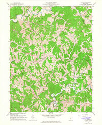
(14)- 1906 Map of Holbrook
 1906 Holbrook1906 Print · USGSRitchie County and the surrounding highlands are captured here at the dawn of the twentieth century. Genealogists can trace family names and early homesteads near Burnt House, the Staunton and Parkersburg Pike, and the village of Pullman.2 unique versions available
 - 1924 Map of Holbrook, 1961 Print
 1924 Holbrook1961 Print · USGSNorth-central West Virginia at the height of its rural settlement density reveals a landscape of ridge-top knobs and narrow hollows. Genealogists and historians can trace dozens of family-named landmarks and local institutions, from Mt Union Church to the many schools like Alum Fork School and Moonrise School.
 - 1926 Map of Holbrook
 1926 Holbrook1926 Print · USGSRitchie and Gilmer Counties are shown here in the mid-1920s, before modern highways altered these mountain valleys. Genealogists can trace family names across dozens of rural institutions, from Fairview Church to the Coal Alum Fork School.2 unique versions available
 - 1949 Map of Clarksburg
 1949 Clarksburg1949 Print · USGSThe upper Ohio River valley and the industrial heart of West Virginia come into focus during this post-war period. Genealogists and researchers can trace the rail corridors of the Baltimore and Ohio and locate centers like Fairmont, Grafton, and Waynesburg.
 - 1956 Map of Clarksburg, 1966 Print
 1956 Clarksburg1966 Print · USGSThe Ohio River valley and the industrial heart of West Virginia are seen here in the mid-1950s as rail and river commerce thrived. Researchers can trace historic transport lines like the Baltimore and Ohio RR and locate ancestral homes in Clarksburg, Moundsville, or Parkersburg.2 unique versions available
 - 1961 Map of Clarksburg
 1961 Clarksburg1961 Print · USGSThe mid-century industrial and river landscapes of West Virginia and Ohio are detailed here, centered on the Ohio River. Researchers can trace the Baltimore and Ohio rail lines connecting towns like Parkersburg, Clarksburg, and Monongah.
 - 1964 Map of Pullman, 1966 Print
 1964 Pullman1966 Print · USGSRitchie County's ridgelines and river forks are captured here in the mid-1960s, centered on the rural hub of Pullman. Researchers can trace old family burial grounds like Taylor Cem and remote country landmarks from Five Forks to Mt Zion Ch.2 unique versions available
 - 1982 Map of Clarksburg, 1983 Print
 1982 Clarksburg1983 Print · USGSNorth Central West Virginia in the early eighties reveals a landscape deeply connected to its coal and gas resources. Genealogists and researchers can trace family landmarks and historical settlements from Clarksburg to Buckhannon, or locate sites like Quiet Dell and Watters Smith Memorial State Park.
 - 1988 Map of Clarksburg, 1989 Print
 1988 Clarksburg1989 Print · USGSThe central Appalachians are documented in detail during the late eighties, showing the industrial and river-based economies of West Virginia, Ohio, and Pennsylvania. Researchers can trace historic rail routes like the B & O RR and locate river towns from St Marys to Parkersburg.
 - 2011 Map of Pullman, 2011 Print
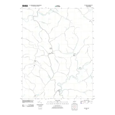 2011 Pullman2011 Print · USGSCovers White Oak, including Pullman, Berea, and other nearby areas
 - 2014 Map of Pullman, 2014 Print
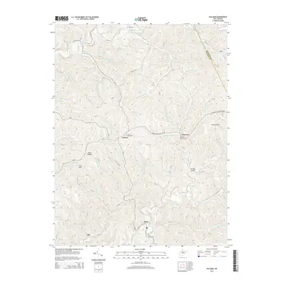 2014 Pullman2014 Print · USGSCovers White Oak, including Pullman, Berea, and other nearby areas
 - 2016 Map of Pullman, 2016 Print
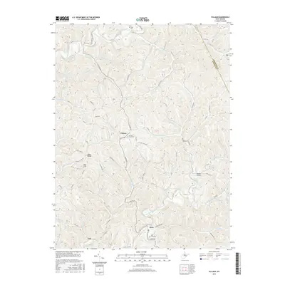 2016 Pullman2016 Print · USGSCovers White Oak, including Pullman, Berea, and other nearby areas
 - 2019 Map of Pullman, 2019 Print
 2019 Pullman2019 Print · USGSCovers White Oak, including Pullman, Berea, and other nearby areas
 - 2023 Map of Pullman, 2023 Print
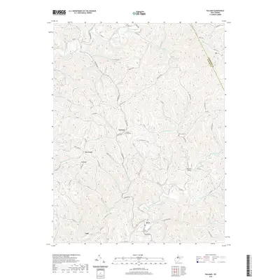
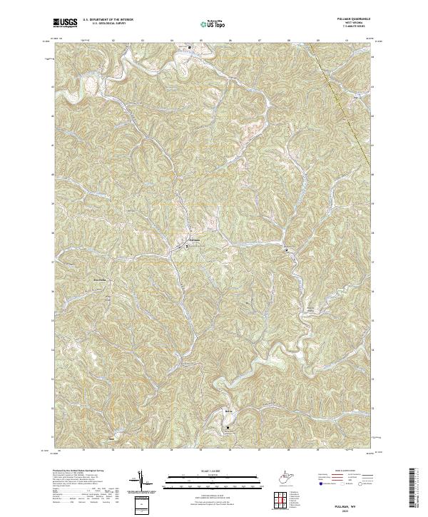 2023 Pullman2023 Print · USGSThe highland valleys of Ritchie and Doddridge counties are shown here in the early twenty-first century as the rivers define the local geography. Researchers can find numerous small burial grounds and rural hubs like Pullman, Berea, and the Pine Grove Cem.
End of results
Showing maps 1-14 of 14
Top cities near White Oak
- Harrisville historical maps
- Pennsboro historical maps
- West Union historical maps
- Ellenboro historical maps
- Pullman historical maps
- Auburn historical maps
Frequently asked questions
- What are the different types of historical maps available for White Oak?
- What is the oldest map of White Oak?
- Where can I purchase historical maps of White Oak for my home or office?
- Where can I download high-res historical maps of White Oak?
- Are there historical topographic maps available for White Oak?
- Is there historical aerial imagery available for White Oak?
- Where are historical maps of White Oak sourced from?