Old Maps of Astor, West Virginia for Academic Research
Study the evolution of Astor with 14 high-resolution historic maps. Whether you're teaching, researching, or modeling changes in land use, these maps provide essential visual documentation of urban, environmental, and geographic change.
- Analyze long-term change: Track patterns in development, transportation, and natural features.
- Ideal for environmental or urban studies: Support academic projects with primary historical map data.
- Use in the classroom or lab: Educators and researchers rely on these maps to bring historical context to life.
These maps are a powerful tool for teaching, research, and visualizing how Astor has changed over the decades.
Astor, WV maps
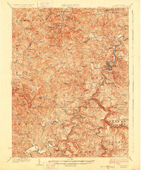
(14)- 1904 Map of Philippi
 1904 Philippi1904 Print · USGSBarbour and Upshur counties are shown during a period of coal-driven growth and rural stability just after the turn of the century. Trace the early industrial footprints of Berryburg and Century, or locate family landmarks like Peter's Mill and the Burnersville Volga P.O..2 unique versions available
 - 1925 Map of Philippi, 1954 Print
 1925 Philippi1954 Print · USGSIn the mid-1920s, the Tygart River valley was a busy corridor of coal settlements and river commerce. Genealogists can locate family homesteads near vanished landmarks like Brownton PO, Pigtail School, and the Electric Line near Galloway.
 - 1928 Map of Philippi
 1928 Philippi1928 Print · USGSBarbour County is shown here in the mid-twenties as the Baltimore and Ohio railroad connected river towns and coal camps. Researchers can trace ancestral roots through dozens of local landmarks like Adaland, Rangoon PO, and the Pleasant Grove Church.2 unique versions available
 - 1949 Map of Clarksburg
 1949 Clarksburg1949 Print · USGSThe upper Ohio River valley and the industrial heart of West Virginia come into focus during this post-war period. Genealogists and researchers can trace the rail corridors of the Baltimore and Ohio and locate centers like Fairmont, Grafton, and Waynesburg.
 - 1956 Map of Clarksburg, 1966 Print
 1956 Clarksburg1966 Print · USGSThe Ohio River valley and the industrial heart of West Virginia are seen here in the mid-1950s as rail and river commerce thrived. Researchers can trace historic transport lines like the Baltimore and Ohio RR and locate ancestral homes in Clarksburg, Moundsville, or Parkersburg.2 unique versions available
 - 1961 Map of Clarksburg
 1961 Clarksburg1961 Print · USGSThe mid-century industrial and river landscapes of West Virginia and Ohio are detailed here, centered on the Ohio River. Researchers can trace the Baltimore and Ohio rail lines connecting towns like Parkersburg, Clarksburg, and Monongah.
 - 1961 Map of Brownton, 1962 Print
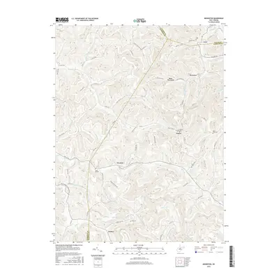
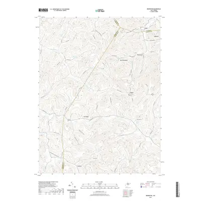
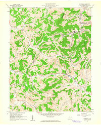 1961 Brownton1962 Print · USGSCoal mining and rail commerce define the Barbour County landscape in the early sixties. Researchers can trace the Baltimore and Ohio line through Brownton or locate local landmarks like the Covered Bridge and Green Hill Ch.3 unique versions available
 - 1982 Map of Clarksburg, 1983 Print
 1982 Clarksburg1983 Print · USGSNorth Central West Virginia in the early eighties reveals a landscape deeply connected to its coal and gas resources. Genealogists and researchers can trace family landmarks and historical settlements from Clarksburg to Buckhannon, or locate sites like Quiet Dell and Watters Smith Memorial State Park.
 - 1988 Map of Clarksburg, 1989 Print
 1988 Clarksburg1989 Print · USGSThe central Appalachians are documented in detail during the late eighties, showing the industrial and river-based economies of West Virginia, Ohio, and Pennsylvania. Researchers can trace historic rail routes like the B & O RR and locate river towns from St Marys to Parkersburg.
 - 2011 Map of Brownton, 2011 Print
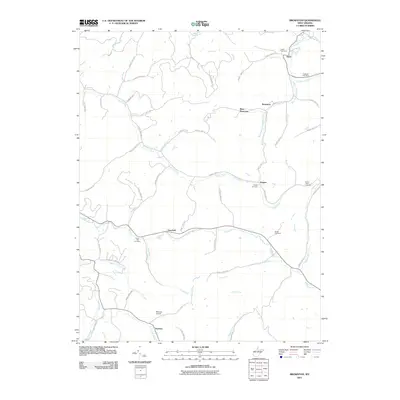 2011 Brownton2011 Print · USGSCovers Astor, including Pepper, Overfield, and other nearby areas
 - 2014 Map of Brownton, 2014 Print
 2014 Brownton2014 Print · USGSCovers Astor, including Pepper, Overfield, and other nearby areas
 - 2016 Map of Brownton, 2016 Print
 2016 Brownton2016 Print · USGSCovers Astor, including Pepper, Overfield, and other nearby areas
 - 2019 Map of Brownton, 2019 Print
 2019 Brownton2019 Print · USGSCovers Astor, including Pepper, Overfield, and other nearby areas
 - 2023 Map of Brownton, 2023 Print
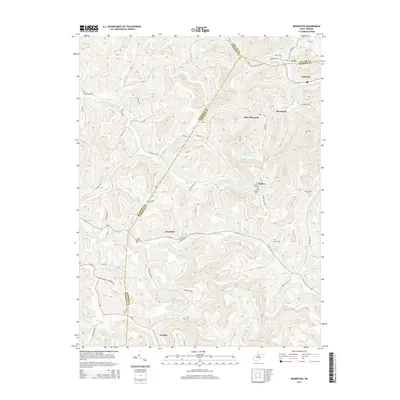
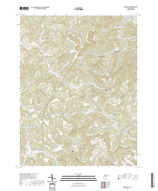 2023 Brownton2023 Print · USGSBarbour County life is captured here in the 2020s, showing a landscape defined by high ridges and family-named hollows. Genealogists can trace ancestral sites at Green Hill Cem and Mount Tabor Cem or explore the settlements of Brownton and Peeltree.
End of results
Showing maps 1-14 of 14
Top cities near Astor
- Fairmont historical maps
- Clarksburg historical maps
- Bridgeport historical maps
- Grafton historical maps
- Pleasant Valley historical maps
- Philippi historical maps
See more
Frequently asked questions
- What are the different types of historical maps available for Astor?
- What is the oldest map of Astor?
- Where can I purchase historical maps of Astor for my home or office?
- Where can I download high-res historical maps of Astor?
- Are there historical topographic maps available for Astor?
- Is there historical aerial imagery available for Astor?
- Where are historical maps of Astor sourced from?