Old Maps of Grafton, West Virginia for Academic Research
Study the evolution of Grafton with 31 high-resolution historic maps. Whether you're teaching, researching, or modeling changes in land use, these maps provide essential visual documentation of urban, environmental, and geographic change.
- Analyze long-term change: Track patterns in development, transportation, and natural features.
- Ideal for environmental or urban studies: Support academic projects with primary historical map data.
- Use in the classroom or lab: Educators and researchers rely on these maps to bring historical context to life.
These maps are a powerful tool for teaching, research, and visualizing how Grafton has changed over the decades.
Grafton, WV maps
(31)- 1886 Map of St. George
 1886 St. George1886 Print · USGSNorthern West Virginia’s rugged river valleys and early rail corridors are mapped here in the mid-1880s. Genealogists can trace family roots in settlements like St George or Terra Alta, while following the path of the Baltimore and Ohio Railroad.
 - 1891 Map of St. George, 1895 Print
 1891 St. George1895 Print · USGSNorthern West Virginia at the end of the nineteenth century was defined by the expansion of the Baltimore and Ohio Railroad. Genealogists can trace early homesteads and landmarks like Valley Furnace, St George, and Terra Alta.3 unique versions available
 - 1902 Map of Fairmont
 1902 Fairmont1902 Print · USGSMarion and Taylor Counties were hubs of coal and transit at the opening of the twentieth century, as the rail lines followed the winding rivers. Genealogists can trace early family settlements and work sites from the Tyrconnell Mines to rural Nebo Church and Boothsville.4 unique versions available
 - 1907 Map of Thornton
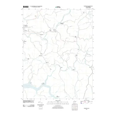
 1907 Thornton1907 Print · USGSPreston and Taylor counties are depicted here in the early years of the century as the rail industry reshaped the Appalachian highlands. Genealogists can trace family roots at specific landmarks like Summers Church, Knottsville, and Slabtown Schoolhouse along the Baltimore and Ohio RR corridor.2 unique versions available
 - 1923 Map of Fairmont, 1956 Print
 1923 Fairmont1956 Print · USGSMarion and Taylor counties are shown during the height of their rail and coal era in the early twentieth century. Researchers can trace family origins through dozens of named landmarks like Jane Memorial Church, T McConnell Mines, and the river crossing at Benton Ferry.2 unique versions available
 - 1926 Map of Fairmont
 1926 Fairmont1926 Print · USGSMarion and Taylor counties are shown during the mid-twenties when coal mining and the rail industry shaped the river valleys. Researchers can locate vanished landmarks like the Tyrconnell Mines and community centers such as Pruntytown and Mt Zion Church.3 unique versions available
 - 1926 Map of Thornton
 1926 Thornton1926 Print · USGSPreston and Taylor counties show a dense network of mountain settlements and rail corridors in the mid-1920s. Genealogists can locate family landmarks such as Slabcamp Church, the Pell School, and rail-side towns like Tunnelton or Newburg.2 unique versions available
 - 1948 Map of Cumberland
 1948 Cumberland1948 Print · USGSMid-century Appalachia and the Shenandoah Valley are shown in detail, documenting the industrial and transportation hubs of the tri-state area. Genealogists can trace family roots through settlements like Double Tollgate and Bunker Hill or along the Baltimore & Ohio RR.3 unique versions available
 - 1949 Map of Clarksburg
 1949 Clarksburg1949 Print · USGSThe upper Ohio River valley and the industrial heart of West Virginia come into focus during this post-war period. Genealogists and researchers can trace the rail corridors of the Baltimore and Ohio and locate centers like Fairmont, Grafton, and Waynesburg.
 - 1952 Map of Cumberland
 1952 Cumberland1952 Print · USGSThe Potomac Highlands and the Shenandoah Valley are revealed in this early 1950s survey of the Appalachian interior. Researchers can trace the river-and-rail corridors connecting Cumberland, Winchester, and the recreational waters of Deep Creek Lake.
 - 1956 Map of Cumberland, 1966 Print
 1956 Cumberland1966 Print · USGSThe tri-state Highlands in the mid-1950s show a landscape shaped by coal, timber, and the massive presence of the Baltimore & Ohio RR. Researchers can trace the industrial corridor from Cumberland through the Allegheny Mountains to mountain retreats like Deep Creek Lake.6 unique versions available
 - 1956 Map of Clarksburg, 1966 Print
 1956 Clarksburg1966 Print · USGSThe Ohio River valley and the industrial heart of West Virginia are seen here in the mid-1950s as rail and river commerce thrived. Researchers can trace historic transport lines like the Baltimore and Ohio RR and locate ancestral homes in Clarksburg, Moundsville, or Parkersburg.2 unique versions available
 - 1957 Map of Cumberland
 1957 Cumberland1957 Print · USGSThe Potomac River valley and the ridges of the Allegheny Front define this mid-century landscape at the intersection of Maryland, West Virginia, and Pennsylvania. Trace the steam-era rail lines of the Baltimore and Ohio RR or locate rural landmarks like St Stephens Church and Stony River Dam.
 - 1958 Map of Thornton, 1960 Print
 1958 Thornton1960 Print · USGSTaylor and Preston Counties are shown in the late fifties as coal mining and rail transport shaped the local economy. Genealogists can trace family names and small-town roots through Knottsville, Bethany Ch, and the Mt View Sch near the Tygart Reservoir.4 unique versions available
 - 1960 Map of Grafton, 1963 Print
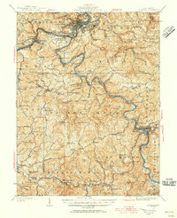
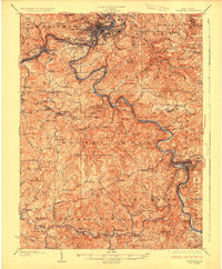
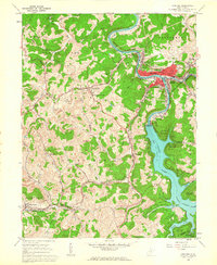 1960 Grafton1963 Print · USGSGrafton and its surrounding Taylor County hills are captured here in the early 1960s, showing a landscape defined by coal, rail, and water. Researchers can trace family roots through the National Cemetery, locate the W Va Industrial School for Boys in Pruntytown, and map the extent of early Strip Mines.3 unique versions available
 - 1961 Map of Clarksburg
 1961 Clarksburg1961 Print · USGSThe mid-century industrial and river landscapes of West Virginia and Ohio are detailed here, centered on the Ohio River. Researchers can trace the Baltimore and Ohio rail lines connecting towns like Parkersburg, Clarksburg, and Monongah.
 - 1961 Map of Cumberland
 1961 Cumberland1961 Print · USGSThe tri-state highlands of Maryland, West Virginia, and Pennsylvania are shown in the mid-twentieth century as a complex landscape of ridges and river valleys. Researchers can trace the winding Potomac River and find old rail-and-river towns like Cumberland, Keyser, and Morgantown.
 - 1962 Map of Cumberland
 1962 Cumberland1962 Print · USGSThe central Appalachians meet at the height of the mid-century industrial era, showing the rugged topography between Morgantown and Winchester. Genealogists can trace family lands near Fort Necessity or along the vital Baltimore & Ohio RR corridors.
 - 1981 Map of Kingwood, 1982 Print
 1981 Kingwood1982 Print · USGSThe West Virginia highlands in the early eighties were a hub of mountain railroading and wilderness conservation. Trace the path of the Baltimore & Ohio RR through Kingwood or explore the early footprints of Canaan Valley State Park and Dolly Sods.
 - 1982 Map of Clarksburg, 1983 Print
 1982 Clarksburg1983 Print · USGSNorth Central West Virginia in the early eighties reveals a landscape deeply connected to its coal and gas resources. Genealogists and researchers can trace family landmarks and historical settlements from Clarksburg to Buckhannon, or locate sites like Quiet Dell and Watters Smith Memorial State Park.
 - 1988 Map of Clarksburg, 1989 Print
 1988 Clarksburg1989 Print · USGSThe central Appalachians are documented in detail during the late eighties, showing the industrial and river-based economies of West Virginia, Ohio, and Pennsylvania. Researchers can trace historic rail routes like the B & O RR and locate river towns from St Marys to Parkersburg.
 - 2011 Map of Thornton, 2011 Print
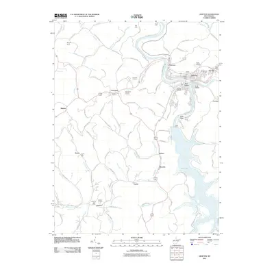
 2011 Thornton2011 Print · USGSCovers Grafton, including Eby, Claude, and other nearby areas
 - 2011 Map of Grafton, 2011 Print
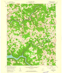
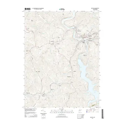
 2011 Grafton2011 Print · USGSCovers Grafton, including Flemington, Belgium, and other nearby areas
 - 2014 Map of Thornton, 2014 Print
 2014 Thornton2014 Print · USGSCovers Grafton, including Eby, Claude, and other nearby areas
 - 2014 Map of Grafton, 2014 Print
 2014 Grafton2014 Print · USGSCovers Grafton, including Flemington, Belgium, and other nearby areas
Showing maps 1-25 of 31
Top cities near Grafton
- Fairmont historical maps
- Bridgeport historical maps
- Pleasant Valley historical maps
- Philippi historical maps
- Barrackville historical maps
- Rivesville historical maps
See more
Top neighborhoods of Grafton
- Lucretia historical maps
- West Grafton historical maps
- Blueville historical maps
- South Grafton historical maps
- Brownlow historical maps
- Fetterman historical maps
Frequently asked questions
- What are the different types of historical maps available for Grafton?
- What is the oldest map of Grafton?
- Where can I purchase historical maps of Grafton for my home or office?
- Where can I download high-res historical maps of Grafton?
- Are there historical topographic maps available for Grafton?
- Is there historical aerial imagery available for Grafton?
- Where are historical maps of Grafton sourced from?