Old Maps of Hovatter, West Virginia for Hiking & Exploration
Hike through history with 19 historic maps of Hovatter. Explore old trails, ghost towns, and forgotten backroads — perfect for outdoor adventurers and local explorers.
- Rediscover forgotten places: Map out old mining camps, roads, and footpaths that no longer exist on modern maps.
- Layer with modern tools: Combine with LiDAR or satellite views to plan hikes through historical terrain.
- Made for exploration: Popular among hikers, overlanders, and local history lovers.
Use these maps to find adventure and explore the hidden past of Hovatter.
Hovatter, WV maps
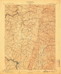
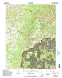
(19)- 1886 Map of St. George
 1886 St. George1886 Print · USGSNorthern West Virginia’s rugged river valleys and early rail corridors are mapped here in the mid-1880s. Genealogists can trace family roots in settlements like St George or Terra Alta, while following the path of the Baltimore and Ohio Railroad.
 - 1891 Map of St. George, 1895 Print
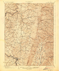
 1891 St. George1895 Print · USGSNorthern West Virginia at the end of the nineteenth century was defined by the expansion of the Baltimore and Ohio Railroad. Genealogists can trace early homesteads and landmarks like Valley Furnace, St George, and Terra Alta.3 unique versions available
 - 1907 Map of Belington
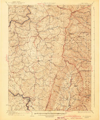
 1907 Belington1907 Print · USGSBelington was a bustling railway hub at the turn of the century where multiple rail lines met the Tygart River. Genealogists can locate family homesteads near landmarks like Olive Hill Schoolhouse, Wilmoth Ford, and the old Turnpike.2 unique versions available
 - 1927 Map of Belington
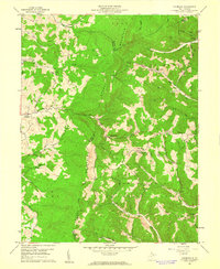
 1927 Belington1927 Print · USGSNorth Central West Virginia is documented here in the late twenties as a network of ridge-top schools and river-bottom rail hubs. Genealogists can trace family landmarks and local institutions like Vannoy's Mill, Valley Furnace, and Moatsville Sta.2 unique versions available
 - 1941 Map of Belington
 1941 Belington1941 Print · USGSBarbour and Randolph counties are shown here during the pre-war era as the Baltimore and Ohio railroad powered the local economy. Genealogists can trace family homesteads near dozens of landmarks including Vannoys Mill, Kalamazoo, and St Joseph School.
 - 1948 Map of Cumberland
 1948 Cumberland1948 Print · USGSMid-century Appalachia and the Shenandoah Valley are shown in detail, documenting the industrial and transportation hubs of the tri-state area. Genealogists can trace family roots through settlements like Double Tollgate and Bunker Hill or along the Baltimore & Ohio RR.3 unique versions available
 - 1952 Map of Cumberland
 1952 Cumberland1952 Print · USGSThe Potomac Highlands and the Shenandoah Valley are revealed in this early 1950s survey of the Appalachian interior. Researchers can trace the river-and-rail corridors connecting Cumberland, Winchester, and the recreational waters of Deep Creek Lake.
 - 1956 Map of Cumberland, 1966 Print
 1956 Cumberland1966 Print · USGSThe tri-state Highlands in the mid-1950s show a landscape shaped by coal, timber, and the massive presence of the Baltimore & Ohio RR. Researchers can trace the industrial corridor from Cumberland through the Allegheny Mountains to mountain retreats like Deep Creek Lake.6 unique versions available
 - 1957 Map of Cumberland
 1957 Cumberland1957 Print · USGSThe Potomac River valley and the ridges of the Allegheny Front define this mid-century landscape at the intersection of Maryland, West Virginia, and Pennsylvania. Trace the steam-era rail lines of the Baltimore and Ohio RR or locate rural landmarks like St Stephens Church and Stony River Dam.
 - 1959 Map of Colebank, 1961 Print
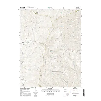
 1959 Colebank1961 Print · USGSThe West Virginia highlands near the triple-county corner of Barbour, Preston, and Tucker are captured here in the late fifties. Researchers can trace rural life through numerous mountain schools and churches like Union Chapel and Murphy Sch, alongside the industrial presence of gas wells and the Valley Furnace settlement.4 unique versions available
 - 1961 Map of Cumberland
 1961 Cumberland1961 Print · USGSThe tri-state highlands of Maryland, West Virginia, and Pennsylvania are shown in the mid-twentieth century as a complex landscape of ridges and river valleys. Researchers can trace the winding Potomac River and find old rail-and-river towns like Cumberland, Keyser, and Morgantown.
 - 1962 Map of Cumberland
 1962 Cumberland1962 Print · USGSThe central Appalachians meet at the height of the mid-century industrial era, showing the rugged topography between Morgantown and Winchester. Genealogists can trace family lands near Fort Necessity or along the vital Baltimore & Ohio RR corridors.
 - 1981 Map of Kingwood, 1982 Print
 1981 Kingwood1982 Print · USGSThe West Virginia highlands in the early eighties were a hub of mountain railroading and wilderness conservation. Trace the path of the Baltimore & Ohio RR through Kingwood or explore the early footprints of Canaan Valley State Park and Dolly Sods.
 - 1995 Map of Colebank, 1998 Print
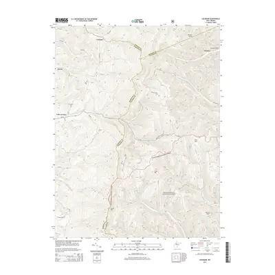
 1995 Colebank1998 Print · USGSThe high ridges of Barbour and Tucker Counties come into focus in the mid-nineties as the Monongahela National Forest meets rural valley life. Genealogists and local historians can trace family roots through landmarks like Valley Furnace, Union Chapel, and the Digman Sch.
 - 2011 Map of Colebank, 2011 Print
 2011 Colebank2011 Print · USGSCovers Hovatter, including Colebank, Preston County, and other nearby areas
 - 2014 Map of Colebank, 2014 Print
 2014 Colebank2014 Print · USGSCovers Hovatter, including Colebank, Preston County, and other nearby areas
 - 2016 Map of Colebank, 2016 Print
 2016 Colebank2016 Print · USGSCovers Hovatter, including Colebank, Preston County, and other nearby areas
 - 2019 Map of Colebank, 2019 Print
 2019 Colebank2019 Print · USGSCovers Hovatter, including Colebank, Preston County, and other nearby areas
 - 2023 Map of Colebank, 2023 Print
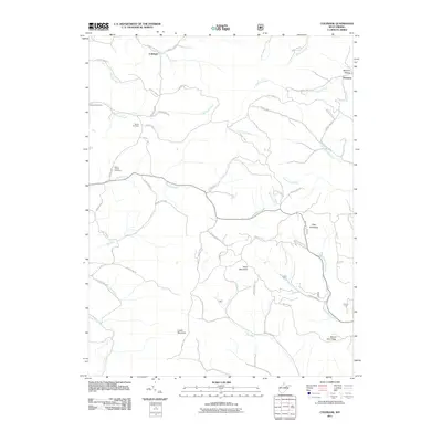
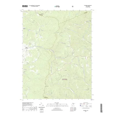
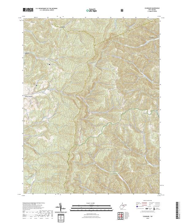 2023 Colebank2023 Print · USGSThe high ridges of Tucker, Barbour, and Preston counties are captured here in the early twenty-first century. Genealogists and local historians can trace family roots through sites like Shiloh Cem, the Valley Furnace community, and the remote reaches of Bearden Hollow.
End of results
Showing maps 1-19 of 19
Top cities near Hovatter
- Terra Alta historical maps
- Parsons historical maps
- Rowlesburg historical maps
- Newburg historical maps
- Tunnelton historical maps
- Hendricks historical maps
See more
Frequently asked questions
- What are the different types of historical maps available for Hovatter?
- What is the oldest map of Hovatter?
- Where can I purchase historical maps of Hovatter for my home or office?
- Where can I download high-res historical maps of Hovatter?
- Are there historical topographic maps available for Hovatter?
- Is there historical aerial imagery available for Hovatter?
- Where are historical maps of Hovatter sourced from?