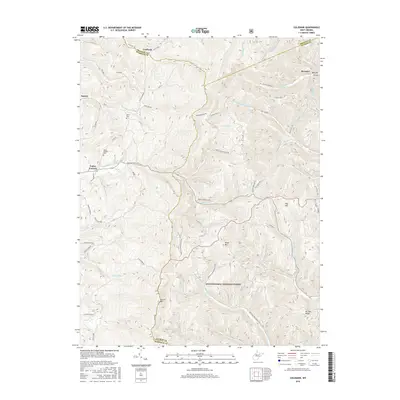
2016 Map of Colebank
USGS Topo · Published 2016About this map
Valley Furnace and the high ridges of the Allegheny Mountains define this area at the intersection of Preston, Barbour, and Tucker counties. In the northern reaches, the small settlement of Colebank sits near the junction of Sinclair Rd and Co Rte 92/18, while the southern half is dominated by the protected lands of the Monongahela National Forest. The map documents a landscape of steep elevation changes, punctuated by named peaks like Texas Mtn, Pifer Mtn, and Laurel Mtn.
Find a feature on this map
68 named features on this map. Tap any name to fly to it.
Don’t see what you’re looking for? This feature index may not catch every label — zoom into the map to look around manually.
Map Details
Editions of this 2016 Colebank Map
This is the sole edition of this map. No revisions or reprints were ever made.
Other maps of this area

1886 · St. George
USGS Topo · 1:125,000

1891 · St. George
USGS Topo · 1:125,000

1907 · Thornton
USGS Topo · 1:62,500

1907 · Kingwood
USGS Topo · 1:62,500

1907 · Belington
USGS Topo · 1:62,500

1908 · Parsons
USGS Topo · 1:62,500

1925 · Kingwood
USGS Topo · 1:62,500

1926 · Thornton
USGS Topo · 1:62,500

1926 · Parsons
USGS Topo · 1:62,500

1927 · Belington
USGS Topo · 1:62,500