
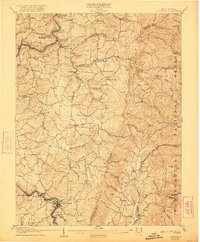
1907 Map of Belington
USGS Topo · Published 1907About this map
Belington sits as a critical rail junction in this 1905 survey, where the Baltimore and Ohio and Western Maryland lines converge along the Tygart River. The landscape reflects a transition from early industrial efforts to established agricultural communities, notably seen at Valley Furnace and the nearby Vannoys Mill on Sand Run. The distribution of rural civic life is dense, marked by numerous named landmarks such as the Mt Contention Schoolhouse and Corinth Church.
Find a feature on this map
91 named features on this map. Tap any name to fly to it.
Don’t see what you’re looking for? This feature index may not catch every label — zoom into the map to look around manually.
Map Details
Editions of this 1907 Belington Map
2 editions found
Other maps of this area

1886 · St. George
USGS Topo · 1:125,000

1889 · Beverly
USGS Topo · 1:125,000

1891 · St. George
USGS Topo · 1:125,000

1892 · Beverly
USGS Topo · 1:125,000

1893 · Buckhannon
USGS Topo · 1:125,000

1896 · Buckhannon
USGS Topo · 1:125,000

1897 · Buckhannon
USGS Topo · 1:125,000

1902 · Fairmont
USGS Topo · 1:62,500

1904 · Philippi
USGS Topo · 1:62,500

1907 · Thornton
USGS Topo · 1:62,500