
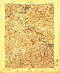
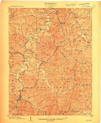
1902 Map of Fairmont
USGS Topo · Published 1902About this map
The Monongahela River forms at the confluence of the West Fork River and Tygart River near Fairmont, anchoring a landscape defined by heavy industrial growth at the start of the twentieth century. This 1901 survey documents a region transitioning through the extraction of natural resources, centered on the Tyrconnell Mines and numerous mining settlements like Monongah, Everson, and Watson. Transport infrastructure is critical to this development, with the Baltimore and Ohio RR and the Grafton and Belington Branch following the river valleys to move coal and goods. While new industry takes hold, older modes of travel like the Morgantown Ferry and Bontons Ferry still cross the waters, and historic routes such as the Northwestern Turnpike and Beverly Turnpike connect rural outposts like Boothsville and Hebron Church.
Find a feature on this map
144 named features on this map. Tap any name to fly to it.
Don’t see what you’re looking for? This feature index may not catch every label — zoom into the map to look around manually.
Map Details
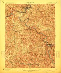
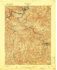
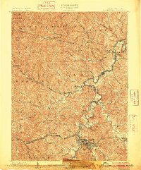
Editions of this 1902 Fairmont Map
4 editions found
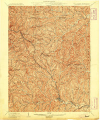
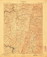
Other maps of this area

1886 · St. George
USGS Topo · 1:125,000

1891 · St. George
USGS Topo · 1:125,000
1902 · Clarksburg
USGS Topo · 1:62,500

1902 · Morgantown
USGS Topo · 1:62,500

1904 · Philippi
USGS Topo · 1:62,500

1904 · Blacksville
USGS Topo · 1:62,500
1904 · Weston
USGS Topo · 1:62,500
1905 · Mannington
USGS Topo · 1:62,500

1907 · Thornton
USGS Topo · 1:62,500
1907 · Belington
USGS Topo · 1:62,500