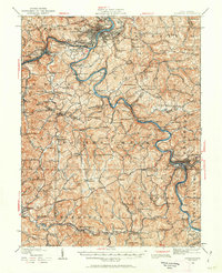
1902 Map of Fairmont
USGS Topo · Published 1913About this map
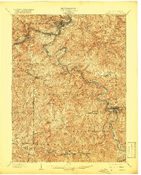
The Monongahela River serves as the central artery for this industrial landscape at the start of the 20th century, where the convergence of the West Fork River and the Tygart Valley River anchors the city of Fairmont. The map documents a region defined by its vital transportation corridors, including the Baltimore and Ohio RR and historic turnpikes like the Fairmont and Beverly Turnpike. Industrial activity is evident at the Tysonnet Mines, while the social fabric of the surrounding hills is marked by rural outposts such as Mt Zion Church and Nebo Church.
Find a feature on this map
124 named features on this map. Tap any name to fly to it.
Don’t see what you’re looking for? This feature index may not catch every label — zoom into the map to look around manually.
Map Details
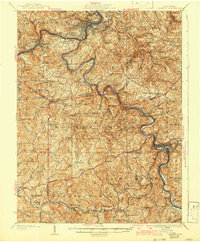
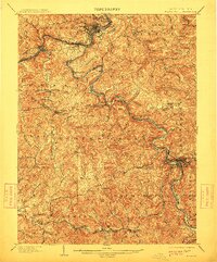
Editions of this 1902 Fairmont Map
4 editions found

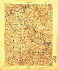
Historical Maps of Fairmont Through Time
3 maps found