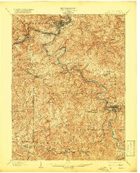
1902 Map of Fairmont
USGS Topo · Published 1919About this map
Fairmont and Grafton anchor a landscape defined by the convergence of industrial rail and winding river valleys at the dawn of the twentieth century. The Baltimore and Ohio RR follows the complex curves of the Tygart River and West Fork River, connecting coal and manufacturing hubs like Monongah, Watson, and Monongah. The presence of historic river crossings such as Benton Ferry and Colfax indicates the importance of these waterways before the full expansion of modern bridge infrastructure.
Find a feature on this map
120 named features on this map. Tap any name to fly to it.
Don’t see what you’re looking for? This feature index may not catch every label — zoom into the map to look around manually.
Map Details
Editions of this 1902 Fairmont Map
4 editions found
Other maps of this area

1886 · St. George
USGS Topo · 1:125,000

1891 · St. George
USGS Topo · 1:125,000

1902 · Clarksburg
USGS Topo · 1:62,500

1902 · Fairmont
USGS Topo · 1:62,500

1902 · Morgantown
USGS Topo · 1:62,500

1904 · Philippi
USGS Topo · 1:62,500

1904 · Blacksville
USGS Topo · 1:62,500

1904 · Weston
USGS Topo · 1:62,500

1905 · Mannington
USGS Topo · 1:62,500

1907 · Thornton
USGS Topo · 1:62,500